Transiting the East River

The friendliest place on the web for anyone who enjoys boating.
If you have answers, please help by responding to the unanswered posts.

tparrent

Member
Joined
Nov 18, 2020
Messages
12
I am about to become the owner of a Nordic Tug 37. I'll be bringing it from Long Island Sound to Burlington VT. That means one of my very first trips aboard will be down the East River.:eek:


Once I get to New York Harbor, I'll be fine. I'm familiar with that area as I used to live aboard a sailboat at Liberty Landing marina in Jersey City.


I also used ot have an office overlooking the East River, which was wonderfully distracting! I watched boat traffic all day and became familiar, from a distance, with the fast tidal flows.


I also once helped take a boat down the river because the skipper assumed I had local knowledge while I assumed he did! We survived. I was not at the wheel so I did not get a real feel for the strength of hte current.


My question is how tough is it to make the trip with tidal flows, rock piles and lots of boat traffic?


I will time the trip to hit slack water tending towards ebb tide. Not sure how long slack lasts but certainly not the hour it will take me to go the distance.


Another choice would be to follow the Harlem River. My sense is that is a trickier trip with swirling currents, tighter quarters and possible necessity for bridge openings (I haven't checked clearances yet).


Anyone with local knowledge (real, not like mine) want to show me how it's done? Aiming for mid July.
 
Good luck with your new Nordic tug. The east river should not be too challenging for you. Just aim to reach Hell Gate at slack, and ride the current from there. Overhead clearance on the Harlem River is 24 feet, if I remember correctly, if you choose that route. There's less traffic heading up the Harlem River than going around the battery, but you won't get the same spectacular view of the city. Eldridge has current tables and charts to help you plan the trip. The East River and the Hudson get bumpy and crowded near lower Manhattan due to ferry traffic, jet skis, tugs and barges, sailing schools, and kayakers. But the view is spectacular. Feel free to PM me if you want more info.

Dave

Sent from my SM-G991U using Trawler Forum mobile app
 
If you're heading up the Hudson, I'd plan to take the shortcut through the Harlem River. Personally, I'd time it for the best tide push up the Hudson and ignore it elsewhere. If you do that, you'll fight the tide through Hell Gate and the Harlem River, but you'll gain more on the Hudson than you lose there. An NT37 is fast enough that fighting the tide through Hell Gate is no big deal. The tide is significant, but it's not the swirling, dangerous mess that some describe (in my experience at least).

My last trip through there was done ~2 years ago, early on a Sunday morning. Turned into the Harlem River around 7 AM. Saw just a couple of boats in the East River and none in the Harlem, so no traffic concerns that early on a weekend. To be fair, I was up on plane the whole way from Stamford, CT until just after the turn into the Harlem, so the Hell Gate experience was basically "oh, hey, our GPS speed went down a bit." With minimal traffic, navigating the area is no big deal at all. The charts are good and nothing is concerningly tight.

Going through the Harlem River, the only bridge you'll need to worry about is the Spuyten Duyvil railroad bridge at the Hudson end of the river. It's a low swing bridge, so it'll always have to be open. Unless there's a train coming, it may already be open. Otherwise, they'll open on demand provided there's not a train approaching (then you have to wait). Check the Amtrak Empire Service schedule, as those are the only trains going over the bridge, so that'll give an idea of what times to expect trains. Figure the trains cross the bridge about 15 minutes before arrival and 15 minutes after departure at NY Penn.

Pictures below are from my transit of the area. In order, they are the turn into the Harlem River, passing under the many bridges in the Harlem River, and then waiting for Spuyten Duyvil to open.
 

Attachments

  • 48824296671_69c523987e_o.jpg
    48824296671_69c523987e_o.jpg
    155.7 KB · Views: 57
  • 48608500488_a4d3b6329b_o.jpg
    48608500488_a4d3b6329b_o.jpg
    176.9 KB · Views: 48
  • 48609038447_9b1f20f297_o.jpg
    48609038447_9b1f20f297_o.jpg
    136.4 KB · Views: 55
If you're heading up the Hudson, I'd plan to take the shortcut through the Harlem River. Personally, I'd time it for the best tide push up the Hudson and ignore it elsewhere. If you do that, you'll fight the tide through Hell Gate and the Harlem River, but you'll gain more on the Hudson than you lose there. An NT37 is fast enough that fighting the tide through Hell Gate is no big deal. The tide is significant, but it's not the swirling, dangerous mess that some describe (in my experience at least).

My last trip through there was done ~2 years ago, early on a Sunday morning. Turned into the Harlem River around 7 AM. Saw just a couple of boats in the East River and none in the Harlem, so no traffic concerns that early on a weekend. To be fair, I was up on plane the whole way from Stamford, CT until just after the turn into the Harlem, so the Hell Gate experience was basically "oh, hey, our GPS speed went down a bit." With minimal traffic, navigating the area is no big deal at all. The charts are good and nothing is concerningly tight.

Going through the Harlem River, the only bridge you'll need to worry about is the Spuyten Duyvil railroad bridge at the Hudson end of the river. It's a low swing bridge, so it'll always have to be open. Unless there's a train coming, it may already be open. Otherwise, they'll open on demand provided there's not a train approaching (then you have to wait). Check the Amtrak Empire Service schedule, as those are the only trains going over the bridge, so that'll give an idea of what times to expect trains. Figure the trains cross the bridge about 15 minutes before arrival and 15 minutes after departure at NY Penn.

Pictures below are from my transit of the area. In order, they are the turn into the Harlem River, passing under the many bridges in the Harlem River, and then waiting for Spuyten Duyvil to open.

Excellent post we agree - made this trip at least 2 dozen times from Northport to Kingston/Catskills area.
If you utilize the the current Eldridge book you can mostly time the LI and Hudson tides very well as long as you have the ability to cruise in the area of 15 knots.
The currents will be against you at the dumpling islands and Hells gate but that will be a short distance if you have the availble speed.
We always check with Amtrack the day/night before commiting to the Harlem river shortcut as there are rare times when they will be under maintenance and will not open per schedule or call - best to not go all the way up and find that out.
You will be in 5 mph zones in some areas of the Harlem river so keep a look out for those areas.
Our boats would typically cruise at 15-17 knots and we would typically time the tides - total time from Northport Harbor to Kingston Lighthouse was usually about 7.5 hrs. That would include 5 mph zones, typical bridge wait times and some slowing at various points along the Hudson. Almost exactly 100 miles from port to port.
Good luck its a nice trip with any kind of favorable weather.
 
Kept my boat at the 78th street boat basin for a few years, went to long island a-lot. The east river is no problem for that set up. You could do it bucking the tide the whole way, but why would you? I would do as others have recommended and just hit as close as slack as you can.

Hellgate developed its reputation back in the days of sailing ships etc…. When there was a huge rock under the water right in front if Gracie mansion. They blew that up (google it) probably a century ago, so the rips and currents are not nearly as bad.

Just add two hours to the current chart at the battery.

I would be more concerned that you had a good running rig and a good anchor (or plan) if you have problems. If your boat is running good, the passing is a no brainer.

The Harlem river is a nice trip and the bridge in the Hudson is pretty good at opening when you request. I think I had to wait 10 min on average maybe longest time was 30 min. Once.

Enjoy the trip. Just an FYI, south of hellgate, and northeast of governor island is an anchorage. Just something good to know. (One time ran into “black out” fog at night heading up the river and pulled in there to wait it out. Dropped hook and slept for 2-3 hours.

Have fun and safe travels
 
The Harlem River route also lets you avoid the increasing commuter ferry traffic on the East River. Now, the river boils continuously almost from ferry prop wash, much more difficult to deal with than the current at Hells Gate. But you have plenty of power and AFAIK there are no speed limits.

David


Yup, only speed limits in that area are 2 (I think) no wake zones on the Harlem River. When we went through, we dropped off plane at the first no wake zone and just ran at slow cruise (except for a bit slower in the 2 no wake zones) until we hit the Hudson.
 
Yup, only speed limits in that area are 2 (I think) no wake zones on the Harlem River. When we went through, we dropped off plane at the first no wake zone and just ran at slow cruise (except for a bit slower in the 2 no wake zones) until we hit the Hudson.

I can remember at least 4 no-wake zones (speed limits) in the Harlem river which increase to more than 4 locations when there is construction on any of the bridges or adjoining areas.
 
“I am about to become the owner of a Nordic Tug 37. I'll be bringing it from Long Island Sound to Burlington VT. “

Can you clear the bridges on the Champlain canal with that boat?
 
“I am about to become the owner of a Nordic Tug 37. I'll be bringing it from Long Island Sound to Burlington VT. “

Can you clear the bridges on the Champlain canal with that boat?


It should clear fine. Lowest bridge is 17 feet and unless it's had something tall added, an NT37 with the antennas down is definitely well under 17 feet.
 
Thanks for all the info!


Sounds like the trip is doable.


I may attend the Nordic Tug rendezvous in Essex Ct right before the trip. If I'm lucky maybe I can talk a local into coming along for the ride.
 
I've done the trip thru NYC several times from the CT River and Mystic.
A great first night stopover would be Manhassett Bay. There are free town moorings available and that location makes it easy to get a good early start going thru the East River and/or the Harlem.
I never worry about the current I just go. Can be a short trip or a long one depending, but just take it easy and enjoy the scenery.
I usually anchor up in Haverstraw Bay after going thru the city. Nice and open and decent protection. Crazy on weekends though.
Good luck and enjoy the ride.
 
If you time the pass under the Throgs Neck Bridge to just about high tide you will have a favorable current thru Hell Gate , down the East river and the tide will become favorable as you power up the Hudson.

Its really scenic , the Harlem River is not scenic and at times there is a delay on the last , the RR, bridge.
 
I also have an interest to head out to Block Island or so and return.


Would be great is someone would make a write up, with routes on a map going out on a southern route and returning on a northern route, with notes.


Is there one?
 
I also have an interest to head out to Block Island or so and return.


Would be great is someone would make a write up, with routes on a map going out on a southern route and returning on a northern route, with notes.


Is there one?


Head out to Block Island RI from where?
 
From NYC website.....

"State Navigation Law: Along with the rules for the Harlem River, you should be aware of other boating safety
regulations. There are specific safety regulations for Orchard Beach Lagoon in the Bronx and Great Kills Harbor
in Staten Island. In addition, state navigation law (section 45) forbids operating a vessel “at a speed greater than
is reasonable and prudent under the conditions and having regard to the actual and potential hazards then
existing”. Specifically, no vessel, other than a tending vessel or if involved in water skiing, may operate “within
one hundred feet of the shore, a dock, pier, raft, float or an anchored or moored vessel at a speed exceeding five
miles per hour”. Even vessels further out may be required to operate at slower speeds, no wake or minimal wake,
and should take every precaution to minimize unnecessary vessel wakes. “Slow Down: Minimum Wake” means
you must operate fully off plane and completely settled in water."
 
Just did the trip through the Gate and down the East River. I hit it within three minutes of slack (it's a short window) and rode the ebb out to New York Harbor. Beautiful ride. Biggest challenge are the ferries. They are everywhere in every direction and they move FAST. They will back out of a dock in front of you and be in your way in seconds. They seem to care very little about you. I had eight of them "in play" at one time.
 
From the Hudson River entrance.


Depending upon ones interests there are numerous potential stops on the Long Island sound side. Some of the most common ones would be Manhasset Bay, Glen Cove, Oyster Bay, Huntington, Northport, Pt Jeff, and Mattituck.
More choices in direction and destinations after that as you can visit numerous locations in Greenport, Montauk, Shelter Island, Sag Harbor, Riverhead ,etc - one could spend weeks or longer exploring these areas.
FWIW - we try to get to Block on a Monday or Tuesday that is not tied to july 4th or VJ day celebrations. Its important to arive early if looking for a good mooring or anchorage choice or having a reservation if in a slip. Block alone could keep us busy for a week without too much trouble.
On the return trip along the Ct coast there are even more potential stops many of which could also take up a lot of time to explore if someone was into that sort of thing. Mystic, Thames , CT River, Thimbles, Norwalk, and others along the way have been great stops.
All during these trips the currents can be up to about 2 knots for or against except for limited areas in Long Island sound at the race and Plum gut. Currents west and south starting near the Throgs Neck bridge can be much higher and are best reviewed with the most recent Eldridge Tide and current book.
 
If you haven’t ever done it going around Manhattan is awe inspiring. A whole different experience from a water perspective. Although agree using the Harlem is most efficient going around is worth it. Have found it’s the southern end of Manhattan that’s nuts. Need someone looking aft as you’re looking forward as they truly come in all directions. We’ve added in a close approach to the Statue of Liberty and that far out the traffic is spread out a bit making it easier to turn to the Hudson and not stress as much. Like following along side of or aft a big barge or other big commercial traffic. Don’t care about you but the others don’t want to hit them. Listen to 9,13 and 16.
 
Last edited:
My delivery trip a couple years ago was the exact opposite. Started on Lake Champlain and ended in Long Island sound. The comments about the currents are worth paying attention to. The current can work for or against you al the way to Albany and beyond. I've only been through Hell's gate once and it was a non-issue. I planned to arrive there at high tide and rode the incoming current up the East river, and the outgoing current into the sound. you could to the same in reverse direction if you plan to arrive at hell's gate at high tide.

Unless you are in a big hurry, I'd suggest taking the route around the tip of Manhattan. Expensive but worth a stay at Liberty landing. Great marina and ferry service into the city. Some great places to visit in southern Manhattan. Time the tides up the Hudson and ride them for as long as you can. Canal locks are fun and nothing difficult if you are prepared. Take your time and don't rush, it's a great trip. Personally I'd skip Block Island. It's kind of out of the way and there are much better places to stay IMO. I find Block Island a bit trashy as well as overrated and expensive. But for some, it's apparently paradise. Depends on what you are looking for I guess.

Contact me directly for any other more detailed info I can provide. Good luck and enjoy. It's an adventure, but a really fun one.
 
Hippo and Smitty....


Good info, thx much. Been up the Hudson River, anchored behind the Statue of Liberty... awsome, and rather smooth after the ferrys stopped. Will probably do it again.


But Long Island is new to me and too busy to head there without some insight. Thanks!
 
I am about to become the owner of a Nordic Tug 37. I'll be bringing it from Long Island Sound to Burlington VT. That means one of my very first trips aboard will be down the East River.:eek:


Once I get to New York Harbor, I'll be fine. I'm familiar with that area as I used to live aboard a sailboat at Liberty Landing marina in Jersey City.


I also used ot have an office overlooking the East River, which was wonderfully distracting! I watched boat traffic all day and became familiar, from a distance, with the fast tidal flows.


I also once helped take a boat down the river because the skipper assumed I had local knowledge while I assumed he did! We survived. I was not at the wheel so I did not get a real feel for the strength of hte current.


My question is how tough is it to make the trip with tidal flows, rock piles and lots of boat traffic?


I will time the trip to hit slack water tending towards ebb tide. Not sure how long slack lasts but certainly not the hour it will take me to go the distance.


Another choice would be to follow the Harlem River. My sense is that is a trickier trip with swirling currents, tighter quarters and possible necessity for bridge openings (I haven't checked clearances yet).


Anyone with local knowledge (real, not like mine) want to show me how it's done? Aiming for mid July.

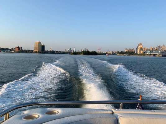
Where in Long Island are you starting from?
 
I also have an interest to head out to Block Island or so and return.


Would be great is someone would make a write up, with routes on a map going out on a southern route and returning on a northern route, with notes.


Is there one?

Sevee, where are you coming from and what info are you looking for? Lots of great places on the north and south shores of Long Island sound. Not much outside of Long Island Sound, meaning the south shore of long island itself if anyone was thinking of taking that route around the outside of Long Island.
 
Buy the 2021 Eldridge Tide & Pilot Book.
The Harlem will save you 20 miles and avoid downtown NY.
Using Eldridge will allow you to take full current advantage.
 
I lived on my sailboat at Liberty Landing for a while. Did a lot of daysailing in New York Harbor so I'm used to the traffic. As I have done the New York thing, I think I'll probably head up the Harlem River to get on my way to Champlain as quickly as I can.


I will likely do a couple day shakedown cruise around Long Island Sound. I'll be solo so will likely pick up moorings as going in and out of marinas singlehanded on a new to me boat can be stressful.

Here is another older post on this as well ...
https://www.trawlerforum.com/forums/s3/harlem-river-32354.html
 
Back
Top Bottom