Chesapeake mile markers not useful?

The friendliest place on the web for anyone who enjoys boating.
If you have answers, please help by responding to the unanswered posts.

sledge

Senior Member
Joined
Sep 19, 2018
Messages
269
Location
Great Lakes in 2024
Vessel Make
American Tug 41
For those of you familiar with the Chesapeake;
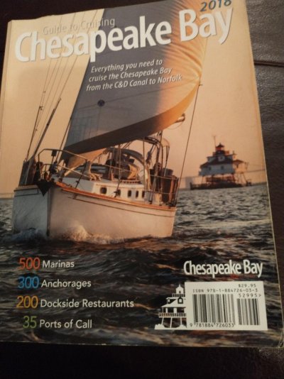
I was reading a cruising book regarding recommended stops on the Chesapeake and for each stop it showed Cmm.... but these numbers don't seem useful for trip planning as they do not correlate to distance as far as I can tell.
For example it shows Solomons, MD as Cmm 97. Then it shows Cambridge, MD at Cmm 81.
By charts, seems like its at least 40 miles of water between them so its not clear to me what the "Cmm" is used for...?

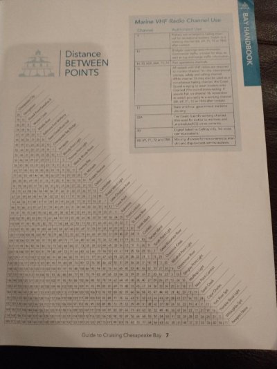
Solomon's is on the west shore and Cambridge on the east. So I'm guessing the mm you have are north to south (or south to north) But I somewhat agree, they would only be useful if you were running between locations on the same side. Probably not even then given you have to go up rivers to each location!

BTW the cruising guide I used two years ago published by CB Magazine had a chart with miles between each location, regardless of where they were. Much more useful. Solomon's to Cambridge is 39 on the mileage chart.
 

Attachments

  • cb1.jpg
    cb1.jpg
    121.4 KB · Views: 56
  • cb2.jpg
    cb2.jpg
    108.3 KB · Views: 60
Last edited:
I’ve not seen a guide using such but, I’ll guess it’s an arbitrary measure straight down the middle of the bay. It would tell you relatively whereabouts on the Bay the location is, nothing more.
 
Yes thanks well if you take two spots on the same side, say Hampton to Yorktown there is still a disconnect for water distance but perhaps Cmm is not meant for this. Hampton Cmm 196; Yorktown Cmm 181, whereas by water theyre nearly 30 miles apart. I guess I was used to reading Atlantic ICW mile markers; for the ICW, they are fairly representative in determining actual distance.
The book in question is "100 great stops on America's Great Loop". when i read a bit more carefully, i did find a statement that these Cmm run from north to south (Havre de Grace is Cmm 12).
Nevertheless, they do not seem useful for cruise planning. I guess they are more almost like direct distance between latitude points as the crow flies.
 
There is a disconnect on other waterway guides too with the exception they often have a small mileage number after the MM saying haw far off the ICW they are.


EVERY stop on the bay would have one as there are no stops on a line drawn up the middle of the bay.


As was suggested earlier....it's only a "guide" not a Nav Plan so each leg requires your nav skill input.
 
"Skill" used to be required. Now with apps such as Navionics, you plug in where you are and where you want to go and the app will draw the route, compute the distance and tell you when you will get there.

There are two ways to cruise the Chesapeake Bay. One is to go up one coast and down the other and the other way is to zig zag back and forth.
 
Never heard of a MM system on the Ches. Been cruising it for years. But what do I know.
 
Solomon's is on the west shore and Cambridge on the east. So I'm guessing the mm you have are north to south (or south to north) But I somewhat agree, they would only be useful if you were running between locations on the same side. Probably not even then given you have to go up rivers to each location!

I’ve not seen a guide using such but, I’ll guess it’s an arbitrary measure straight down the middle of the bay. It would tell you relatively whereabouts on the Bay the location is, nothing more.


I've not seen Cmm or similar either, but these sound like plausible interpretations.

Yes, Solomons is on the western shore, and Cambridge is to the east... but Cambridge is also a boatload of miles up the Choptank River... and since the Cmm idea doesn't seem to have a way to account for that... I'd have made the same guesses about it just being a basic north-to-south reference.

-Chris
 
From Waterway Guide....


Herring Bay


  • Location: Chesapeake Bay
  • Mile Marker: Mile 67.6-5.5 Miles West
  • Lat / Lon: N 38° 44.506' / W 076° 33.128'
  • Depth: 10-12 Feet
  • Description: Known locally as the "Swimming Hole" this is popular day anchorage. Some boats do.......
I think I remember my old edition has a chart in the front of the guide with a line drawn nearly up the middle of the Bay. So as far as use...it's a quick too as is the info I just posted above for quick calculations between places.
 
If I ever manage to get launched this year first thing I'm a gonna do is look for them mile markers !!

Want to see if my GPS is accurate !!
 
Back
Top Bottom