Magna,
I have also done connections with the Garmin audio cable. You should have ordered the NMEA® 0183 with audio cable (010-12852-00).
This will go into the green port on the back of your 8612.
The optional NMEA® 0183 with audio cable (010-12852-00) includes bare wires and an RCA connector for an audio out connection to a stereo.
The NMEA 0183 with audio cable provides one differential NMEA 0183 input and output port. You will not need the input port and out of all these wires you will only use the gray, the pink and the brown. The gray is the NMEA + , pink is NMEA - , and the brown is a ground.
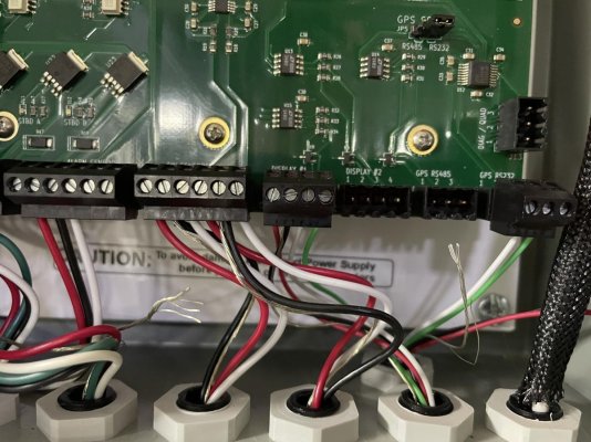
Wire the gray to the GPS RS485 J10 pin number 1 of your StableMotion Control Roll Controller and wire the pink to the number 2 pin next to it. The brown goes on the 3 pin . These are way off to the right on the pin board on the controller main board. Check to see that the jumper in JP5 is in the pin 2 and 3 position.
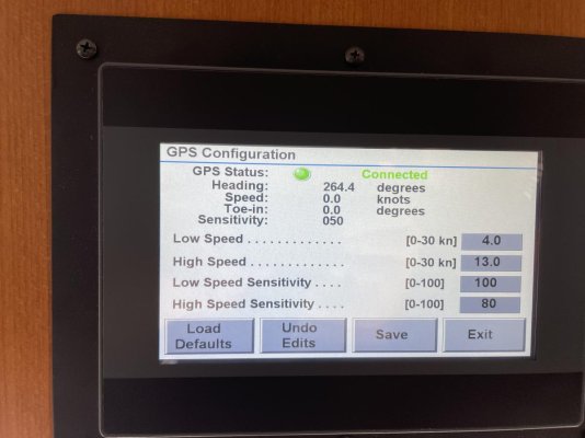
When you are ready go into your GPSMAP 8612 and set the NMEA0183 output settings.
SelectSettings>Communications>NMEA 0183 Setup>Port Types . Select the input port and set it to NMEA Std. and then do the same for the output port. (These both may have defaulted to NMEA Standard)
Then go to
Settings>Communications>NMEA 0183 Setup>Output Sentences. and turn off all sentences except the ones that are required for you roll controller. The manual should tell you which it wants.
The pin set up and the color coding for the Garmin audio cable look like this.
Pin
Wire Function
Wire Color
1
NMEA 0183 Rx/A (In +)
White/orange
2
NMEA 0183 Rx/B (In -)
White
3
NMEA 0183 Tx/B (Out -)
Pink
4
NMEA 0183 Tx/A (Out +)
Gray
5
Ground
Black
6
Alarm
Yellow
7
Accessory on
Orange
8
Ground (shield)
Brown
9
Audio Left Channel
White
10
Audio Common
Blue/red
11
Audio Right Channel
Red