Bob Cofer
Guru
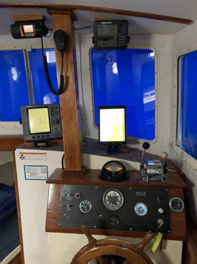
Puffin came with a 5” chart plotter from about 2003. Not much of a display. I have opted to without a dedicated plotter and am going to use an iPad instead with a dedicated multiplexer.
I’ve installed a Quark QK-A026 with its own AIS and GPS antennas. It takes those and the NMEA 0183 depth info from my Sounder and Electronic Compass and transmits it over its own WiFi network to all of the devices on Puffin. My display is a WiFi only iPad Air 2 running iSailor with the AIS and NMEA modules activated. All of the information can be accessed via this program.
Makes a nice uncluttered helm. We do carry a compass and chart book of our cruising area (Puget Sound to Alaska) as backup along with Radar and the Depth Sounder.

Bob
I’ve installed a Quark QK-A026 with its own AIS and GPS antennas. It takes those and the NMEA 0183 depth info from my Sounder and Electronic Compass and transmits it over its own WiFi network to all of the devices on Puffin. My display is a WiFi only iPad Air 2 running iSailor with the AIS and NMEA modules activated. All of the information can be accessed via this program.
Makes a nice uncluttered helm. We do carry a compass and chart book of our cruising area (Puget Sound to Alaska) as backup along with Radar and the Depth Sounder.

Bob
