Day 8 (I think). Should be the 14th of Sept. I think I lost a day somewhere.
We slept in since the tide was going to help us if we left around noon. We'd decided at the last minute to split the trip to Princess Louisa into 2 legs. Today we'd make it to Hotham Sound, see the falls there, and anchor near the Harmony Islands, or deep in, up at the head of the bay if the islands weren't a good fit.
As we got set to go we were surprised to find a family of little "water weasels" (that's what they looked like), apparently known as sea otters, playing on the dock next to us. They were unafraid, playing, wrestling, and pooping wherever they felt like it. It was pretty cool to watch. The ladies were thrilled and took countless pictures. After a while I was like, look, I gotta go pay the marina and hit the chandlery, so sorry weasels, I'm coming thru. Not well received by the ladies, but time was passing. I had something to buy that we needed. You got it. A few hundred feet of nice floating poly line!

Jay and Lori were the friends we'd picked up the night before. He and I grabbed the dink gas can and headed out. The fuel dock wasn't open yet, so we dropped the can there and hoofed it to the chandlery. We got 200' of 1/2" poly line, and a bunch of caribeeners for an idea i had for making it easier to raise and lower the kayaks from the bridge deck. We stopped at the gas place and toted it all back to the boat where the little otter animals were still playing. It looked like momma and 3 cubbies. I had to admit they were cute. Except when they hissed at you for walking on their dock. Not so cute then.
We got under way on another amazing day with calm water, headed for Jervis Inlet. Of course, as we backed away from the dock it happened again. RIIIIIIIING! #%$@&! Stupid engine. The #2 engine failed again. By now we were good at it. (I forgot to mention in the last post that it happened leaving Prideaux and again leaving Tenedos). I kept the boat moving using one engine, rudder, and thruster while my awesome wife ran into the engine room to perform the ritual: right engine control breaker off, right prime pump on, restart #2 engine, right engine control breaker on, yell up "Ok, you're good", turn the right prime pump back off. If you haven't read the previous posts, we've been dealing with some air in the line of the right engine since I changed filters in WA. After about 5 minutes of idling the right engine takes a nap. As soon as you put the prime on it'll restart. Once it's restarted you can turn the prime pump off and the thing works for the rest of the day. So you forget about it. Till the next morning... This time I set an alarm in my phone to bleed the right engine tonight.
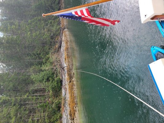
Jervis Inlet is a wierdly shaped fjord what juts out of the Strait of Georgia. It goes east-ish for a few miles, then does a series of 90 degree turns, first left, then right, then left again, all the way up to Princess Louisa Inlet. At some point it becomes "Queen's Reach" instead of Jervis inlet. Hotham Sound, where we intended to stay that night, is just before the first 90 degree jog to the left. The trip there took us probably 3 or 4 hours. There's a 1400 foot water fall at the southeast corner of the sound that is quite a sight in the spring and early summer. When we got there it was hard to pick out, and not much to see, since the lake above the cliff there hadn't seen rain for months. The Harmony Islands were enchanting, really a neat place, creating a beautiful and cozy anchorage between the islands and the mainland. On of the islands is private, and because the area is tight there's not much room. We found there were already several boats there, so we were squeezed out. We tried anchoring in a couple different spots, but it was in 80 feet of water, and the anchor dragged again on the rock bottoms, so as the sun got closer and closer to the hills we made for the anchorage at the head of the sound, about 5 miles in. I was concerned, as I don't like anchoring in new places at night, so as we raced the setting sun northbound I saw a small shallow section along the right side. Everywhere else was the usual steep cliffs plunging into deep water, but the chart showed a shelf here, and there appeared to be a seashell-covered beach. We turned in and to our delight found a great little spot. The water was 50' deep, shallowing slightly toward the shore. We got our stern-tie rig set up, the kayak prepped, and dropped the hook. It held the first time (yes!), so I hurried to the back, hopped into the 'yak, and paddled our new yellow poly line over to a tree at the shore's edge. Oh, this was SOOOOO much better than the friggin' rope. I looped it around a tree and was back in no time. We were probably 80' from the shore, and the sun was setting as we tied the last knot. Lori, who, like my wife, LIKES cold water, was suited up and asked if she could jump in. Soon she was swimming around in the 62 degree water. I have to admire her. I could not enjoy something like that. We had a great time laughing about it, then played some cards, talked into the night, and headed for bed. We had to leave at 0630 tomorrow. The entrance to Princess Louisa Inlet is a set of narrows called Malibu Rapids. The rapids should only be crossed by boats like this at or close to slack tide. To leave room for fudge we decided to leave at 0600. Sunrise was 0730.
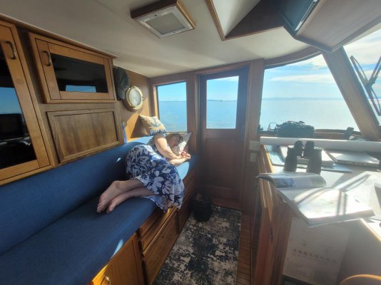
Day 9: 0400. I ate something bad last night. My alarm was set for 0530, but at 4 I'm up with a stomach ache. To let my wife sleep I head to the helm with a book, planning to read till i fall asleep or 0530, whichever is first. For grins, I take a handheld spotlight and check the stern tie. Holy crap. When we went to bed we were 60-80 feet from the shore. From the helm looking back it looks like the swim platform is touching the seashell-covered shoreline. The tide has gone way out, and we are much, much closer to shore. I walk back to the cockpit silently thanking God for waking me. With the spotlight I can see we're actually about 10-15 feet from shore, and it drops off steeply from there. But it's still too close for comfort. I head froward and suck in some of the anchor chain. We had done accurate math on the tide and our depth on arrival, but I think the thing we didn't consider was how the extra slack in the chain as the tide fell would be taken up by the tightening of the line to the shore as our position dropped relative to where we'd tied up. The stern tie kept us close to shore as the water level dropped, pulling us rearward at the same time more of the beach became exposed. When stern tying to a steep dropoff, like Melanie Cove, you can be in close to the shore. Falling tides mean nothing when the water is still 50' deep at the shore. But when stern tying to a sloping shore we should have used the max line available to keep us away from the shore as the tide fell.
At 0530 I woke Deb and we shattered the deep silence and started the engines. We loosed the yellow poly line and rolled it onto the spool without a hitch, except that I was now having to make regular runs to the head. My stomach ache had matured... We hoisted the anchor between my urgent sprints to the head, and pointed the bow toward the mouth of Hotham Sound, Jervis Inlet, and Princess Louisa Inlet. At our speed of 7.5 kts we should arrive at Malibu Rapids 20 minutes before high slack tide.
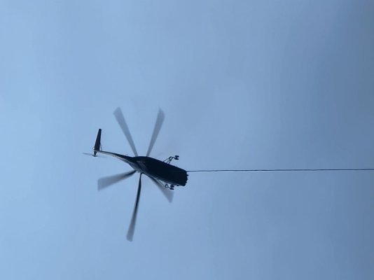
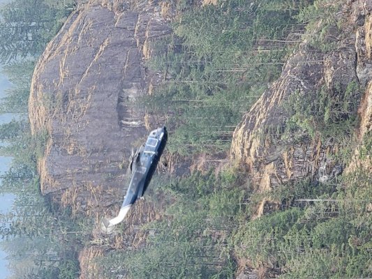
This was the first semi-cloudy morning, and the wispy clouds clung to the high mountainsides as the gray dawn slowly broke. It wasn't the cheerful blue we were used to, but it was magnificent and beautiful in a different way. The trip up Jervis was like following a mile-wide river that winds its way inland, except that we had a push from the incoming tide, enough so that we slowed back to avoid arriving too early. The many wild, jagged, and widely varying rock formations of the mountains on either side kept our interest along the way. We came across a series of boats that we recognized from the Harmony Islands the night before, and realized they'd been staging, like us, for the run to Princess Louisa. About 2/3s of the way up Jervis we came across a helo logging operation in progress. As a career helo driver I was fascinated to watch the crew. They were good at what they were doing. They used what's known as a long-line. They'd fly up the steep mountainside to an area near the top where there was dense forest. We'd often lose sight of them in the cloud bases. When we found them again they'd be hovering over the top of 100' tall trees with the line (presumably) hanging down between the trees being tied by a ground crew to a single big, long log. The log secured, the pilot would climb vertically until the log cleared the surrounding trees, then he'd nose over and, with the log held vertically by one end, swinging out widely behind and to one side, he'd dive down the side of the mountain. At maybe 200' above the water he'd flare, bringing the log under control and just in front of the helicopter. Then he'd lower the end of the log to the water, smack in the middle of this log boom (a raft of logs held in a bunch by cables). Then, in a very respectable display of incredible skill, he'd gently lower the upper end of the log, held by his cable, into the water. It was like he was putting a baby in it's crib - that's how softly he'd place the log in. We were very impressed. We got to watch him do 3 or 4 logs before we lost sight of him; things pass slowly at 8 knts.

The rest of the route was as unremarkable as it could be when you're surrounded on two sides by 6-7000' mountains and a salt water fjord under your keel. We arrived right on time at Malibu Rapids, and found several boats already heading out from Princess Louisa. The rapids have a blind turn, so people call on 1W on channel 16 stating their type and size, which way they're coming and offer a chance to deconflict traffic. We heard or saw 6 boats coming out by the time we arrived, and we were the first one in for the day, so we were expecting to find a good spot to anchor, moor at the dock, or on a mooring ball. We entered the rapids about 15 minutes early, and we could feel the movement of the water as it pushed us, but there was no problem at all. In a couple minutes we were thru. The view was surreal. I'll leave it to the pictures to describe. I can't do it justice.
On the northern point of the rapids is one of the most fantastic resorts you've ever seen. I'll share more about it in the next post. It's owned by YoungLife, a Christian youth ministry. We were given a tour of it while we were in Princess Louisa, and it's breathtaking. It's history goes back to the 1950's, and it's a pretty neat story.
We were in a celebratory mood despite the gray overcast. We had arrived! This had, like Desolation Sound, been a dream destination for us for several years, and now we were here. Our eyes drank up every view and angle greedily. It's around 3 or 4 miles from the rapids to the end of the inlet, where the world-famous Chatterbox Falls roars day and night into Princess Louisa. Halfway there you pass a sign asking you to leave no wake, as it ricochets around the inlet. We passed McDonald Island on the port side, site of a small camp also owned by YoungLife, I think. There are trails on the mainland side there we'll hike tomorrow. Finally, the end of the inlet came into view. The clouds still clung to the tops of the mountains, but all around you could see little slivers of waterfalls, probably 7 or 8 of them, tumbling down in narrow sheets or like trails of gauze stretching from cliff to ledge to outcropping. And there, at the end of the inlet, was Chatterbox. It was late summer now, and though it was a substantial falls, it wasn't quite as loud and strong as we'd thought it might be. We didn't want to tie to the dock, so we debated anchoring, but ultimately chose to tie to one of the 5 mooring balls there. We were the only one on a ball, which was nice. THere were 2 boats anchored near the falls, and three at the dock. We moored to a ball right at the foot of a wispy little drizzle of a waterfall about 200 yards from Chatterbox, then my wife and our friends went to shore to see the falls and get the lay of the land. I needed to stay close to a head for a few more hours.

They weren't on shore 10 minutes when it finally began to rain. It started out as a drizzle, then a rain, and before long it was coming down like a Florida thunderstorm. They ducked under a small roofed pavillion for shelter, and after an hour or so it let up enough for them to dinghy back. They were full of pictures and excitement about the falls. It was pretty spectacular even though it wasn't at full flow. It rained the rest of the afternoon, evening, and night.
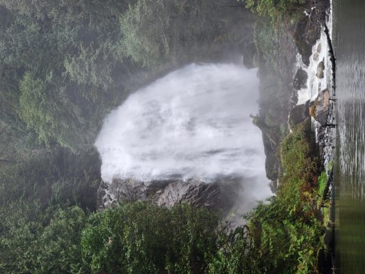
The next morning it was still raining, but forecast to break up and become sunny by noon. As we came up from our staterooms we became aware of a sound we couldn't place. What was that noise...? Looking outside we were stunned to see the trickle of a waterfall we'd moored next to had become a torrent, 30 feet wide with several rivers of water cascading off the rocks and into the inlet below. All around the inlet, what had been gauzy little wisps were all wide, rushing waterfalls, and where there had been NO falls now were new ones. It was startling. It looked like we were in a completely new anchorage. And there, louder and more attention-commanding than anything else in the inlet, was Chatterbox Falls. Overnight she had become a raging, roaring torrent, her highest visible waters at the top literally leaping out and over the falls. The crashing waters smashed into the rocks below with such force it looks like a power washer was spraying sideways. The wind created by the impact and speed of the flood pouring over the falls caused the trees next to the falls to sway like a gale was blowing. The rain had brought out, for time, the real Chatterbox, just in time for our visit.
The previous day, while my wife and friends were ashore, a float plane had landed and disgorged a bride in her white bridal dress and her groom in his black tux. Their photographer was with them, and they'd come to take wedding pictures by Chatterbox. Sadly, as they began to take the pictures, it had begun to rain, and before they could finish and get back to the plane, they were literally drenched, and carrying their shoes along what had been a dry trail, but was now just a muddy line in the grass. We felt badly for them, and wished they'd waited and come today instead - the rain was gone by 9, and the sun broke thru by noon, and Chatterbox was at her peak, showing off her might. It would have been a great time for pictures...
I was feeling better finally, so after breakfast we dinghied over to the foot of the falls to feel and hear its power. Then we tied up to the dock and walked the short trail to the side of the falls. You can get extremely close to the bottom of the falls, and it would be easy to climb up to the top. But there's a sobering sign there that implores people not to climb up the rocks. It says 12 people have lost their lives there ignoring the warning. Instead, we walked up as close to the side as possible. You can;t stay there very long, as it's pretty loud, and the spray will drench you in less than a minute. We got the obligatory pictures, then followed the trail down to the foot of the falls. There's a dam of logs and rocks that blocks you from seeing where the waters actually impact the rocks at the bottom, but you can see the river flowing out from around the dam, and the trees and leaves being blasted by the wind, the spray,and experience the falls that way. Bottom line, it was a great experience to see it, to be there when it was strong. All around were waterfalls, nothing like Chatterbox, but the overall effect was unreal. It was wild, untame-able, and vast, highlighting how small and fragile we are. Some thousands of feet up the mountains on the side of the falls were some ledges. On each ledge were 100+ foot tall trees, clinging to these narrow outcroppings. From our vantage point they appeared tiny - it wasn't until we looked at them thru binoculars we realized how large the trees are. The spaces are so vast, the objects that fill your vision so large that it's hard to grasp the immensity of what we were looking at. Big. Giant. Huge. Vast. Whatever descriptors you can use, they fail to convey. Pictures are an inadequate medium for sharing the experience. It was awesome.
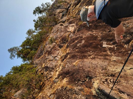
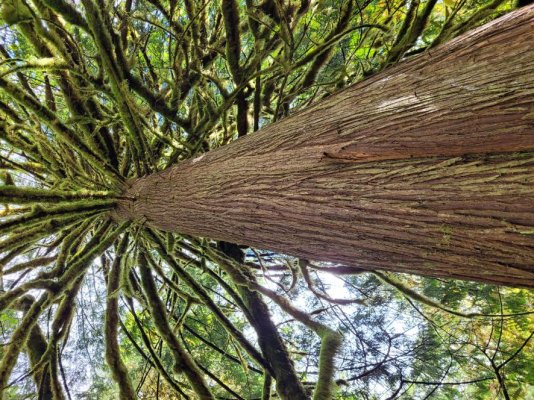
After a couple hours exploring the area we went back to the boat for lunch, then decided to walk the trails across from McDonald Island, 2 miles back down the inlet. We'd been told, "Don't come back till you've seen the bear." Um, ok... We left the dignhy at a small dock attached to a bald rock outcropping, surrounded on 3 sides by water. The trail leads deep into the forest where the trees are covered in spanish moss. Stumps are all that remain of what were once giants - trees that were 200 and 300 feet tall, old growth that was logged many decades ago. The trail is a loop that takes you to a rocky "beach" on the side of the inlet. There, our two wives climbed into the water and swam around. It was cold, and they both climbed out after a few minutes. We left the trail and walked back along the shoreline most of the way. It's a wonderfully scenic trail and shoreline, especially in the sun, as the water turns an emerald shade of green close in, and the sheer, 6,000 foot cliffs across the inlet are starkly visible. We found veins of quartz running thru the rock in many places. In 1927 a widow named Muriel Wylie Blanchet lived in the Pacific Northwest with her 5 children. She took her 25' power boat up into Desolation Sound, the Broughtons, and Princess Louisa every summer for 4 months at a time. In 1961 she wrote about their adventures back then in the '20s in a book called "The Curve of Time". We'd heard about the book, and ordered a copy so we could read it on the trip. It was fascinating to see and hear the contrasts and similarities today. Contrasts in the safety and knowledge and technology we bring, and the number of people and civilization that have filled in a lot of the area; similarities, in how the things she describes - the mountains, the falls, the waters, the wildlife, the wilderness - they're all the same. You can even follow the trail to the trappers cabin she talks about above Chatterbox falls. She's a skilled writer, and it's an amazing story to read if you ever come up here.
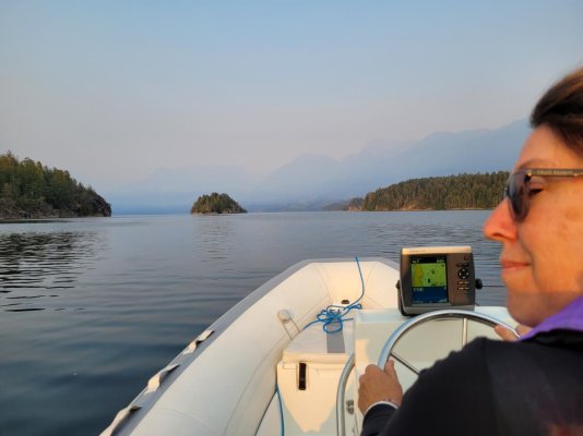
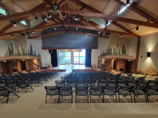
As we left The trailhead and dock by McDonald Island it was about 1530. On an impulse, I steered the dink toward Malibu Rapids. I figured we could check out the rapids and see if it was in motion. I'd also called the YoungLife site there at the rapids weeks before to see what they were about. The young lady on the other end had said they sometimes would open the store in the afternoons and you could buy a cup of coffee or some ice cream. As we got within sight of the place we could see a sailboat leaving the YoungLife dock, and 3 young men on the dock. We pulled up, and a bearded man of around 30 pleasantly greeted us, asking if he could help. I explained about the ice cream and wondered if the store was open. He hesitated, and said, "Well, it's not open, but I guess I could see if we can get someone to open it." We thanked him, but said, no, we don't want to bother them, we just had heard about it and found it interesting. He asked if we would like a tour of the place. "Right now?" "Sure, if you want." We were tied up and off the dinghy in seconds. He was the client service manager, named Jed. He struck me as a very mature, gracious, humble, but highly competent guy. The place was beyond stunning. It's gotta be worth 20 or 30 million dollars. You have to get a tour to believe it. Some examples: They can house and feed 375. They own a 350-person ferry for bringing churches, youth groups, and other groups in and out of the place. The have separate housing, very NICE housing, for girls, for guys, and for marrieds. They've recently installed their own hydroelectric power plant. It's built on the other side of Jervis Inlet/Queens Reach, almost a mile across the water. It's powered by a hidden mountain lake that has a perpetual, glacier/snow/rain-fed waterfall. The output cables run across the bottom of the inlet, over 1000' deep, and up into the complex on the other side. They have a gym that's twice the size of any high school gym. You can play multiple games of basketball there without interfering with each other. I can't describe it, but it was impressive. They're doing some pretty neat things there. Get a tour if you can. Support them if you're able.
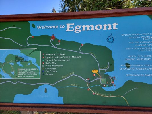
We finally let Jed go about 1715 and headed back to our boat. It had been a full and wonderful day. Tomorrow we'd head back out the rapids at noon. We told Jed we'd blow the horn as we went by to say thanks. When tomorrow was ended we hoped to be tied to a dock in Egmont, the jumping off point for Princess Louisa, and home to the Sechelt Narrows, aka, Skookumchuck Rapids, reportedly the fastest rapids in North America.






 I pulled it all back in and we moved on toward our first night's destination, Squirrel Cove (so named, I think, because there are NO squirrels there...). Squirrel Cove is pretty cool. You enter a moderately large square-ish bay, drive to one of the corners, the one that DOESN'T look like it's little channel goes all the way thru. The other corner has what appears to be a wide channel leading to an inner bay. Don't go there. Go thru the little one. It's tight, but deep. You pass thru it and enter an inner bay that's bigger than the outer bay, and mud bottom, uniformly around 20-40 feet deep. It's perfect. The mountains and hills are 360 degrees around it, it's beauty is stunning, and it has a little lagoon up in the NW corner.

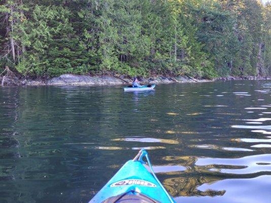


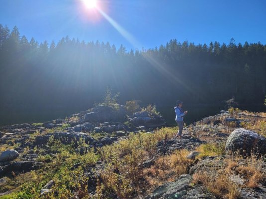
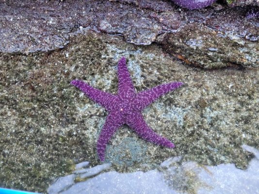


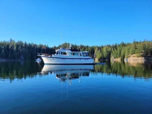

 We'd only attempted it once before, with another couple some months earlier in our home waters of the San Juan Islands. I understood the desired end-state but hadn't spent a lot of time mentally walking thru how to do it. Ok, I'd spent no time thinking it thru. The other couple and we spent almost 2 hours providing good wholesome entertainment for our fellow boaters as we fumbled around. Ultimately, tho we got ourselves tied to the shore, we abandoned the idea, pulled the rope in and found a place to anchor.









 Should have struck while the iron (pastry) was hot on our way in. Bummer. Lesson learned. Do it now. Don't wait. Tomorrow had no guarantees.