- Joined
- May 11, 2019
- Messages
- 3,450
- Location
- United States
- Vessel Name
- Muirgen
- Vessel Make
- 50' Beebe Passagemaker
As some of you may be aware, Laura and I, aboard MV Muirgen are finishing up our voyage from the PNW, down the West Coast, through the Panama Canal, and now across the Caribbean Sea, enroute to Florida. The following incident occurred several hours ago, and I thought it important enough to share with members on TF.
Location: Caribbean Sea, enroute from San Blas Islands, Panama to Florida.
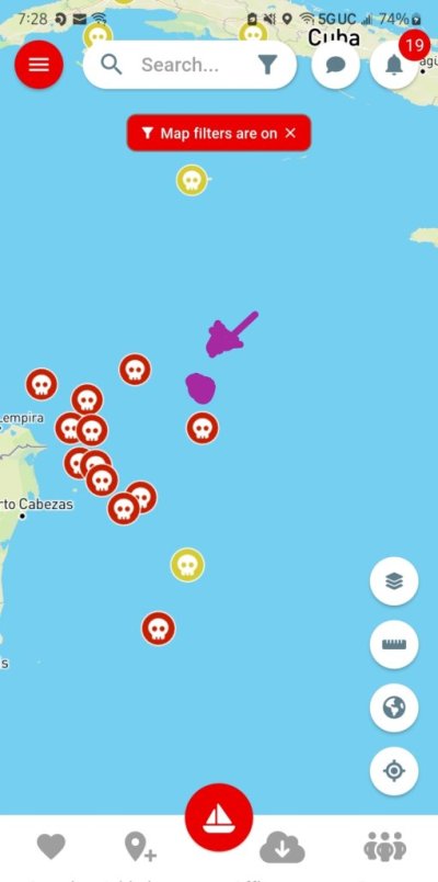
When/Where: 20 April 2024, 1830 cst. Vicinity of Thunder Knoll, (Lat/Long: 16.21.197N, 81.26.630W) , approximate 175 nm SSW of Grand Caymans, and 140 nm off the coast from Nicaragua/Honduras border.
Description of events: We were heading 319 degrees true, enroute to Yucatan Channel, 8.2 kts SOG.
We were on a course to pass East of Thunder Knoll by about 5 nm.
We observed a vessel on radar in the vicinity of Thunder Knoll (Lat/Long: 16.21.197N, 18.26.630W), heading 225 degrees true, 0.9 kts to 2.4 kts SOG. Vessel was a 50’ to 65’ fishing vessel, white hull, beige superstructure.
As we approached to within about 1.8 nm of the vessel, the vessel changed course to 020, and increased speed to 8.5 kts.
On the radar, the vectors appeared to indicate we were on an interception course.
We turned right 20 degrees to 340 degrees, the vessel turned right to roughly 040, still on an interception course according to the radar. We turned further right 75 degrees, to 055 degrees.
The vessel turned right to about 050, which now placed him in our port quarter.
We increased our speed over ground to 8.8 kts, monitoring RPM and EGT. We weren’t maxed out yet, but close to it.
It was getting dark, and we turned off our NAV lights, and AIS. The other vessel was silhouetted in the sunset on the Western horizon. We were due East of the other vessel, against the darkening horizon.
After about 25 minutes, with several additional course changes which the other vessel mimicked, we had opened the range to about 2.3 nm (from 1.8 nm). At that point, the vessel turned around and headed back to the SSW, decreasing speed to about 3 kts, and eventually to between 0.7 to 1.5 kts, generally back to where he had originally been when we first saw him.
As I write this, he is now 8.4 nm distant, back on a course of 253 degrees at 2.6 kts. Our intent is to clear the area for at least another two hours, then turn our NAV lights and AIS broadcast back on. We still have AIS receive, as well as radar reflectors.
We warned another vessel, SV Courage, who we are in contact with, and who is about 45 nm behind us, and he is changing course to 360 to stand clear to the East of the Thunder Knoll by 30 nm.
For what it’s worth, we got out 4 flare guns, large and small, with about 25 total cartridges, 3 parachute flares, and a Hawaiian Sling. We prepared to lock all the windows, and further prepare to be boarded. Details aren’t important.
I also had United States Coast Guard Sector Key West on my phone ready to call them via wifi calling over Starlink.
We were also prepared to activate two PLB’s and an EPIRP that we would place out of view in various locations. We were also prepared to activate DSC on the VHF as well. None of this may have helped us, but might assist in the individuals being apprehended if things went bad.
We have no way of actually knowing the other vessels intentions, but given our location 140 miles off of the border between Nicaragua and Honduras, and given reports over the Panama Posse and other websites of problems encountered, with recommendations to remain a minimum of 125 nm off land in this area, we were in a state of, shall we say, heightened awareness.
End result is that we are unmolested, and continuing on our way, but it was an interesting situation.
I guess my takeaway from this is that it is better to think through these type of situations before hand, so that if, God forbid, they come up, you already have a basic idea of how you are going to respond.
Tomorrow, I will be discussing the incident with USCG Sector Key West.
Fair winds and following seas to all!
Incident report # 3292 uploaded to CSSN 20 April 2024, 2226 cst.
Location: Caribbean Sea, enroute from San Blas Islands, Panama to Florida.
When/Where: 20 April 2024, 1830 cst. Vicinity of Thunder Knoll, (Lat/Long: 16.21.197N, 81.26.630W) , approximate 175 nm SSW of Grand Caymans, and 140 nm off the coast from Nicaragua/Honduras border.
Description of events: We were heading 319 degrees true, enroute to Yucatan Channel, 8.2 kts SOG.
We were on a course to pass East of Thunder Knoll by about 5 nm.
We observed a vessel on radar in the vicinity of Thunder Knoll (Lat/Long: 16.21.197N, 18.26.630W), heading 225 degrees true, 0.9 kts to 2.4 kts SOG. Vessel was a 50’ to 65’ fishing vessel, white hull, beige superstructure.
As we approached to within about 1.8 nm of the vessel, the vessel changed course to 020, and increased speed to 8.5 kts.
On the radar, the vectors appeared to indicate we were on an interception course.
We turned right 20 degrees to 340 degrees, the vessel turned right to roughly 040, still on an interception course according to the radar. We turned further right 75 degrees, to 055 degrees.
The vessel turned right to about 050, which now placed him in our port quarter.
We increased our speed over ground to 8.8 kts, monitoring RPM and EGT. We weren’t maxed out yet, but close to it.
It was getting dark, and we turned off our NAV lights, and AIS. The other vessel was silhouetted in the sunset on the Western horizon. We were due East of the other vessel, against the darkening horizon.
After about 25 minutes, with several additional course changes which the other vessel mimicked, we had opened the range to about 2.3 nm (from 1.8 nm). At that point, the vessel turned around and headed back to the SSW, decreasing speed to about 3 kts, and eventually to between 0.7 to 1.5 kts, generally back to where he had originally been when we first saw him.
As I write this, he is now 8.4 nm distant, back on a course of 253 degrees at 2.6 kts. Our intent is to clear the area for at least another two hours, then turn our NAV lights and AIS broadcast back on. We still have AIS receive, as well as radar reflectors.
We warned another vessel, SV Courage, who we are in contact with, and who is about 45 nm behind us, and he is changing course to 360 to stand clear to the East of the Thunder Knoll by 30 nm.
For what it’s worth, we got out 4 flare guns, large and small, with about 25 total cartridges, 3 parachute flares, and a Hawaiian Sling. We prepared to lock all the windows, and further prepare to be boarded. Details aren’t important.
I also had United States Coast Guard Sector Key West on my phone ready to call them via wifi calling over Starlink.
We were also prepared to activate two PLB’s and an EPIRP that we would place out of view in various locations. We were also prepared to activate DSC on the VHF as well. None of this may have helped us, but might assist in the individuals being apprehended if things went bad.
We have no way of actually knowing the other vessels intentions, but given our location 140 miles off of the border between Nicaragua and Honduras, and given reports over the Panama Posse and other websites of problems encountered, with recommendations to remain a minimum of 125 nm off land in this area, we were in a state of, shall we say, heightened awareness.
End result is that we are unmolested, and continuing on our way, but it was an interesting situation.
I guess my takeaway from this is that it is better to think through these type of situations before hand, so that if, God forbid, they come up, you already have a basic idea of how you are going to respond.
Tomorrow, I will be discussing the incident with USCG Sector Key West.
Fair winds and following seas to all!
Incident report # 3292 uploaded to CSSN 20 April 2024, 2226 cst.