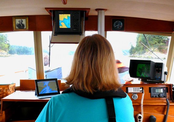
Paper chart for the area is always on the helm as the chartplotter/computer doesn't give the me the overview picture.
We still do this but we actually don't use the paper charts anymore even though they're there at the helm. Instead we now use an iPad with Navimiatics, which is a charting app (NOT a navigation app). This is far superior to paper for overview purposes because one can zoom in for a super-close detail look and then back out to include, in our case, all of Vancouver Island for example, with just a couple of finger swipes. Navimatics also overlays Active Captain so all the marina, anchorage, navigation, etc. information from AC is available right on the chart with just a finger tap.
And since we have a wifi/digital iPad instead of a wifi-only iPad, we need no connectivity at all to use Navimatics. Only the wifi/digital iPads have a stand-alone GPS receiver in them so need no connectivity at all, neither wifi nor digital, for positioning information. So the thing will track and show our position even if we're in the middle of the Pacific.
Navimatics shows the position of the vessel on the chart and also can lay a track behind it and show what we at Boeing call a "noodle," a line projected ahead of the vessel symbol showing where the vessel will be in a given time at its current speed.
The photo shows our underway configuration. In this case we're going through a narrow pass so have both plotters in chart display mode. Most of the time we have the old Echotec in chart display and the Furuno NavNet in split screen with the radar on top and the course and steering information on the bottom. We still have our chartboard and relevant chartbook beside the helm but today get almost all our "big picture" info from the iPad.
Attachments
Last edited:


