Now I am starting to think there is some BS going on.
Go to
Mike's Weather Page... powered by Sparks Energy!
They have been saying for nearly 18 hours that Irma has been moving west and then slightly west by NW. Every update since early this morning says that she will remain over Cuba for a "few hours." Maybe their definition of a "few hours" is different from mine.
However the latest update is that
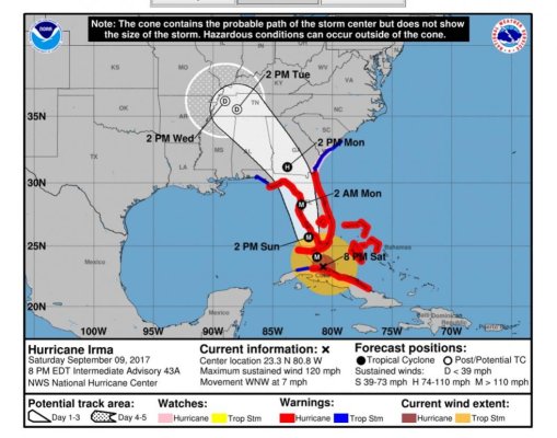
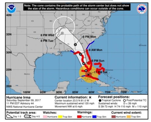
"At 800 PM EDT (0000 UTC), the eye of Hurricane Irma was located by
a NOAA Hurricane Hunter aircraft and NWS Doppler radar near
latitude 23.3 North, longitude 80.8 West. Radar loops indicate
that Irma has temporarily slowed down, but the hurricane has been
moving toward the west-northwest near 7 mph (11 km/h) since earlier
today. A northwest motion is expected to begin tonight with a turn
toward the north-northwest on Sunday."
Well based on this chart it would need to start going durn near North By NW very soon. In fact if in does stay over Cuba for a while it would have to go nearly due north to match that track.
I understand that these are hard to predict - bt the next "M" mark is withing hours and yet the track seems to conflict with the narrative.
What the hell gives here? Do they not want to show it going further off shore because that might make people complacent?