It's happened again. Boat meets rock in Prevost

The friendliest place on the web for anyone who enjoys boating.
If you have answers, please help by responding to the unanswered posts.
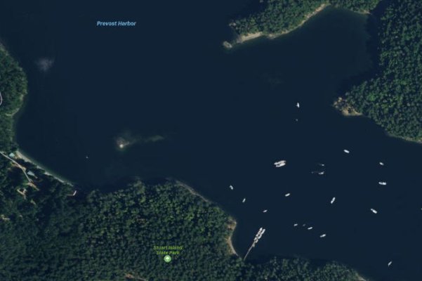
The last couple weeks of boat grounding is giving me a little anxiety. I believe i have good and current charts but i dont have bay knowledge .
Rod

Cruising guides can really help with filling in some local knowledge. Most of them will talk about the more unknown hazards or offer points of reference to navigate around something. The 2016 Waggoner Cruising Guide for example offers a paragraph of caution about the reefs the Norwester ran into and the one Latis found. This cruising guide would have been of high value to either skipper, it costs $35. In addition to a cruising guide you can also find stuff on the web. If you are going to some place new and things look skinny on the charts just do a web search on the location. You may find additional information about how to approach something or undocumented hazards. Here is another San Juan Island example about entering Fisherman Bay on Lopez Island. https://lopezfun.com/marina/ If you scroll down the marina gives you some tips about entering the channel. Here is a second example https://www.islandsmarinecenter.com/entering-fisherman-bay/

Aside from charts and guides there is usually additional information out there for popular places that have hazards. If you have a little bit of anxiety consider it an asset to help keep you on your toes.
 
Do you think he'll get his damage deposit back?

Funny, but most charters in Puget Sound don't do the damage deposit anymore. Now it's a nonrefundable "daily damage fee" surcharge on top of the rental rate along with another one for P&I insurance. As a semi-regular charterer (chartee? chârté?), I'm not happy about that, but waddya gonna do?
...
...
...
...
Besides, you know, buy your own boat :lol:
 
Last edited:
Yeah, that rock is plain as day on the sat view.
 

Attachments

  • provostharbor2.jpg
    provostharbor2.jpg
    30.6 KB · Views: 165
This is a charter boat and was out on charter, four people on board. Tow Boats US have been on scene all day, plugging some potential leaks and preparing to tow it off at 11:00 tonight. It is resting on the starboard stabilizer fin. It will be towed back to Anacortes and hauled out there. Here are more pictures.

Yikes. I'm glad this isn't the boat we had scheduled for June, though I had considered it :eek:
 
Cruising guides can really help with filling in some local knowledge. Most of them will talk about the more unknown hazards or offer points of reference to navigate around something. The 2016 Waggoner Cruising Guide for example offers a paragraph of caution about the reefs the Norwester ran into and the one Latis found. This cruising guide would have been of high value to either skipper, it costs $35. In addition to a cruising guide you can also find stuff on the web. If you are going to some place new and things look skinny on the charts just do a web search on the location. You may find additional information about how to approach something or undocumented hazards. Here is another San Juan Island example about entering Fisherman Bay on Lopez Island. https://lopezfun.com/marina/ If you scroll down the marina gives you some tips about entering the channel. Here is a second example https://www.islandsmarinecenter.com/entering-fisherman-bay/

Aside from charts and guides there is usually additional information out there for popular places that have hazards. If you have a little bit of anxiety consider it an asset to help keep you on your toes.


Not to downplay the value of local knowledge, but in this case I don't think there was any need for it at all. The hazards are clearly charted, so nobody should need a guide book to remind them to look at the chart and avoid the hazards.
 
First of all this is not the same rock. The Northwester hit a rock out side of Prevost Harbor and this boat hit the reef inside of the harbor.

This is a charter boat and was out on charter, four people on board. Tow Boats US have been on scene all day, plugging some potential leaks and preparing to tow it off at 11:00 tonight. It is resting on the starboard stabilizer fin. It will be towed back to Anacortes and hauled out there. Here are more pictures.


almost looks like it will buff out. the charterer and boat owner may be extremely lucky


HOLLYWOOD
 
almost looks like it will buff out. the charterer and boat owner may be extremely lucky


HOLLYWOOD

Good news, according the the management company the running gear was apparently untouched, some fiberglass work to be done on the hard and apparently will be back on the charter calendar before the end of the month. Was offered to me but I think I’m keeping my reservation for something slightly smaller and cheaper.
 
Another boat on the rocks last night.

Yet another boat went on the rocks at the other end of the bay last night. It was a sail boat about 25' or so. This boat belonged to someone local and had been anchored in the bay. Early evening the wind came up and it drug across the bay and on the rocks. It was rescued by someone at high tide as it was tied to a dock when I got up this morning.

So that makes three. Anyone who wants to come to Prevost now should be safe. Just pay attention!
 
Funny, but most charters in Puget Sound don't do the damage deposit anymore. Now it's a nonrefundable "daily damage fee" surcharge on top of the rental rate along with another one for P&I insurance. As a semi-regular charterer (chartee? chârté?), I'm not happy about that, but waddya gonna do?
...
...
...
...
Besides, you know, buy your own boat :lol:

Having been a "chase boat" for a couple of local chartering companies you would be surprised at how little actual damage is done every year. I have taken divers to boats to unwrap a line wrapped in a prop, replace a prop(s) damaged due to hitting something in the water, and towed a 44' sail boat 40 miles in that lost a prop from wrapping a line up and then trying unsuccessfully to unwrap it with engine power. Hauled fuel, new anchors and an operator when husband evacuated to hospital due to heart issues. All part of being in business.
 
Having been a "chase boat" for a couple of local chartering companies you would be surprised at how little actual damage is done every year. I have taken divers to boats to unwrap a line wrapped in a prop, replace a prop(s) damaged due to hitting something in the water, and towed a 44' sail boat 40 miles in that lost a prop from wrapping a line up and then trying unsuccessfully to unwrap it with engine power. Hauled fuel, new anchors and an operator when husband evacuated to hospital due to heart issues. All part of being in business.


Which is why I would prefer a refundable deposit however large instead of subsidizing the cost of others’ mistakes, personally. Knock on wood but I’ve never damaged anyone’s boat, at least not since I was 15.
 
The added fees are just part of the business plan for charter companies now. We chartered one for 4 days a few years ago to see if we could stand being on a trawler, by the time it was all added up the cost was ~50% more than the advertised rate. And none of it was really optional. Just a way for them to advertise lower rates.
 
Rocks, Prevost

Somebody should sacrifice one of their crab pot floats or an empty bleach bottle, tie enough line to account for tides to something heavy they don't care about, and drop it on top of the rocks there :eek:

Its charted.
 
Russell
I'm curious .. .. .. how is it that a boat out of LaConnor is in Prevost Harbor? We would LOVE to be able to cruise BC with friends (who are in Vancouver) this summer, but AFAIK the border is still closed. How did you get to Prevost?
Marty Oppenheimer
 
Ah, no, Prevost Harbor is definitely in BC
 
Ah, no, Prevost Harbor is definitely in BC

There may be a Prevost Harbor in BC, but THE Prevost Harbor in question which many of us here have visited is in Washington, Stuart/Satellite Island.
 

Attachments

  • 028B5BA8-06DB-4CA9-86F1-6324DE150223.jpg
    028B5BA8-06DB-4CA9-86F1-6324DE150223.jpg
    86.1 KB · Views: 49
Prevost Harbor is on Stewart Island in the San Juan's, Prevost Island is an island within the Canadian Gulf Islands. These accidents occurred in Prevost Harbor on Stewart Island, USA.

Ps: Nice boat martyopp............:thumb:
 
Last edited:
Prevost Harbor (as opposed to Prevost Island in BC) is definitely in the US. Of course, our cell phones don't exactly know that, as we usually get a "welcome to Canada" text on the north side of Stuart Island! LOL

Amazing you were there to witness the unfortunate incident, Russel. Hopefully you're right that such accidents happen in threes! In which case Prevost should be safe for the rest of the year. Although I won't hold my breath on that...
 
Not sure why people find this so confusing. If you can't read, just follow the colors. You need to stay away from the dark blue, the water is getting shallow, this is the danger zone. And if your in the green, well, it's probably to late!

I have marked the rocks where these groundings happened with a way point. There is another smaller reef in the bay that I see boats try to run over. It has a fairly smooth top so most boats can back off it. Click on image to enlarge.

The picture you attached says it all. The rocks aren't anywhere near what I would call the traffic lane.

I find it odd that in both groundings, both boats were no where near the center of the channel.

Typically, I keep my boat in the middle of a narrow waterway.
 
First of all this is not the same rock. The Northwester hit a rock out side of Prevost Harbor and this boat hit the reef inside of the harbor.

This is a charter boat and was out on charter, four people on board. Tow Boats US have been on scene all day, plugging some potential leaks and preparing to tow it off at 11:00 tonight. It is resting on the starboard stabilizer fin. It will be towed back to Anacortes and hauled out there. Here are more pictures.

Same Harbor different rock... rocks 2 boats 0
 
What do you do with toilet wax rings?
Hi Niel. You stuff them into gashes, cracks holes in the bottom. use them to help secure other materials as leak stops.
 
Prevost is completely unsafe, don’t go there. Good, now maybe I can get in there more easily this summer.

Neither of those rocks are in unexpected places. If you tried to mark every shallow rock outcropping up here, You would be kept busy for a long long time. Plus, it’s completely unnecessary. Most of the rocks in unexpected places are marked and they don’t move around much. Most areas simply require prudent seamanship and an occasional look at the charts. Honestly I think f you google the placemat version of the San Juan islands chart, the detail would be sufficient to navigate Prevost harbor. It’s not a chart issue. It’s a seamanship issue.
 
ghost I agree.
If these were sailboats maybe, but viewing from the CB you can see 'land ho' if paying attention.
 
Back
Top Bottom