Pairadice and ASD Columbia River Adventure 2018

The friendliest place on the web for anyone who enjoys boating.
If you have answers, please help by responding to the unanswered posts.
Weather Hold

Pairadice and ASD are in Kennewick WA on a weather hold until tomorrow. Storm blew in from the coast. Lots of rain on the coast, lots of wind here about 20kts+. The winds are subsiding later today and be nice tomorrow.

From our current location the trip to Lewiston ID is 128.5 miles, locking 4 dams. It will take 4 days to reach Lewiston, but we will most likely spend a few days here and there. Travel each day will be around a 30 miles or so.

We will spend a week or so in Lewiston then start the journey back to the lower Columbia River.

Living the life my friends....:thumb:
 

Attachments

  • IMG_2114.jpg
    IMG_2114.jpg
    146.3 KB · Views: 85
Yes you are!


We're sitting here in Zurich looking out the window at the hills. Early to bed tonight due to a long day tomorrow.


Camera battery died today so not a lot of photos and no way to charge it because these Swiss have weird electrical plugs. I'll post 'em as so as I can but I'll do it in a different thread.


Boat safe guys!
 
On The Move

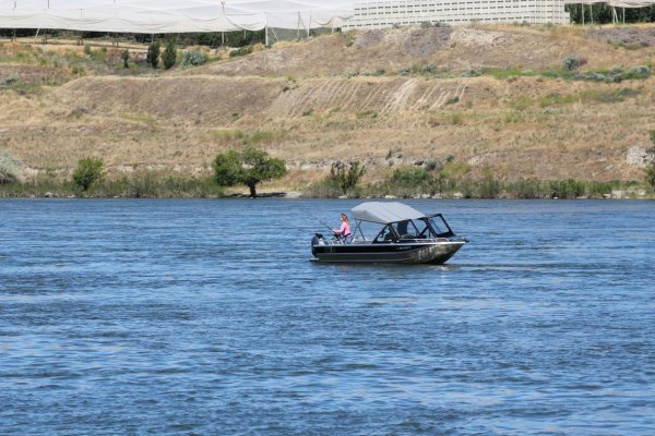
Today was a short run of 21 miles, but we are officially in the Snake River following the path of Lewis and Clark. When we entered the Snake we saw a replica of a dug out canoe. There was these huge tarp type coverings over fruit or cherry trees. Saw a lady with a salmon on her line and industry along the river. Old building for which I have no idea.

We locked through Ice Harbor Dam. Piece of cake! The Admiral has the locking down good.

Nice sunny day and about 80f. Fishhook Recreational Area is a Corps of Engineers park. Very very nice. Moorage is $7.....

Tomorrow we will be locking through Lower Granite to Lyons Ferry. Looks like the winds will be up on Wednesday, so we may spend a day or two here.
 

Attachments

  • IMG_2131.jpg
    IMG_2131.jpg
    109.6 KB · Views: 86
  • IMG_2136.jpg
    IMG_2136.jpg
    156.1 KB · Views: 83
  • IMG_2172.jpg
    IMG_2172.jpg
    168.6 KB · Views: 76
  • IMG_2174.jpg
    IMG_2174.jpg
    117.7 KB · Views: 73
  • IMG_2175.jpg
    IMG_2175.jpg
    120 KB · Views: 78
  • IMG_2177.jpg
    IMG_2177.jpg
    196.6 KB · Views: 71
  • IMG_2182.jpg
    IMG_2182.jpg
    98.1 KB · Views: 72
  • IMG_2204.jpg
    IMG_2204.jpg
    102.7 KB · Views: 70
We will spend a week or so in Lewiston then start the journey back to the lower Columbia River.

Living the life my friends....:thumb:


Why come back? Truck to Sioux City and do the east coast. Trucking about 1300 miles.


ICW, canals, great lakes - my dream cruise.


9737063096_44449E597F2D8C73A5E204EE39E4A00B.jpg
 
Last edited by a moderator:
Beautiful day to head up the Snake!

That replica canoe is adjacent to the Lewis & Clark interpretive center which is near where the expedition camped in Oct of 1805. I believe the old building referenced is what remains of a watering station for the old steam locomotives.

We look forward to seeing you guys on the 4th!
 
A few more pics of Ice Harbor Dam and Fishhook Rec area
 

Attachments

  • IMG_2247.jpg
    IMG_2247.jpg
    114.2 KB · Views: 67
  • IMG_2253.jpg
    IMG_2253.jpg
    97.3 KB · Views: 72
  • IMG_2256.jpg
    IMG_2256.jpg
    166 KB · Views: 71
  • IMG_2259.jpg
    IMG_2259.jpg
    159.7 KB · Views: 72
  • IMG_2261.jpg
    IMG_2261.jpg
    117.8 KB · Views: 78
  • IMG_2265.jpg
    IMG_2265.jpg
    153.7 KB · Views: 73
Doug, great pics all. I'm glad you all are having a fun time on the dry side of the state.
 
Hey all, we have made it to Boyer Park just below the last lock. Cell service and wi-if is almost non existent. We head to Clarkston Sunday and hope for regular cell service. Tons of photo’s to upload.

Cheers, Pairadice and ASD
 
Loyds Marina to Boyer Park

Wow took over an hour and a half to upload this.....

Locked through Little Goose Thursday. Cell signal is spotty to none at best. This surprised us. We are at Boyer Park, just below Granite Dam, the last dam in the system. We will stay here for a few days then on to our final destination, Lewiston/Clarkston. Our moorage will be at Hells Canyon Resort. Hold up here for a few weeks, then head back down.

Locking through isn't a big deal anymore. This time we left a little sticker on the bollard.

More pics when we get to Lewiston/Clarkston...
 

Attachments

  • IMG_2412.jpg
    IMG_2412.jpg
    89.4 KB · Views: 84
  • IMG_2413.jpg
    IMG_2413.jpg
    79.2 KB · Views: 90
  • IMG_2414.jpg
    IMG_2414.jpg
    98 KB · Views: 83
  • IMG_2478.jpg
    IMG_2478.jpg
    196.3 KB · Views: 85
  • IMG_2494.jpg
    IMG_2494.jpg
    145.1 KB · Views: 86
  • IMG_2497.jpg
    IMG_2497.jpg
    153.8 KB · Views: 77
  • IMG_2523.jpg
    IMG_2523.jpg
    146.2 KB · Views: 77
  • IMG_2530.jpg
    IMG_2530.jpg
    111 KB · Views: 78
  • IMG_2537.jpg
    IMG_2537.jpg
    197.3 KB · Views: 77
Wow took over an hour and a half to upload this.....
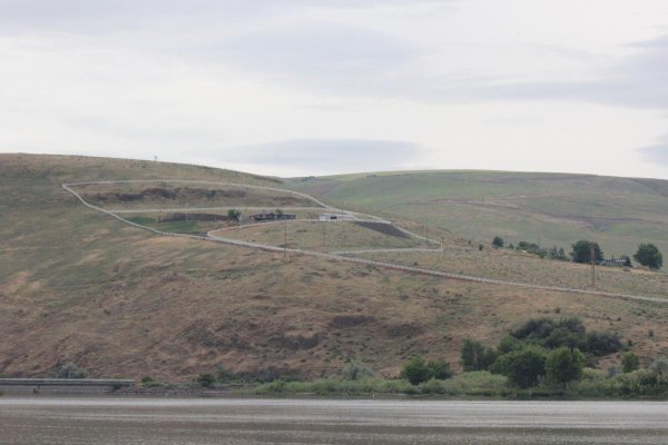
Locked through Little Goose Thursday. Cell signal is spotty to none at best. This surprised us. We are at Boyer Park, just below Granite Dam, the last dam in the system. We will stay here for a few days then on to our final destination, Lewiston/Clarkston. Our moorage will be at Hells Canyon Resort. Hold up here for a few weeks, then head back down.

Locking through isn't a big deal anymore. This time we left a little sticker on the bollard.

More pics when we get to Lewiston/Clarkston...

Your in for a treat on the trip back down.. the boat will float off the wall and make down locking a lot easier. Also going with the current really makes a difference.
HOLLYWOOD
 
John and Tom, Hollywood's spot on with his comment about locking through being easy when you're headed downstream. It'll amaze you how easy it is.


We should be back in Seattle Friday and in the Tri Cities on Saturday (assuming jet lag doesn't kick my butt too bad!).


Keep us posted on where you go when you get to Lewiston/Clarkston.
 
Boyer to Lewiston/Clarkston

What a ride! We have gone 420 miles from our winter dock. Pairadice a little less. After 3 days at Boyer, we left the dock to make the 9 AM lift. The Lower Granite lock is right around the corner. The entrance to Boyer is about 7 ft. What I would give to have 7 feet here in Clarkston. More later.

The lock entrance was no worries, but the lock master wanted us to tie up on the port side. We are use to stbd ties. What was different was the bubbles and water inside the lock. Fist time seeing this. The lift was fast too, about 12 minutes! Once on top we had to push some logs aside to get out of the lock, but we are past our last "up lock!!"

The cruise into Lewiston/Clarkston was nice. We did gain full cell service once we rounded the corner to town. It was a surprise that cell service is spotty at best up the entire Snake River.

So approaching Hell Canyon Resort. I was told there was shoaling in front of the marina. This was confirmed by a sail boat we met on the way up from the lock.

Looking at Google Earth the "long dock" looked pretty straight forward. As we were approaching a guy showed up at the end of the dock waving us off!!! I immediately went hard to port. But I was in 22 ft of water.... He directed us up river. We saw all these white markers in the water. He told us to go up river until was were across from the culvert, then turn stbd and put the bow on the edge of the dock. OK..... 20 ft of water, no big deal.

Then all of a sudden I was in 5 ft of water, then 4...crap. Made it to the dock pulled up the dock and I was in 7ft. 12 feet off my stbd it was 2 ft.

Pairadice's turn. John followed the narrow channel, but he was going to stern in. He cam out of the channel and soft grounded. He was able to to get off, went back to the river and bowed in. At the end of the dock there is a "4 ft hump." Once tied up we both were not happy campers.

If we had know about the extent of the shoaling we would not have stayed here. Unfortunately for us it is the only dock in town. The dock......

This is one of the worse docked we have been too as far a condition and lack of dredging. We found out later from folks on the dock, that the owner got into a pissing contest with the Corp of Engineers. Thus they will not allow him to dredge. Sad, because he has a great location, but the docks are in poor condition, shoaling is shutting down his operation. I would not recommend any boat over 30' to consider docking here, and a 30' may be iffy.

That being said the staff is great. They made sure we good at the dock. We have electric and water. Susan also reduced the moorage fees. The Admiral flays out this week for a trip back to Missouri and will be gone for a week and a half.

Our only concern is what happens if the water level goes down.........to be continued!
 

Attachments

  • IMG_2539.jpg
    IMG_2539.jpg
    135.8 KB · Views: 76
  • IMG_2547.jpg
    IMG_2547.jpg
    128.5 KB · Views: 76
  • IMG_2548.jpg
    IMG_2548.jpg
    146 KB · Views: 79
  • IMG_2549.jpg
    IMG_2549.jpg
    131.2 KB · Views: 78
  • IMG_2556.jpg
    IMG_2556.jpg
    143.2 KB · Views: 70
  • IMG_2557.jpg
    IMG_2557.jpg
    128.3 KB · Views: 74
  • IMG_2561.jpg
    IMG_2561.jpg
    95.3 KB · Views: 68
  • IMG_2562.jpg
    IMG_2562.jpg
    137 KB · Views: 72
More pics
 

Attachments

  • IMG_2567.jpg
    IMG_2567.jpg
    193.6 KB · Views: 67
  • IMG_2568.jpg
    IMG_2568.jpg
    89.3 KB · Views: 63
  • IMG_2569.jpg
    IMG_2569.jpg
    88.3 KB · Views: 60
  • IMG_2571.jpg
    IMG_2571.jpg
    145.8 KB · Views: 60
  • IMG_2572.jpg
    IMG_2572.jpg
    112.8 KB · Views: 67
  • IMG_2573.jpg
    IMG_2573.jpg
    107.8 KB · Views: 65
  • IMG_2574.jpg
    IMG_2574.jpg
    75.1 KB · Views: 66
  • IMG_2575.jpg
    IMG_2575.jpg
    109.2 KB · Views: 62
Tom and John, nice photos all, and a good writeup. We just got home from our trip and have been without internet or cell service for the past 5 days. Tom, I got your text, will get back to you in a short bit.
 
Thanks for the photos and and updates. This has made me want to consider such a trip some day. Have to retire fully first and likely will need to take the trip down the coast solo as I don’t think I’ll get my wife West of Juan de Fuca.
 
Brewery hopping

Finally getting a chance to do a bit of Brewery hopping. First one is Riverport. More to follow if we don’t get too hammered.
 

Attachments

  • image.jpg
    image.jpg
    131.5 KB · Views: 61
  • 2CF4EF2D-E615-4AE4-A720-9F78F4A6889B.jpg
    2CF4EF2D-E615-4AE4-A720-9F78F4A6889B.jpg
    144.8 KB · Views: 64
First one of many!
 

Attachments

  • image.jpg
    image.jpg
    91.2 KB · Views: 61
We made it to Roosters stop #2 and a band to boot, this might be our last. Way to many choices on the tap menu.

Cheers All
 

Attachments

  • 36286EC3-8227-4450-AB7D-6EF70224E5BD.jpg
    36286EC3-8227-4450-AB7D-6EF70224E5BD.jpg
    197 KB · Views: 79
Glad you guys are having fun up there. It's a great stretch of river, very scenic, easy to navigate except for getting into your dock there. Too bad the owner got into a pissing match with the Corps. That's a battle you can't possibly win.


Looking forward to seeing you on your trip back down. I had another Klondike bar in your honor last night. Still 4 left and I'm hoarding those.
 
A few more pics of our bar adventures.....
 

Attachments

  • 20180623_164826.jpg
    20180623_164826.jpg
    99.4 KB · Views: 73
  • 20180623_164845.jpg
    20180623_164845.jpg
    110 KB · Views: 67
  • 20180623_180924.jpg
    20180623_180924.jpg
    109.1 KB · Views: 76
  • 20180623_212026.jpg
    20180623_212026.jpg
    85.1 KB · Views: 63
  • 20180623_212034.jpg
    20180623_212034.jpg
    129.1 KB · Views: 62
Hell's Canyon Excursion

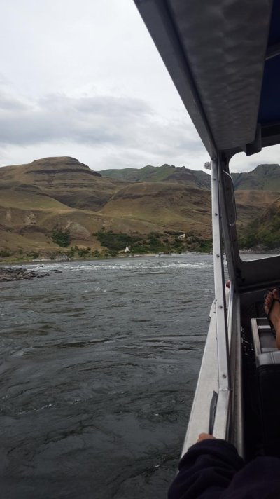
Yesterday we loaded up and took a jet boat ride into Hell's Canyon. It was a fun ride for about 5 hours. The boat is 34 ft long with 3 Chevy 350cid engines with Hamilton jets.

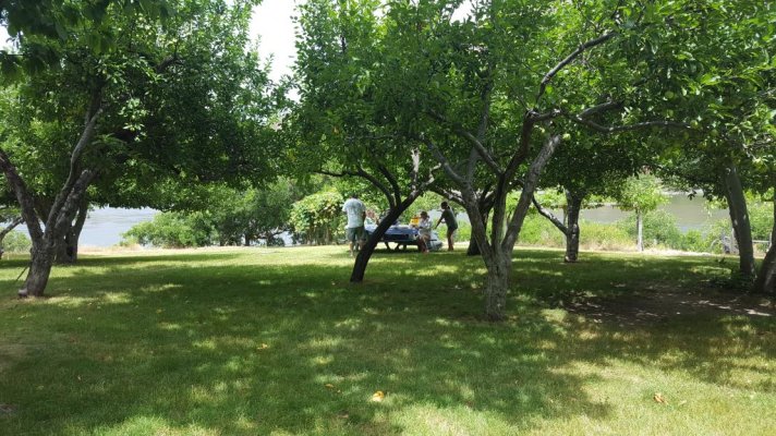
The jetboat company provided lunch at the Forest Service entrance to the Canyon. There were fruit trees and grape vines. The Crusty was also on the search. For what, no one knows!!

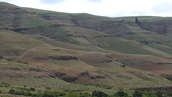
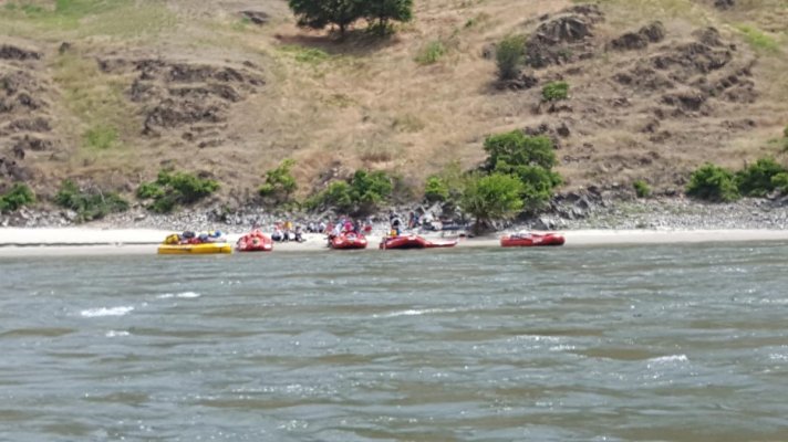
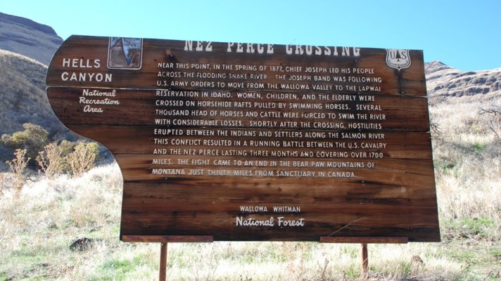
The further up we went the narrower the river. Once we passed the Salmon River, the Snake River became very narrow and fast. We continues up through rapids and fast water until we reached the Nez Perce Crossing:

https://www.nps.gov/nepe/learn/historyculture/dug-bar-history.htm

This was an awesome place. See the picture next post that explains it.

We used this jetboat company. We liked them because it was a small family operated company. We would recommend them.

https://snakedancerexcursions.com/
 

Attachments

  • 20180625_095838.jpg
    20180625_095838.jpg
    66.6 KB · Views: 69
  • 20180625_103633.jpg
    20180625_103633.jpg
    93 KB · Views: 67
  • 20180625_103858.jpg
    20180625_103858.jpg
    100 KB · Views: 56
  • 20180625_104746.jpg
    20180625_104746.jpg
    78.6 KB · Views: 73
  • 20180625_112837.jpg
    20180625_112837.jpg
    163.5 KB · Views: 65
  • 20180625_112845.jpg
    20180625_112845.jpg
    107.3 KB · Views: 63
  • 20180625_113505.jpg
    20180625_113505.jpg
    195.9 KB · Views: 70
  • 20180625_114325.jpg
    20180625_114325.jpg
    75.2 KB · Views: 60
  • 20180625_114340.jpg
    20180625_114340.jpg
    192.6 KB · Views: 62
  • 20180625_114351.jpg
    20180625_114351.jpg
    127.2 KB · Views: 62
Here are some more pics to include an old range marker from the early 1900s.
 

Attachments

  • 20180625_120345.jpg
    20180625_120345.jpg
    196.5 KB · Views: 62
  • 20180625_121304.jpg
    20180625_121304.jpg
    105.6 KB · Views: 62
  • 20180625_122743.jpg
    20180625_122743.jpg
    103.8 KB · Views: 58
  • 20180625_125400.jpg
    20180625_125400.jpg
    135.5 KB · Views: 61
  • 20180625_130432.jpg
    20180625_130432.jpg
    151.1 KB · Views: 65
  • 20180625_125855.jpg
    20180625_125855.jpg
    99.5 KB · Views: 67
  • 20180625_130437.jpg
    20180625_130437.jpg
    110.5 KB · Views: 63
  • 20180625_131633.jpg
    20180625_131633.jpg
    163 KB · Views: 60
  • 20180625_131747.jpg
    20180625_131747.jpg
    198.8 KB · Views: 66
  • 20180625_133501.jpg
    20180625_133501.jpg
    121.7 KB · Views: 62
Last of the pics to include the Nez Perce crossing. Unbelievable the way they crossed!!
 

Attachments

  • 20180625_133601.jpg
    20180625_133601.jpg
    83.4 KB · Views: 65
  • 20180625_133622.jpg
    20180625_133622.jpg
    132.6 KB · Views: 69
  • 20180625_133634.jpg
    20180625_133634.jpg
    120.2 KB · Views: 62
  • 20180625_135656.jpg
    20180625_135656.jpg
    154.8 KB · Views: 73
  • 20180625_135706.jpg
    20180625_135706.jpg
    137.8 KB · Views: 56
  • Crossing.jpg
    Crossing.jpg
    171.8 KB · Views: 76
Yesterday we loaded up and took a jet boat ride into Hell's Canyon. It was a fun ride for about 5 hours. The boat is 34 ft long with 3 Chevy 350cid engines with Hamilton jets.

The jetboat company provided lunch at the Forest Service entrance to the Canyon. There were fruit trees and grape vines. The Crusty was also on the search. For what, no one knows!!

The further up we went the narrower the river. Once we passed the Salmon River, the Snake River became very narrow and fast. We continues up through rapids and fast water until we reached the Nez Perce Crossing:

https://www.nps.gov/nepe/learn/historyculture/dug-bar-history.htm

This was an awesome place. See the picture next post that explains it.

We used this jetboat company. We liked them because it was a small family operated company. We would recommend them.

https://snakedancerexcursions.com/


"The Crusty was also on the search. For what, no one knows!!"

My guess would be a 'Diet' of sorts.:hide:

 
I think that's the same company whose boat we took that same trip on. Great scenery and a great ride but it kinda spooked me when he'd run on plane 2'-3' from the rocks at the edge of the river.


Thanks for sharing the pics. BTW ,we may have to change our plans for the 4th. They changed the location of the fireworks light off place so our plans may have to be adjusted a bit. I'll do some checking and let you guys know.


Pyromaniac GFC
 
No worries. We should be in Tri-Cities on Sunday if we don't ground out trying to leave this marina.
 
Back
Top Bottom