Simrad NSE Help

The friendliest place on the web for anyone who enjoys boating.
If you have answers, please help by responding to the unanswered posts.

Jmreim

Senior Member
Joined
Jan 7, 2019
Messages
179
Location
USA
Vessel Name
Boundless
Vessel Make
2013 North Pacific 43'
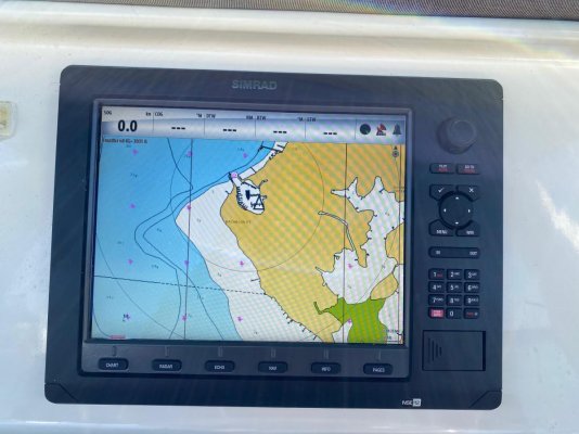
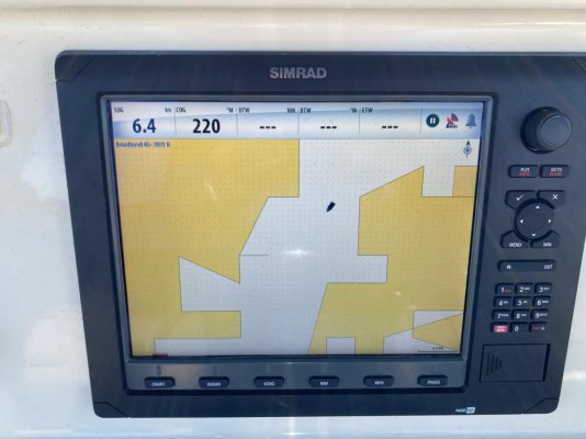
Just bought a new boat (to me) with a Simrad NSE12 and Navionics charts. While trying to learn it, think I my have errantly changed something that has caused the chart detail to disappear (see before and after images below). Thought it might be a satellite connection issue but that doesn't appear to be the case.

Does anyone know what I've done and how it might be rectified? Simrad doesn't seem to support the NSE anymore.
Thx -
Jim
IMG_3467.jpg

IMG_3500.jpg
 
You’re seeing the base map with no proprietary chart on top.
Get it to read whatever micro SD you have and it’s fixed
 
It looks like you have inadvertently switched to displaying the base ( loaded) charts that come with the MFD. You need to switch to Navionics to get the detail you showed
 
If it were switched to the charts that came installed, those would be “Insight” charts and there should still be detail. If there is more than one plotter networked with this one and the SD card is in the other plotter and if that plotter is not turned on, it will look like that. Need more info but I suggest that because in the first shot your radar is on and in the second it is not.
 
I had an NSE12 (currently an NSS Evo3S) and I agree with the previous posters, your chart chip may be corrupt and need to be replaced. I had this issue with my unit, support suggested that the reader was not working, and that I insert a chip with nothing on it and go into the menu to see if the chip showed up. If it doesn't show up, it's the chip reader, if it does it's probably a corrupt chip.
 
More Simrad Help Pls?

So just to continue this thread as I take 2 steps forward and sometimes 1-2 steps back -
Got the upper helm working by inserting my Navionics card - all good there. Unfortunately, the upper/lower helm units seem to be working independently. I thought they were working together a few wks ago when I bought the boat but I'm either wrong about that OR I've inadvertently screwed it up someplace.The lower unit appears to use a similar NSE OS as the upper unit but the lower unit uses a greenmarine display and it has no card slot on he front - I'm not sure where it's getting the Navionics chart data from?
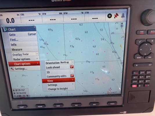
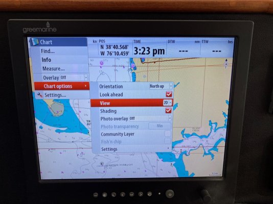
The upper unit appears to have a slightly different menu system as you can see in the pics below (1st pic is upper, 2nd pic is lower). For example, the upper unit has a menu item for Easy View in the View menu but the lower unit does not.
Any ideas on how to get these units networked again and establish the upper unit as the master and the lower the slave???
Thx again -
Jim

upper helm.jpg

lower helm.jpg
 
The lower unit you have pictured is just a display, there is a unit connected to it which is the "brains" for that unit, probably a NSO. That box will have a card slot in it, there is still a lot more to figure out but first you need to identify the components you have and then read the installation and operaters manuals for each to figure out how it is configured.
One thing that is straightforward to tell you is the network cable is what is sharing chart data between the two units, not the NMEA 0183 or 2000 cables.
 
Last edited:
Back
Top Bottom