Using Your AP on Routes

The friendliest place on the web for anyone who enjoys boating.
If you have answers, please help by responding to the unanswered posts.
I doubt they all were on AP...as you can see here, many dont use it in confined waters.

I NEVER hog th he middle of the channel unless totally alone.....but many boaters either have no they are hogging the center, feel because their boat is bigger they need it, or just dont care about others.

I have no experience with auto routing, so I cant comment on that, just guessing that most dont use nav mode in confined areas, and some just auto and adjust as necessary.

All in all, just some are bad drivers.
 
Last edited:
For years I never trusted the "track" function on my AP. I either plotted a single waypoint and hit the "go to" button or some times I made a rhumbline from San Diego to Avalon and just used the the"Auto" feature to parallel that line. (Lots of traffic using a direct route to & from Catalina Island that makes it prudent to just move to one side of the direct course about a hundred yards to minimize traffic encounters.) This made it easier for a newbie to see what he/she was doing when helming the boat. Now that I have much newer Raymarine Nav gear & their Evolution AP, I do trust the "track" function but still move to one side of the intended course for time to time.:blush:
 
Last edited:
We've not yet used our AP in auto route mode, just use it for maintaining a heading.
But the statement above brings up a question. During a trip last month we were southbound on the ICW for several days so we were going against the flow of most of the traffic still migrating north. We encountered many, many boats that were tracking down the center of the channel, often in areas where the channel was very narrow where boats should be favoring the starboard side in order to allow sufficient room to pass. Many of those that we passed did not move from the center of the channel. We often had to move out of the channel in order to get by. Is traveling down the center of a channel (not favoring the starboard side) possibly the result of using an AP on auto routing?

Auto route creation doesn't have logic or manners. It simply creates the shortest route to your destination. Hopefully avoiding hazards.

That's the reason I create routes for both direction to a location minding direction of travel in narrow channels and current and other boat traffic in open areas. Even have several routes for differen stages of tide and current in narrows.
 
95% of the time. Here in the PNW we have many rocks and reefs combined with strong currents doing all kinds of strange things. My Raymarine e80 and autopilot keep me within 0.01 NM of route I plan, and warn me if currents are so strong that at 7.5 KTS, can't keep on that track. This is the safest way to stay off the rocks, and the AP steers much better that I do. But still never leave the helm. I'll be upgrading my e80 to Axiom system, and if my legacy AP won't fully integrate, I will upgrade the AP too. It's that important. [emoji4][emoji924]
Does anyone ever use their AP and ChartPlotter/GPS to run routes - either with or without manual authorization to change course?

I have the capability, but frankly can never see the reason why I would ever do so.

I use the AP to run the ICW so that is clearly changing course by degrees so not applicable to this conversation.

But when I run to the islands, say from The Berries to Allen Cay in the Exumas I have all the waypoints in and could set an auto route through Porgee Rocks etc. east of Nassau.

But I would much rather set it waypoint by waypoint and be in total control. Clearly then I need to use my chartbook or other list of the waypoints in order, selecting the next waypoint and using Go To, but that is a simple process.

Anyone use auto routes?
 
We almost always make routes manually, then let "George" steer them, including most turns. Ours won't make a turn w/o human authorization, so we're still making the decision to turn.
 
I had a 'buddy boat' following me a few years ago. He had his AP setup to follow the plotted course. We ended up leaving late because of fog and his Radar not working. We were bucking a tide at that point and it put our arrival at Woods Hole, MA much later than anticipated. That would have us fighting the inbound flood. I was hand-steering at the time. To make some time, I cut a corner that cut distance by about 4 -5 miles, but it brought us on the back side of a large reef, but our course was allowing us plenty of water.

His AP was still trying to get him back to his way point. At that point his AP was fighting him to bring him ACROSS the reef. Something to think about if you decide to deviate from your plotted course.
 
We almost always make routes manually, then let "George" steer them, including most turns. Ours won't make a turn w/o human authorization, so we're still making the decision to turn.

My AP is named "Otto," but the one I installed on my friend's boat is called "Rich" or "Dammit Rich" if not doing what he wishes it would.
 
My AP is named "Otto," but the one I installed on my friend's boat is called "Rich" or "Dammit Rich" if not doing what he wishes it would.

Ours is named "Bob." My grandson came on the bridge one time and asked who was steering. I said, "Bob." He looked around carefully and then gently asked, "Can you... SEE... Bob right now?" Smartass. Yeah... that's my grandson. LOL
 
I had a 'buddy boat' following me a few years ago. He had his AP setup to follow the plotted course. We ended up leaving late because of fog and his Radar not working. We were bucking a tide at that point and it put our arrival at Woods Hole, MA much later than anticipated. That would have us fighting the inbound flood. I was hand-steering at the time. To make some time, I cut a corner that cut distance by about 4 -5 miles, but it brought us on the back side of a large reef, but our course was allowing us plenty of water.

His AP was still trying to get him back to his way point. At that point his AP was fighting him to bring him ACROSS the reef. Something to think about if you decide to deviate from your plotted course.
Just turn off your AP and/or track/nav function?
 
Whether using the AP or not, here on the east coast AICW there are many cruisers who slavishly follow the magenta line used on the charts to show the ICW's route. This has caused many a boater to run into relatively new shoals, snags and even moved markers. For instance, the "Cumberland crossings" in Georgia was one of the poster children for this. You'd see comments on various sites complaining about running aground while "right in the middle of the channel".

The NOAA began to remove the line from chart updates, causing much hue and cry.

I used the AP all the time, but inshore, mostly as a form of power steering device. The PO had blessed us with long-corded remotes at both helms, so I could lean back in the helm chair with feet on the dash steering with thumb and forefinger. I had waypoints for routes throughout the plotter, and could adjust our course to the reality presented in front of us and the latest LNMs.

The only time I used the "NAV" function was in open waters such as the ocean, Gulf, large sounds and bays. But always kept a close watch.
 
I'm an auto route guy for the most part and did most of the loop that way, even in the inland rivers. For the most part, it was quite accurate... but had to be watched.


When there were other boats or obstructions, I simple selected heading hold or operated manually. Worked fine.


To hold a course, I've got a heading "no drift" mode that works well in a cross current... or just plot a course.
 
We do this and love it, but we are still on WATCH the entire time. Last weekend we had a boat doing this that was cross our course and came with in a few hundred yards of us, we radio prior to them get that close, advise of the issue, reminded we had right of way and his response was OH WELL, my nav system is in control and I do not know now to change course!!!....very scare and if we were not on watch would have hit (simrad was warning us which was great.

Just share, great tool but you still need to at the helm and eyes wide open.
 
I use routes all the time. I don’t think my AP can change course automatically at each waypoint and if it could, I wouldn’t enable it. I have to acknowledge that the leg is complete and give the AP permission to make the course change to the next waypoint in the route.
 
Just share, great tool but you still need to at the helm and eyes wide open.

Exactly, it's a tool. Still need a human brain and eyes to be in charge.

We use Nav all the time, as stated previously, but one of us is always on the helm chair keeping a lookout and making decisions on courses change and crossing and passing situations.

However, if I'm by myself and have to hit the head, I'll glass ahead and to the sides to make sure I'll have enough time to do what I need to do before leaving the helm. And also to make sure a waypoint and course change is not imminent.
 
Last edited:
The PO had blessed us with long-corded remotes at both helms, so I could lean back in the helm chair with feet on the dash steering with thumb and forefinger.

Feet on the dash! Who would (note remote to left of console) do that?

Traveling to Coecles Harbor Shelter Island, Long Island NY last weekend.

Rob
 

Attachments

  • IMG_2797.jpeg
    IMG_2797.jpeg
    80.9 KB · Views: 26
We are consistent with others who use auto route and keep watch. I find it very beneficial in the PacNW. The off or standby buttons are on the AP for a reason! Dodge buttons are there for a reason! There is no way I can steer as effectively as the AP with our passages, currents, etc. In an area such as ours, with very few direct routes between two points, auto route combined with manual intervention makes for a very efficient and relaxing passage.
 
We are consistent with others who use auto route and keep watch. I find it very beneficial in the PacNW. The off or standby buttons are on the AP for a reason! Dodge buttons are there for a reason! There is no way I can steer as effectively as the AP with our passages, currents, etc. In an area such as ours, with very few direct routes between two points, auto route combined with manual intervention makes for a very efficient and relaxing passage.

I hope you meant Nav on the autopilot. Auto route is entering destination and starting point on a chart plotter and have the plotter create the route.

Nav is where the plotter drives the boat following the route created by you or auto route precisely and making turns at waypoints with authorization from the helmsman. Or helmswoman.
 
Yes. Of course (pardon the pun). Use Axiom to create auto route. Start voyage with AP on standby. Select follow route on Axiom. Turn (older) AP to track. Acknowledge. Rinse and repeat. All well documented in user manuals. Sit back, watch for dead heads and traffic, monitor AIS and or radar targets, take action as necessary. Key in PACNW is having attention focused on watching for deadheads and other crap in the water. Steering isn’t my job. Managing the process is.
 
Yes. Of course (pardon the pun). Use Axiom to create auto route. Start voyage with AP on standby. Select follow route on Axiom. Turn (older) AP to track. Acknowledge. Rinse and repeat. All well documented in user manuals. Sit back, watch for dead heads and traffic, monitor AIS and or radar targets, take action as necessary. Key in PACNW is having attention focused on watching for deadheads and other crap in the water. Steering isn’t my job. Managing the process is.

So after Axiom creates the Auto route, do you proof it before following it? Make tweaks?
 
Yes syjos. I take a look at the whole route but not in detail. Again, this is for our cruising in our area. Auto route sometimes makes too many waypoints or takes a tack that I don’t like. I monitor in real time. Sometimes I’m doing a parallel universe route on an iPad with Navionics. As many of you know, getting around in the San Juans, Gulf Islands, or points north involves a LOT of turns/waypoints so for me, manual entry is a non starter. Because there are so many turns I need to keep an eye on the routing. Because there are so many charter boats, etc. I need to keep an eye on traffic. Auto routing linked to our AP makes the process of getting from start to destination less about steering and more about safety. I also know that I could never steer more efficiently then “Brunhilda” as we have named our set up. Cross track error is seldom more than .3 degrees and is usually 0 to .1.
 
It's interesting to hear how some of us won't let our pilots turn at a waypoint without us giving it permission, where others allow the pilot to turn on it's own as soon as the new waypoint becomes active.


I believe it's universal that all pilots sounds an alert that needs to be acknowledged when there is a change in waypoints, so the difference is whether that acknowledge is also required for the course change.


Most recently I have felt it's better to let the pilot make the turn on it's own. The reasoning is that I have a change in course in the route for a reason, often because of a hazard. The desired operation is to turn, because continuing on is very likely a bad thing. I think the only case where continuing on the old course would be benign (but still not what's desired) is in open water.


Since the only reason you wouldn't make the turn is because of traffic or floating debris, while not making the turn is a likely bad thing, it seems that on balance it's better to the allow the pilot to make the turn. At least that's been my thinking.


I'll say again that none of this relieves you of any watch keeping duty, but it is useful, and I think safer, to have the assistance of an AP so that steering doesn't consume so much of your attention.
 
I use routes because I like to have the whole route laid out on the screen for perspective. Also it allows me to check the ETA to my destination periodically for planning purposes.

I don't like to use auto-routing to build my route, because I prefer to study the chart closely while building the route manually which helps me to be better prepared for any tricky bits or new waters.

I don't like to let the AP follow the route. I will usually set the autopilot based on heading and adjust manually using the AP control. I will generally follow the route I planned, but deviate from it for all sorts of reasons (traffic, weather, current, sightseeing, restricted areas, etc. I am always concerned that the AP does not know anything about other boat traffic (especially for large commercial vessels), and that charts are not always accurate (so routes based on charts can be unsafe). I will use the Go To Waypoint for multi-hour legs, but then I start adjusting the heading anyway.
 
All I can think of for not letting AP follow routes when it makes sense...and evel the level if "makes sense" increases is experience with AP....or just plain time driving boats where there is still excitement in actually steering.

Understandably if one has a bad experience with AP, one might be hesitant to use it to its fullest extent...or maybe they read about situations where even pros screw up using AP.

But not at least allowing an AP to track to a waypoint you are steering to anyway visibly seem silly to me as it will automatically make drift corrections better than you and steering around traffic (unless very heavy) or other objects (unless a field of floats) is really no big deal unless you have a strange AP.
 
It's interesting to hear how some of us won't let our pilots turn at a waypoint without us giving it permission, where others allow the pilot to turn on it's own as soon as the new waypoint becomes active.


I believe it's universal that all pilots sounds an alert that needs to be acknowledged when there is a change in waypoints, so the difference is whether that acknowledge is also required for the course change.


I do like the mandatory acknowledgement feature for AP changing course at waypoints because for me, at least, waypoints can often be in the vicinity of buoys. Turning in the vicinity of buoys is a good time to be on sharp lookout and have accurate control...even if letting the AP make the turn (at risk of stating the obvious...)
 
I guess we all have our preferences. I don't like a warning at every waypoint. Some routes contain 100s of them and just drives you nuts. For the same reason, I don't proof read the route.


It's easy to realize there's a wpt coming up for the most part.... a marker, curve in the river, etc., so you expect it and just look at the chart plotter and verify it.


I also have the ability to skip a waypoint, which I do if it makes the route better.
 
Route Waypoints

I use a very simple route when I cross the channel to Catalina. I use the AP and a route.

It's almost a strait shot (small turn at R10), but I include route waypoints on each side of the shipping lanes which remind me I'm crossing it.

My Raymarine AP requires a button push before it will move to the next waypoint. I can always advance the waypoint before I reach it if I don't want the alarm since my shipping lane waypoints are inline with the route .
 
I don't use Auto route, not even sure if I have it!

I zoom out (Time Zero on a PC with 24" screen) and manually enter waypoints to set the general route. The I go back to start of route and zoom in for more detail on the charts, and move the waypoints or insert extra waypoints if needed, or if it makes a better route overall.

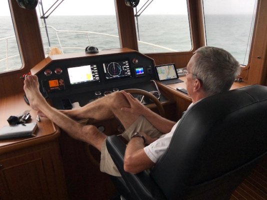
I'm using a Furuno NavPilot, and NN3D (flybridge) & Furuno radar all integrated with the PC charting. After raising anchor I start the boat toward the first waypoint and select NAV. At each waypoint there is a short alarm which I can silence, but even if I don't then the boat just makes the turn and carries on. Thats my preferred setting. Like TT noted above, the waypoint is there because a turn is desirable or needed, so default should be to make the turn.

I'm usually single handing. If I go to the galley to make a coffee, or to the head, I only do so when radar/AIS/visual check of 360° indicates no traffic or obstructions within 10 minutes of my travel time. And I am always at the helm for turns, even though I usually do absolutely nothing but watch.

At times I might 'skip waypoint' to automatically change heading while remaining in NAV mode to avoid another boat. But usually I'll avoid boats that are fishing by going from NAV to Standby, change heading then press AUTO to hold that heading until clear of the other boats. At that point I'd normally then press NAV again.

If I was a long way off the route then the AP might want to return to the route by making a sharper turn than I would like. In that case I go to standby, set a preferred heading to return to the route and use AUTO to maintain that heading until I get a bit closer to the route, and when somewhere near the route press NAV.

Using NAV is a godsend. I can select the amount of XTE the AP can have before making course changes, and have it set such that it follows the route pretty closely. But not set the allowable XTE so tight that the AP is having to 'work overtime' making small corrections.

There is a lot of functionality in the NavPilot that I've never bothered to learn, such as setting a trolling pattern to follow and other stuff that commercial fishermen might like to use.
 
Last edited:
There is a lot of functionality in the NavPilot that I've never bothered to learn, such as setting a trolling pattern to follow and other stuff that commercial fishermen might like to use.

I wonder how many on here have used their MOB button to see how it works before they actually need it?
 
On a power boat, if someone goes over and you know when....better to hit MOB on the plotter unless the AP memorizes the point for future recovery, chop the throttle and either back down and turn if the person is in sight or just pull. A quick u-turn.

All the stuff about Williamson turns, etc is for big ships. Cute feature, but like many feature on a plotter, we never bother to get good with them as they are rarely used or impractical.
 
First time we trained the kids on MOB I told them that I was going to throw an empty gallon milk container overboard and select one of them to watch it constantly with an outstretched arm pointing at it, so I could handle the boat and always know where I was in relation by looking at the pointing finger.

Threw the jug overboard and told my son that he was it. He did what I asked and pointed at the floating milk container. Things were going fine until the other two kids watched him for a while and then both put their arms out as well and started singing "YMCA..."

Ok it was funny and we had a laugh, but then we did it again!
 
Last edited:
Back
Top Bottom