Where experience comes from...

The friendliest place on the web for anyone who enjoys boating.
If you have answers, please help by responding to the unanswered posts.

AKDoug

Guru
Joined
Feb 7, 2013
Messages
1,252
Location
USA
Vessel Name
Melanie Rose
Vessel Make
1999 Willard PH
Hello all! I will "tell on myself" a good bit in this thread. I am going to focus on running a boat from Seattle to Prince William Sound in Alaska, two different trips in two entirely different kinds of boats.

My first trip was in a brand new Bayliner 24' Trophy in 1985, no experience in a boat this size, and no experience with the Inside Passage. I had the boat run for 10 hours by the dealership before I came down from Alaska to pick it up. All my equipment was delivered to the dealership where I bought the boat, and several days were spent assembling it all and storing it away before my wife showed up.

The locals watched me cut up a 600' anchor line, and wondered what the heck I needed that much line for. When I explained the trip and my destination to them they responded by bringing me all of their charts and books for the passage. I had to purchase NO charts, and some of the guide books had courses and reciprocals marked on the pages, and interest points and local history written on the land masses. Awesome!

When we left, we ran an average of over 200 miles a day, up through Nanaimo and Campbell river and on into Queen Charlotte Straight before stopping for the first night (just short of Alert Bay). The skies were gray, following winds and seas, the engine ran perfectly and we averaged 3 mpg, stopped for fuel at every opportunity.

The weather caught up with us just past Petersburg and we had to anchor for a day to let the wind pass us by before going on into Juneau, otherwise there was nothing remarkable about the trip. No deviation from a straight line of travel to Juneau. I had no autopilot, no GPS, no chart plotter, no auxiliary craft and no auxiliary power. Just an EPIRB, flasher type sounder, a compass, and a VHF radio.

By comparison, when I left Anacortes in 2013 in the Willard, I had spent a couple of weeks going through a 13 year old boat that had sat unused and unloved on the hard for most of it's life. It had a VHF and a compass, nothing else. I installed a full Simrad electronics package, broadband radar, broad band sonar, chart plotter with GPS, and an auto pilot. I had the "Alaska" chip for the plotter, and a handful of large scale charts that would take me through the route with little detail. I also stuffed in a Fusion 700 iPod stereo and one pair of speakers :)

I was also single handing, at least until Ketchikan, where a friend with an alcohol conviction was going to join me for the open water passage over the Gulf to the Sound. Canada hates alcohol convictions, no matter how old they are...

I was fortunate to meet a nice gentleman with a Nordy 40 in Anacortes, who gave me some handling lessons with my new full displacement boat, and a lot of travel tips. I knew I didn't want to fight the currents at Campbell river at 6 knots, so I went by the Northern route. I had borrowed a bicycle from the Harbormasters office in Anacortes for my stay, and after provisioning up (mostly) and returning the bike I took her out for a checkout of the autopilot. Once out, I said "what the heck" and headed North, spending the first night on a buoy just inside the border of the US. A short three hour run to Pender Island to Customs, cleared with a phone call, and I was on my way.

Here is where things began to not go according to plan. The Insight charts imbedded on the plotter were for US waters, and suddenly I had no charts in the plotter. They had been excellent while in the US, and suddenly there were no charts and I was on paper. Then, I saw a vessel coming through from the North so I decided I could cut through between the Islands, so I ran up into the bay and into the channel. I then found myself in a stream too narrow to turn around in, too fast to back out of, and so shallow I could see the bottom all the way through as it carried me through and spit me out the other side. Needless to say it scared the crap out of me! I assumed the other vessel had come through, in hindsight it was probably anchored in the bay and was coming out, there was far too much current for it to have come in against it.

Now I felt I was in comfortable waters, and headed North up the inside of the island chain protecting me from the Straight of Georgia. I motored along at 7 knots, making about 6 against the current I would grow used to for the entire trip North. I jumped the Straight to the inside of Texada Island, confident I would find a place to anchor along the island for the night. Nope! I was finally worn to the bone, and anchored out in the open water off the Sunshine Coast Highway by Lois River, looking at vehicle lights on the highway and a few house lights, in 40' of water. It was an awesome and calm night, stayed that way and I got a good nights sleep.

The next morning I headed North again, sheet glass water, orcas splashing along off to port, coffee in hand and well rested. Of course, we all know it could have been otherwise. If need be, I would have motored all night. This was my first real realization that I would have to plan my anchorages much better at 6 knots than I had to at 24 mph...

I need to go do a few things, I will follow up with this thread a little later.
 
Continuing on, I would note that on THIS trip I had a dingy and motor, lots of tools, a complete set of scuba equipment, and all of the parts and pieces accumulated over the years owning the Bayliner. I loaded it all in a crate and shipped it by barge to Anacortes so I had everything to work on the boat before departing, and not having to purchase everything all over again.

My Nordy 40 friend had told me that if I caught the tides wrong that boats would be circling up at Stuart Island. I asked why they wouldn't be anchored, but he assured me they would be circling. When I got there, they were circling. I assumed I could find a spot to anchor, but he hadn't told me it was 400' deep all over, and that's why they would be circling. I went to idle and drifted while I took my first shower aboard. While I cleaned out the shower water from the forward bilge, I kept checking for the tide change. Turned out the mud wasps had plugged the discharge fitting for the shower, easily fixed but not yet discovered. Post cleanup, I entered the stream of vessels going North and was spit like a watermelon seed through Cordero Channel and down to Current Passage past Ripple Rock, sometimes topping 14 knots SOG. I spent the night in a little cove past Harwick Island, having made my 80 mile goal for the day. I had spent the night in the same cove in 1985 in the Bayliner, so it was familiar territory. The next day of cruising was uneventful, and I moved out to God's Pocket to anchor for the night before jumping the open water of Queen Charlotte Sound. This anchorage came highly recommended by my Nordy friend, and was as close to a start point for my crossing as was possible to find.

Queen Charlotte was a bit lumpy, with 6-8' swells running in on the port beam, a very comfortable ride and the first "real" water I had been in with the Willard. It made for a long day, and since I had no chart chip to navigate by I shot radar bearings and set the autopilot to "go to" the cursor in order to let the autopilot do the work for me. It was very satisfactory, if not efficient.

Keep in mind I have been having adventures like this one all of my Alaskan life, boldness "with calculation" has always been my forte. There was no point at which I was the least bit uncomfortable about what I was doing. The weather pattern was an amazing high pressure system that just sat in one place and graced me with flat seas and calm winds for my entire trip.

I ran all the way to Lama Passage up by Bella Bella and tucked into a tiny cove peeking out into the passage. The next morning I ran past Bella Bella looking at how much it had grown since 1985. Back then it was little village full of grump natives who acted reluctant to sell you fuel, it is a full blown city now! The Bayliner ate a tank of fuel a day, the Willard sipped 100 gallons between Anacortes and Ketchikan. Fuel was never, and is never, a concern. I am known at the docks as "the water guy"! Sometimes I put a few gallons in out of guilty feelings...

Now back in familiar territory, I headed up to Butedale to spend another night, and looked over the ravages of time to that old cannery. If you haven't toured Butedale, there is a wonderful thread on the place you should check out. There are no decent anchorages close by, the bottom in Butedale is foul with debris from the old workings and you would be crazy to risk an anchor there in my opinion. The dock is adequate, if not sturdy. From there I ran a short day to be poised for the jump across Prince Rupert, staying in a little bay with hot springs at the head and out of the swell of passing vessel wakes.

The next morning was heavy with fog, and I soon had a line of sailboats astern following me, as they could tell I had radar and knew where I was going. It burned off before noon, and the sun came back out. I ran all the way to just short of the border before stopping for the night, no good anchorages so I just kept on going until very tired. I stopped and anchored in a spot with good protection from the prevailing wind, knowing if it switched I would have no protection at all. Of course it switched, so about 3 hours later I pulled the hook and ran around the other side of the point and found protection again and got back to sleep. I was in Ketchikan by noon, cleared customs and went looking for a new regulator for my propane stove, which I had destroyed while trying to adjust it.

And most wonderful of all, my new "Alaska" chart chip was working and giving me fantastic detail and waypoints that worked! I spent two days in Ketchikan, my friend from the Kenai Peninsula flew in and met me and we restocked provisions and took on 100 gallons of fuel. Buying beer in Alert Bay had Visa questioning my card, so they had shut it off in transit. A phone call and it was back working again, apparently Visa hates those little back country stores in foreign countries :)

Next section will be traveling in the USA. By now some of you think I am completely nuts, some way too bold, and others think I am having an adventure.
:)
 
A couple of pictures

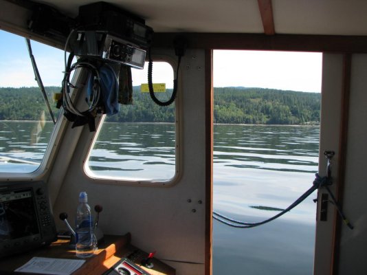
The second night, anchored in the open off the Sunshine Highway
 

Attachments

  • sunshine hwy.jpg
    sunshine hwy.jpg
    107.2 KB · Views: 144
Picture

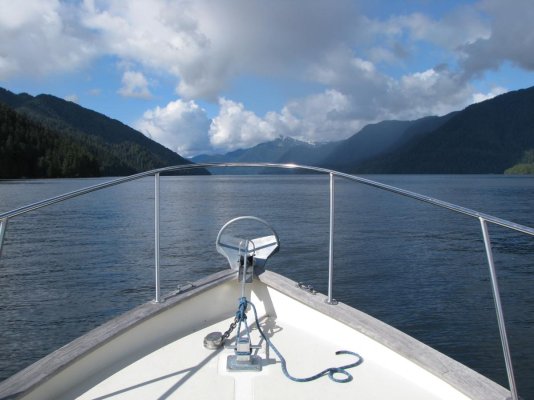
Cordero Channel, what I want my Willard to be when it grows up :)
 

Attachments

  • 046.jpg
    046.jpg
    141.8 KB · Views: 150
One more

Grenville Channel headed to Butedale
 

Attachments

  • Granville Channel.jpg
    Granville Channel.jpg
    112.2 KB · Views: 162
Like Doug I got allot of experience compressed into driving my boats home from Washington State, up the inside passage and across their Gulf of Alaska, a 1500NM trip

The biggest "tell on yourself" I have was the time when I left Prince Rupert in what I thought was 3-5' seas, that ended up being 3-5 meter seas. The year was 2003, April probably 17th or thereabouts.

We had pulled into Prince Rupert Yacht Club late after a hard day running up on plane at 26 knots in my Bayliner 3488. I was tired, a few days into what was hopefully going to be a record dash from Seattle to Whittier, Alaska.

I listened to the marine forecast which called for "seas 3-5" in Dixon entrance.
so my buddy Dave and I took off.

We rounded the corner of the little island that kinda protects Prince Rupert and were in the thick of it. I should have turned around right then, but this day I made a bad decision.

The seas were from the aft, And I remember it took all 630 horsepower to climb them. They were driving us north, but as we got closer to our turn around the big island and into Tongass Narrows I just could not do it without broaching. We were running out of water in a hurry, being forced ashore.

Well fortunately I was able to get behind a small island and hide until later that evening when the seas abated, but that was to this day the most scared and the most stupid mistake I have made on the water.

After that I did do something though. I developed the skills and became a very good rough water boat driver.

To do this, first I read... David Pascoe has a great series on rough water seamanship, for one. Then I took that Bayliner out in increasingly rough weather over a period of time to build the skills necessary to safely pilot a boat in bad conditions. I started out with breezy days. Then over time I intentionally went out in SCA conditions. At one point I even started intentionally braving gale force conditions.

To this day I am glad that I made the effort to learn rough water seamanship skills. Those skills make it so that when we are faced with difficult conditions I have the ability to get through them safely. This also projects to my wife as confidence. She knows that we'll be OK, and while nobody likes rough water we can and do get through it safely.

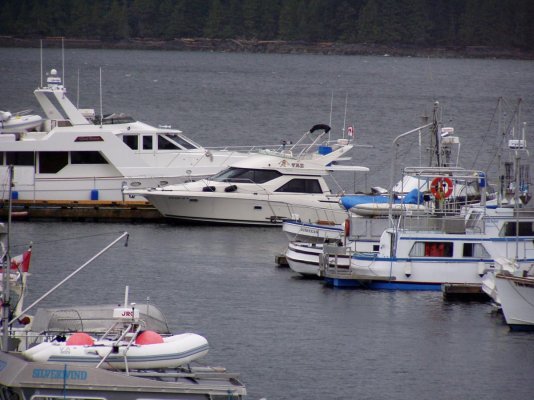
Here's two photos. The first is our boat sitting at Prince Rupert Yacht Club. The second is what the salon looked like after the rough water. And yes the drawers latch! The force broke the latches!
 

Attachments

  • P1010071.jpg
    P1010071.jpg
    149.5 KB · Views: 138
  • P1010072.jpg
    P1010072.jpg
    112.9 KB · Views: 137
Last edited:
It was great to have company on board, the plan was for us to alternate piloting once we got to the Gulf, but while Inside I wanted to pilot my own boat. We considered running out towards Sitka, so I could dive for abalone before we got out of their range. My friend had never been through the Wrangle Narrows past Petersburg though, and he wanted to see it so we did. Just past Petersburg on the mainland side there is a great bay to stay in, well protected from the swells of passing boats. That was his first night aboard.

The next day found us motoring West and slightly South to get back over to the main passages that run North. The Dalls Porpoise were everywhere, seas less than 2' and powder blue skies. We saw several whale watching vessels, towing rafts of inflatable boats like little docks behind them, searching for the whales. They seemed to be hanging out in the passage that runs through to Sitka, most of the whales we saw were up by Glacier Bay.

I can't honestly remember where we spent the next night, I think we actually made it all the way up Chatham Strait and around the corner, passing the entrance to Glacier Bay where we saw hundreds (no kidding) of humpback whales gathering. We pushed on around to Elfin Cove, and finding the Cove itself inhospitable we anchored out behind one of the islands in a slight swell. I remembered it being a wonderful little hippy town in 1985, now it's an icky guide town plundering tourists. We actually had a guy on the dock turn his back to us so he wouldn't have to talk to us while he yakked on his cell phone. Sad...

The weather forecast was excellent, with the exception of possibly having some weather puff up in Glacier Bay and push over the mountains past Lituya Bay.
We cruised past the Coast Guard station at Cape Spencer and headed North (mostly West actually) up the coast. Once past Lituya (Google that and read about it) I decided to get some sleep and for the first time of the trip turned the helm over to my companion.

Remember that little puff of weather maybe? Well, I awoke from my "nappy" and we were way off shore. I was upset, and chewed some butt about doing it the way I said to do it, and "not the way you think you should do it". We could see some kind of sickly yellow brown stuff towards shore, and the next thing you know we were bucking 7' seas with 3' whitecaps on top grinding our way in to get close to the beach. It felt completely safe, don't get me wrong. But I had very specifically told my companion to stay close to shore, because the forecast was for the weather to come up and blow "from offshore". Strike one for him...

It did lay down, the marine weather said it was pretty horrible in Glacier Bay. I can only imagine. The weather was fantastic, seas less than 2', and we were sun bathing in our underwear. When we passed Yakutat the city was setting all time high temperature record and the water was sheet glass. There was no reason to stop so we didn't, just motored on towards Kayak Island.

My previous trip in the Bayliner the weather was fantastic when I left Elfin Cove (alone), but came up into 4' seas with whitecaps about 2/3 of the way. I spent 9 hours behind the wheel going so slowly I wasn't sure if I was making any headway against the current until I saw crab pot bouys passing down the side. When I arrived in Yakutat I waited for my brother to fly in with extra fuel cans before heading on towards Prince William Sound. We spent the night in Icy Bay, getting slammed by ice bergs the size of dump trucks all night long, didn't sleep a wink. We would get out on the bow and walk the anchor line around the bergs and then jump back onto the boat as they would go by. Stay out of Icy Bay... Needless to say we didn't stop there in the Willard.

Our plan was to stop at Kayak Island and do some beach combing if the weather let us, it's one of the last places you can find the glass Japanese net floats reliably. My previous trip my brother and I had run inside the Island and cut a bunch of miles off, with one of us standing on the bow watching for the giant rocks in the shallow water. We got there at night in the Willard and the GPS and charts were not in sync, so we opted to run around the long way outside of the island. I let my companion know the chart plotter and charts were not in sync, and went to bed with the directions to wake me when we rounded Kayak Island.

When he woke me, we were just coming in to a spit that should have given us protection to drop the anchor and sleep for a bit, beach combing in the morning light. Well, my companion is used to power boats that are fast, and he cut the corner not calculating the current and put us in zero feet of water before you could say howdy. I heard the hull bump the bottom, he said "what's that"? And I said "that's the bottom of the ocean hitting my boat dumb asterisk" :) Saving grace, the rocks were very round, the tide was coming in, and the current was carrying us back off of them as I pushed with a boat hook.

Did I mention I was a little pissed off? Anyway, strike two, and on my boat you don't get three. I had the helm for the rest of the trip, and I learned a very valuable lesson or three. Don't assume your companion has the same skills you do, don't assume they will ask you what you want done, and don't allow anyone else to be responsible for operating your boat in shallow water or taking it into or out of the harbor. Lessons learned.

I've got a ribeye that just came off the grill, and a baked potato. I'll get back to this in a while...
 
Last edited:
The weather after Kayak Island matched my mood, it was gray and cold. I had full dive gear on board, but had to get into protected waters before I could go over the side. I checked the bilges, and was pretty confident there was no damage to the hull, positive there was none to the running gear. We pushed across the Copper River flats, watching for the occasional set of swells that would combine into a particularly nasty wave, not like you do much dodging at 7 knots, but you can change the angle you take the wave from... It was uneventful, and we motored into Cordova mid afternoon, tying to the dock for the first time since leaving Ketchikan.

While I am tattling on myself, I will admit my lack of "full displacement" boat handling skills while docking in Ketchikan wasn't pretty. There were lots of blue mussels littering the deck where my bow rail had scraped them off the pilings :) I am doing much better now... Why is it that the Harbormaster always gives the new guy a down wind and port side to berth? These days I am a very proficient single hander in most weather conditions, if it's really horrible I just stay out until it gets better :) I am also completely retired, so I have no schedule I must keep.

We took on 130 gallons of fuel, leaving us 20 in the tank, and we could have made it all the way to Whittier easily. We then ran to Perry Island, where I donned my scuba gear and went into the water for a look see. There was one tiny little scrape where the paint was off but no gouging into the hull, that was it! Fuel consumption dropped from a gallon an hour at 7 knots to .42 GPH at 5.5 knots once we were out of the currents and over 263 hours in the Sound. The boat only draws 3'8" and is built like a tank, the Bayliner it replaced drew 3' and I used to hang up stuff in the prop all the time, mostly seaweed. I have never hung anything up in the prop with the Willard, just hung seaweed on the rudder.

I spent the rest of the summer in PWS, moving around to Seward for the Silver Salmon Derby in August and then on to Homer for winter storage on the hard. Over the last three years I have average 550-650 hours of run time per year, and I truly love this boat. It is the best fish catching boat I have ever had, the cockpit layout leaves a lot to be desired but man does the boat catch fish.

I hope you all enjoy reading my post, I have enjoyed reliving the memories. I'll tack a few more pictures onto the end.
 
More pictures

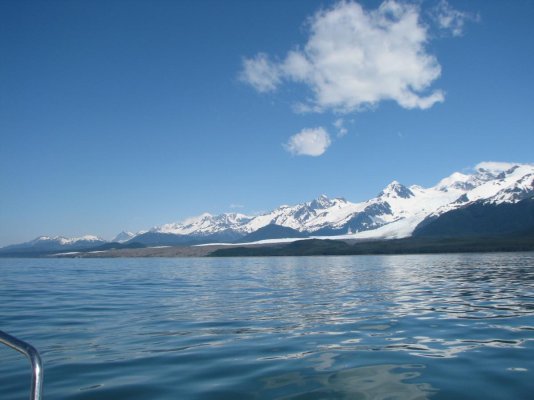
Cape Spencer lighthouse departing the Inside Passage, Lituya Bay from well offshore, and Yakutat Bay also from well offshore...
 

Attachments

  • Cape Spencer Lighthouse.jpg
    Cape Spencer Lighthouse.jpg
    83 KB · Views: 149
  • Lituya Bay.jpg
    Lituya Bay.jpg
    98.9 KB · Views: 145
  • Yakutat.jpg
    Yakutat.jpg
    111.6 KB · Views: 170
I posted this story of one of our most dramatic learning experiences several years ago, but it might be interesting to some.


Back in 1996, we were on our first SE Alaska cruise in our C-Dory 22. We had worked our way north from Sitka, toward Cross Sound and Elfin Cove along the outside of Chichagof Island, and ducked inside some of the small islands just north of the Khaz peninsula via an intricate route called Piehle Passage. Went back outside maybe 15 miles further north at Imperial passage, and then turned back into protected waters at Lisianski Strait. Weather was fine, we loved that run.

Two weeks later we headed back south along the same route, anchoring for the night halfway down to Sitka. This time we had with us a guest, who had never seen waters any wilder than Lake Powell.

Next morning the SW wind was up to maybe 15 knots, but it didn't look too bad. We were inexperienced interpreting barometer changes for weather prediction, and were out of weather radio range.

We proceeded down through Piehle Passage, poked our nose out of the narrow opening, and found we were heading into 8-10 foot relatively gentle waves. Thought they might be just swells piling up as they came in to shallower water there, and if we crossed them to deeper water it might be OK to head SSE on the outside, down toward Sitka. Turned out to be not such a fine idea.

Just outside the narrow exit into open water, we manage to get kelp wrapped around our 90hp outboard, shutting off the water flow and activating the overheat alarm. So now we’re in big waves, without power. I fire up the 9.9hp kicker (it started right away, thankfully), but then we could go only basically straight out into the waves while the big motor cooled down. So I sit out in the rain steering the kicker, watching the bow go up and down ever higher for maybe 15 minutes, while every so often Cindy tries the big motor, until finally it comes on without the alarm. By this time we're a mile or so offshore, and the waves are getting really big. I come back into the cabin, and we try to figure out what to do.

Don't want to head SSE to Sitka, because there would be 15 miles of unprotected water and the waves are already up to 15+ feet. Wind is only maybe 20 knots, but later we learned that the waves tend to pile up especially big in that area (where the bottom comes up from very deep to only 100 feet or so) when the wind comes from certain directions. After all, there’s nothing west of us until the Aleutians.

We don't want to go back into Piehle Passage, because of the kelp, and the narrow rocky entrance. We decide to go with the wind and waves, NNW 8 miles to Khaz Bay, a much wider opening. Heading that way is tricky, as over toward the shore there are big rocks just below the surface. They create huge explosions of spray when the water is moving up and down that far. On and off from the massive wave tops we can see these boomers, looming out there in the rain. The waves keep driving us closer toward them, and we decide we'll never make it on this course, so we have to bear left. The size and steepness of the waves keep us from going just a bit left, so we have to tack WSW to gain sea room, then come back to our desired NNW course. After a mile or two of WSW, we turn back NNW, eventually get to the mouth of Khaz Bay, and slide in to safe anchorage.

We had estimated the following seas at 15-25 feet. While Cindy was navigating, I had been concentrating on steering and continually adjusting the throttle, so we would climb up the back of a wave, slow down and mush through the top of it, then maintain our heading down to the next trough, not going so fast as to stick our nose into the next wave. The C-Dory was so good! We never once took green water over the bow, in maybe 1.5 or 2 hours of this (we were too busy to look at a watch - sure wish I had videotape). I would hate to try the same thing in our present much heavier deep-V boat.

At anchor later, whilst thanking our lucky stars, we were scanning the radio (still out of VHF weather broadcast range) and listened in on two commercial fishermen who had been out in the same stuff in a 38 and a 54-footer. They clearly had not enjoyed it. We broke in, told of our adventure, and asked them how big they thought the seas had been. They said 20 to 30 feet, with an occasional 35. Thank you again, C-Dory!

Over the next three days we holed up, waiting for the seas to moderate. We tried poking outside three times, and each time came back in with our tail between our legs. We called fishermen who were on the outside for conditions reports, and finally got one that said waves were down to halfway reasonable. We asked him if he thought we’d be OK in our 22-footer, and he said yes. As we came out Imperial passage heading north, he called us back. He had been talking to his mate, and revised his opinion. “You could make it, but it sure won’t be a cake-walk.” Two hours of 10-15 footers later, with our hearts still up in our throats, we gratefully rounded the nun into the mouth of Lisianski, and began to relax. Pulled into Pelican, refueled, and found we were down to 5 gallons of gas – maybe fifteen miles worth.

1995CindyandCindySea.jpg


After 11 years, our guest did finally come back to SE Alaska with us. He had a ball, and we didn't try to kill him. He's been back just about every summer since.


EDIT - Maybe I should mention some of the lessons we learned:

If the wind is up and you're not receiving weather radio, you might be cautious about venturing out into unprotected waters through a narrow opening between tall rocks. Choose the wider opening with much better visibility.

If you had come in through that narrow opening earlier and found it guarded by an unavoidable large kelp patch, consider that the kelp might be there again when you go back out.

By all means, make sure your kicker will start readily when you need it. (ours did that time)

If you're cruising in remote wild places, you should probably know how far a tank of fuel will take you, and be able to interpret the fuel gauge to have a decent guess at how much fuel you have left. When we reached Pelican and refueled, we wrote down how many gallons it took to get to each mark on the gauge - very useful.

At that particular location, the bottom is fairly shallow for some distance out from the rocky shore. Different from much of the Inside Passage coast, where it generally gets deep fast. Locals who live on a small island in the vicinity said that when swells from offshore are large, they hit that shallower water and become much larger and sharper, even when wind is not too strong (it was about 20 knots in our case). They were not surprised to hear the size of waves we reported, and said that they generally travel down to Sitka only when the wind is from the E or NE.
 
Last edited:
Great story, I am hoping there will be a few more brave souls willing to share their learning experiences in this post. These sort of things are where confidence grows!
 
Great stories

Most of us learn though our mistakes. Over confidence got me in returning up the coast of California from Monterey to Moss Landing. Just a short run 20 miles or so. My wife had been crewing for a freind in a Hobie race and we had spent the weekend in Monterey harbor with my 2855 Bayliner. The same boat we had taken to Glacier Bay from Everet Washington the prior year. Celebrations lasted late into the afternoon on Sunday after the races and remembering old times I figured what the hell we'll hangout and easily make Moss Landing for the night. I have years of racing sailing experience sailing Monterey Bay and Santa Cruz Bay. This is where arrogance comes into play, I know that the Monterey trench shoals on about a rumb line between Monterey and Moss Landing, going from 1000's of feet to about 60. With afternoon winds and ocean swells very large breaking waves often form
In the late afternoon. I know that so why did I find myself exposing my family to 15 to 20ft breaking waves. These can be a lot of fun on a Hobie but deadly in a 28 ft boat. It was too rough to send my wife down for life jackets , to dangerous to turn around. All I could do is quarter the waves around the larger breaking waves and head further off the coast and into non breaking waves where hopefully I could turn and surf into Moss Landing. We had a wave rip off side the canvas. This was a wake up. call , I really put my family in danger , my arrogance damn near blew it.
 
AK,

Great story and fun reading.
 
My "Oops" learning experience also happened in Prince William Sound. In the early '70's I was in AK in the USAF and my boss had a ~24'-26' "cabin cruiser". The boss and 3 others of us who all worked and hunted together decided we would take his boat to Whittier via the train tunnel then boat across PWS to Hinchinbrook Island, a distance of 75-80 miles.


We loaded the truck and trailer on the train, went through the tunnel and launched the boat in Whittier. We had paper charts of PWS and knew where we wanted to end up so we kept track of our compass headings as we headed out. We figured we'd run the reciprocal courses on the way back.


The trip going SE out of Whittier Inlet was perfect. Nice day, four guys having fun, etc. Oh, did I mention that none of us had any open water experience?


We got to Hinchinbrook and cruised around for a couple of days then it was time to head back. Well, the weather had changed. It wasn't horrible but we were socked in by low clouds and a persistent rain.


No problem. We headed out, set our compass course, turned on the windshield wipers so we could watch for floating debris and relaxed. We knew how long it should take us to reach Naked Island, which was about 2/3 of the way back.


Well, Naked Island had disappeared. Not disappeared as "lost in the clouds and rain", because visibility was pretty good. Oh, did I mention this was before GPS? And before chart plotters? And we had no radar?


We kept forging ahead, having no idea where we were except that we knew we were not where we should have been. We started spotting floating bits of ice berg, and then they were getting bigger and bigger to about the size of a car.


Eventually we found another boat, a commercial fishing boat, and asked him where we were. It seems we were WAAAAY off course, ending up near Glacier Island which was about 20 miles north of where we wanted to be.


Oh, and did I mention that we had timed our departure from Hinchinbrook Island so we'd have time to load the boat on the trailer than get a spot on the train? And we'd calculated our fuel so we'd have plenty to get back to Whittier?


We got up on plane, cruised in the approximate direction we needed to go and made it into Whittier with just a few minutes to load up the boat, and with just fumes in the gas tank.


Our error was that when we turned on the wiper motor the electric field it created froze the compass heading on what we'd originally set. No matter what direction we turned the boat the compass never changed.


Later, after we got back to Anchorage and had a few beers we were able to joke about it.
 
Great sea stories, and good "lessons learned" wrap ups. As the OP said in naming this thread, experience often comes from being in tight spots. Some of my most influential boating lessons are probably burned into my psyche because they were fueled by adrenaline. But, I've learned a hell of a lot more boat handling from the occasional ten difficult minutes than from ten weeks of boating in nice weather conditions. More on that another time . . .
 
RCook, you did not tells us the whole story of that area, like what did you do in Rosey's Bar and Grill in Pelican.
 
Hi OldDeckhand,

After we got refueled and tied up to a float, we stumbled into the cafe - don't remember the name - for breakfast. We looked pretty be-draggled - no shower for several days. When the waitress came over, she asked us if we were "in for the closing". I guess we looked scruffy enough we might have been commercial fishers who had just made it back into port. After breakfast we hit the pay shower in town - unlimited hot water - what a pleasure!

Can't recall how much time we spent later at Rosey's, but I do remember putting a fairly good dent in the on-board gin supply. In fact, we started on that right after safely anchoring in Double Cove on the day of the big waves.
 
Do you remember standing on the bar at Rosey's to pin a dollar bill to the ceiling?
 
If you don't try; you can't experience.

Thanks for the stories. I can't wait to get up there myself.

Richard
 
Back
Top Bottom