Anchor Drag Alarm Feature?

The friendliest place on the web for anyone who enjoys boating.
If you have answers, please help by responding to the unanswered posts.

O C Diver

Guru
Joined
Dec 16, 2010
Messages
12,929
Location
USA
Vessel Name
Slow Hand
Vessel Make
Cherubini Independence 45
I have several anchor drag alarms onboard that all set the anchor location based on your current GPS position. Wondering if anyone has one that allows you to point on a chart where your anchor is without using current position?

As an example, lets say you power set your anchor. From where you dropped the anchor to where it's finally set is now 75' away. You know the anchor is North of you and you put out 100' of rode is there an alarm app that allows you to point on the screen where you think your anchor is? It would be nice to touch a spot on the screen that indicates 100' from your position and set the drag alarm to that point.

Ted
 
I use Anchor Alarm app. I can move the center of my circle to adjust for forgetting to hit it when I dropped my anchor.
 
Ok, so how do I get that point to be an anchor drag alarm without driving back over it?

Ted
Thought you wanted another way to get a point on chart.
I guess activating an epirb and tying to the anchor is not a good idea either.
 
I use Anchor Alarm app. I can move the center of my circle to adjust for forgetting to hit it when I dropped my anchor.

Good one. Have to try it out next month. The alarm will wake the dead!
When I forget which is most of the time I’ve just started the engine, idled up over top of the anchor, activated the anchor watch then fell back on the hook again.
 
Last edited:
After doing more research, going into Aquamaps anchor drag alarm will allow me to adjust the anchor point, but not as simple as putting a position on the map. GPS in the tablet has a larger error circle than my external antenna.

Ted
 
I use Anchor Alarm app. I can move the center of my circle to adjust for forgetting to hit it when I dropped my anchor.

I see several in the app store. Not sure which one you are referring to.

Ted
 
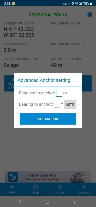
I use Anchor Lite, the free version of Anchor Pro. It allows you to input direction and distance from current position, which I find pretty easy.

2143540207.jpg
 
Mine app is "Anchor Alarm". That is the name, it is free and I believe you can upgrade to Pro version.

I use Anchor Lite, the free version of Anchor Pro. It allows you to input direction and distance from current position, which I find pretty easy.

Ok this looks like it may work well.

Thanks!

Ted
 
I use Anchor Pro(among others). You can set the anchor in a position relative to your current one by selecting that option when you set the alarm. It will ask for distance and bearing from current. It also allows for custom coordinates, but I have never tried that. Seems too imprecise?
 
I have several anchor drag alarms onboard that all set the anchor location based on your current GPS position. Wondering if anyone has one that allows you to point on a chart where your anchor is without using current position?

As an example, lets say you power set your anchor. From where you dropped the anchor to where it's finally set is now 75' away. You know the anchor is North of you and you put out 100' of rode is there an alarm app that allows you to point on the screen where you think your anchor is? It would be nice to touch a spot on the screen that indicates 100' from your position and set the drag alarm to that point.

Ted

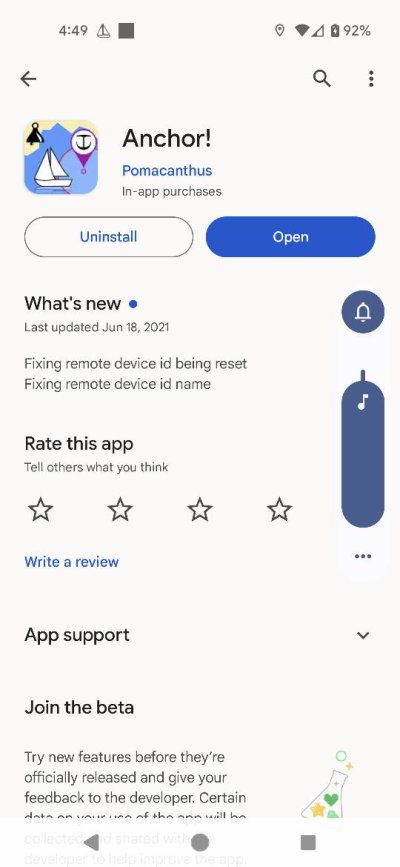
“Anchor!” has that feature. So does the anchor alarm that is with aqua maps.
 
I wonder if air tag in a water proof case attached to the anchor will work?
Bluetooth signal up to 33 feet
 
Last edited:
After doing more research, going into Aquamaps anchor drag alarm will allow me to adjust the anchor point, but not as simple as putting a position on the map. GPS in the tablet has a larger error circle than my external antenna.

Ted

Ted: does your Nav system have a Wi-Fi connection? If so, that’s an easy way to use your external GPS antenna as the source for Aqua Maps on your tablet.
 
After doing more research, going into Aquamaps anchor drag alarm will allow me to adjust the anchor point, but not as simple as putting a position on the map. GPS in the tablet has a larger error circle than my external antenna.


I didn't find the Aquamap process sufficient for placing the alarm point at the same place the anchor is. Their adjustment system seems too course to help.

I tried using AM on a phone at the bow when I dropped the anchor... and then transferring that point to Aquamap on a tablet, too. Phone more portable, tablet easier to manage power and has a louder alarm. No joy. I asked Aquamap about it, nice note back, "for the moment is is not possible to share" but forwarded my note to the development team to "definitely consider it" for future releases.

Best I've come up with in the meantime is to schlepp the tablet to the bow and marking the location while dropping the anchor. Cumbersome. Perhaps a bit risky, depending on conditions. Usually doable, though...

-Chris
 
Vesper anchor watch is the app we use but it's pertinent to only to a Vesper AIS system. I can adjust the anchor position if I forget to hit the "drop anchor" icon when the anchor is deployed but the app is only a plotter screen that shows the ships position relative to the anchor as well as AIS targets, which is nice, but it isn't overlaid on a chart so honestly, trying to reposition the anchor location is only a guess & the times I've tried it, I didn't have a lot of confidence that the anchor location was displayed correctly.
The app is nice because it is displayed on multiple screens at once. We keep it on the ipad at the helm where my wife presses the deploy button when I signal her that the anchor is on the bottom ,or sometimes I'll take my phone with me & hit the deploy icon myself. I mainly like it because the software is transmitted via wifi from the Vesper AIS and not the phone or tablet so if the battery dies or I shut them off, our anchor drag data isn't lost. Plus I take the phone to bed with me where I can see at a glance that we're secure in addition to the location of other ais targets around us.
 
Ted: does your Nav system have a Wi-Fi connection? If so, that’s an easy way to use your external GPS antenna as the source for Aqua Maps on your tablet.

No, unfortunately it doesn't. I'm going to play with both Aquamaps and Anchor App to see if that fits the bill on the way South from Chesapeake to Fort Myers.

Ted
 
I didn't find the Aquamap process sufficient for placing the alarm point at the same place the anchor is. Their adjustment system seems too course to help.

I tried using AM on a phone at the bow when I dropped the anchor... and then transferring that point to Aquamap on a tablet, too. Phone more portable, tablet easier to manage power and has a louder alarm. No joy. I asked Aquamap about it, nice note back, "for the moment is is not possible to share" but forwarded my note to the development team to "definitely consider it" for future releases.

Best I've come up with in the meantime is to schlepp the tablet to the bow and marking the location while dropping the anchor. Cumbersome. Perhaps a bit risky, depending on conditions. Usually doable, though...

-Chris

I usually anchor with an anchor marker float, so after anchoring, will try estimating direction and known distance of the rode to see how that works on the trip to Florida.

Ted
 
I simply factor in the scop when setting the alarm circle. I don't turn on the plotter (and anchor alarm) until I go to bed.
 
I usually anchor with an anchor marker float...

Do you always use the anchor float? Sure seems like a good idea.

I use Anchor Pro which will email alarms unlike the free version. In the coming months I expect to upgrade my old Standard Horizons and iPad/Navionics world to a Garmin GPSMap system. How do the chartplotter based anchor alarms compare to mobile device based apps?

No, I don't always use the float.

None of my Garmin stuff allows you to move the anchor unless you motor over it to reset the anchor alarm. That may have changed as Garmin hasn't offered software updates in 4 years for my equipment. They no longer support it, so I probably won't buy from them again.

Will probably have 10+ anchoring opportunities heading South, so will be doing some app analysis.

Ted
 
I simply factor in the scop when setting the alarm circle. I don't turn on the plotter (and anchor alarm) until I go to bed.

I like my alarm circles tighter (anchoring in narrow channels) and also anchor often in areas with reversing tidal currents.

Ted
 
Select Waypoint when the anchor is dropped, and it should pop up on your MFD. Then set your anchor, laying out the chain. Make sure the anchor alarm radius includes the waypoint, and leave your MFD switched on, of course.
 
Select Waypoint when the anchor is dropped, and it should pop up on your MFD. Then set your anchor, laying out the chain. Make sure the anchor alarm radius includes the waypoint, and leave your MFD switched on, of course.

That is not as easy for some of us as it seems when written. It can be a busy time.
 
Select Waypoint when the anchor is dropped, and it should pop up on your MFD. Then set your anchor, laying out the chain. Make sure the anchor alarm radius includes the waypoint, and leave your MFD switched on, of course.

As mentioned in the first post, that's fine if your anchor digs in right there. Sometimes it slides across rock until it finds a spot to dig in. Sometimes it gets dropped in soft mud and needs to move until it finds solid bottom. Sometimes there is significant current in a river or from tidal current, where it takes time to get enough scope to dig in.

Sometimes the anchor doesn't end up where you dropped it.

Ted
 
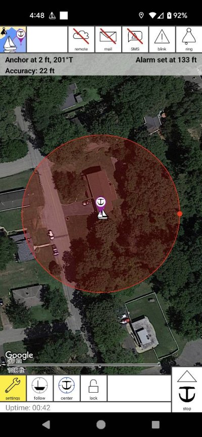
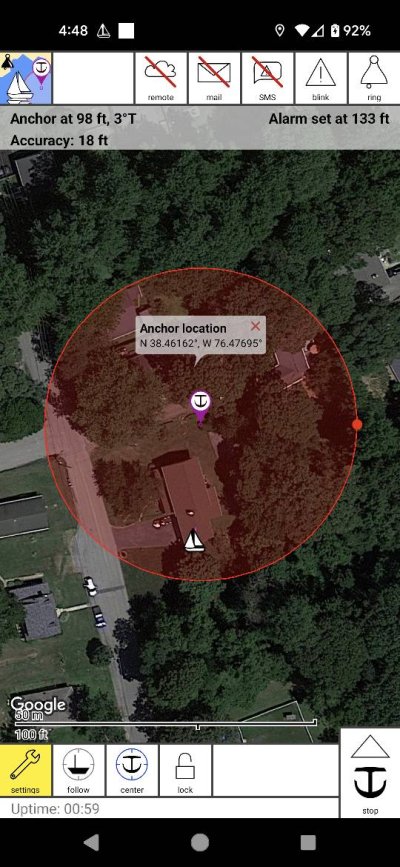
Yes, we use Anchor! app.

You pushed the anchor button and it puts the anchor at your boat. You then put your finger on the anchor icon and drag it where you want it. The distance read out changes as you drag the icon. It uses Google Earth which makes it easy to figure out your orientation.
It also has a feature that will email you if your boat moves when you are ashore. Of course you would need a cellular device on the boat and your phone with you.
The app lets me sleep at night [emoji4]Screenshot_20231016-164914.jpgScreenshot_20231016-164825.jpgScreenshot_20231016-164842.jpg
View attachment 142866
 
Last edited:
As mentioned in the first post, that's fine if your anchor digs in right there. Sometimes it slides across rock until it finds a spot to dig in. Sometimes it gets dropped in soft mud and needs to move until it finds solid bottom. Sometimes there is significant current in a river or from tidal current, where it takes time to get enough scope to dig in.

Sometimes the anchor doesn't end up where you dropped it.

Ted

If the anchor doesn't set, just retrieve and start over again.
 
How do the chartplotter based anchor alarms compare to mobile device based apps?


We use Nobeltec Time Zero Pro. I can set the anchor alarm with a mouse click, then click again and change the circle diameter and move the circle. I push the center of the circle up to where my track line shows I stopped and went to reverse to lay out the chain. Set the alarm circle size and you're done.


We encounter strong enough tide swings that its important to get the center of the circle pretty close to the anchor location. If I center it on the boat, I'm pretty likely to wake up to an alarm in the night when the current reverses.
 

Latest posts

Back
Top Bottom