No-GPS Chart Plotter

The friendliest place on the web for anyone who enjoys boating.
If you have answers, please help by responding to the unanswered posts.

Endeavour

Newbie
Joined
Feb 5, 2021
Messages
3
Vessel Make
National Steel & Shipbuilding - US Amry
One of these days the GPS system will go down. Does anyone know of a "manual" chart plotter that doesn't rely on GPS? By this I mean software that uses (free) NOAA charts and has tools to simply compass-based piloting and ded reconing? If not, what features would you want to see in such a program?
 
And a sextant plus the skill and experience to use it. Guess it depends where you plan to be.
 
openCPN

You can google it
 
Thanks, All. Let me re-phrase:

The chart-plotters I use regularly (TimeZero and openCPN) don't lend themselves to navigating by compass or sextant if the GPS network (or my GPS equipment) goes down. I would still have access to my electronic charts, and would like an app that makes it easy to do bearings and plottings on screen. Paper charts are impractable (and expensive) for me, since I range from Mexico to the Aleutians. I have the skills on paper, just want software that lets me apply them.
 
Coastal Explorer on a laptop.
 
If the GPS network goes down, you might be better off just hanging out where you are as really bad things are probably afoot.
 
On the East and Gulf Coasts I can do my plotting on a MapTech ChartBook the old fashioned way. That is a whole region of paper charts bound together in a single book.
I have OpenCpn on a laptop and cannot see a way to turn on any manual plotting tools. I also have Garmin 5212 touchscreen chartplotters and they do not lend themselves to manual plot of bearings either. On my phone, I have both Garmin BlueChart Mobile and Navionics apps. Both allow a single A to B range and direction line independent of the boats position. Both are also out of date apps that still work but cannot be updated.
 
Thanks, All. Let me re-phrase:

The chart-plotters I use regularly (TimeZero and openCPN) don't lend themselves to navigating by compass or sextant if the GPS network (or my GPS equipment) goes down. I would still have access to my electronic charts, and would like an app that makes it easy to do bearings and plottings on screen. Paper charts are impractable (and expensive) for me, since I range from Mexico to the Aleutians. I have the skills on paper, just want software that lets me apply them.

https://www.charts.noaa.gov/InteractiveCatalog/nrnc.shtml
download and then use your compass and depth sounder.
 
If you are concerned about GPS going down, you could convert to a GNSS system like the Furuno Satellite compass SX 70 or GNSS receiver like the GP 170. That way you have access to Glonass, Galileo et al. With the advent of ECDIS for ships and the discontinuance of the requirement for them to carry paper charts, the technology is becoming more common. Of course since apparently you can't afford paper charts, though being able to afford to cruise the entire North American west coast, you'll find those solutions pricey.

Thing is, you can get paper charts for a particular voyage as noted above downloaded from NOAA and other sources. You can get older coastal charts at surplus stores. Great for planning and dead reckoning.
 
Timezero has a pretty useful divider function that lets you do manual plotting on the electronic chart.

I primarily use it to set up drifts for bottom fishing but it could easily be used in conjunction with a magnetic compass to take bearings, plot positions etc. It allows you to start the plot line at any point on the chart, then move the end point to any location. It dynamically shows you bearing and distance along the plot line from the origin point.
 
And now you know why I recommend writing down your lat and long and ideally SOG (speed over ground) every hour.
If everything 'go south', you know where you were and with a little bit of math, a sharp pencil, dividers and a straight edge, a magnetic compass, you should have a pretty good idea where you are on your paper reasonably updated charts. You did bring the paper charts, right?
When you get closer to shore, add in a depth sounder.
 
Last edited:
I don't get it. Infrastructure for GPS system has been running with 100% reliability for 25-years. And it needs to be back-stopped by static electronic charts on a PC? By far, most likely cause of loss of GPS is a lightning hit or electric fire/malfunction that takes out your boat....and everything on it.

I'd be curious what other insurance policies for meteor-strike probability events people are contemplating.
 
Thanks, All. Let me re-phrase:

The chart-plotters I use regularly (TimeZero and openCPN) don't lend themselves to navigating by compass or sextant if the GPS network (or my GPS equipment) goes down. I would still have access to my electronic charts, and would like an app that makes it easy to do bearings and plottings on screen. Paper charts are impractable (and expensive) for me, since I range from Mexico to the Aleutians. I have the skills on paper, just want software that lets me apply them.

I use Open CPN all the time without the GPS plugged in...on a pad that has telephone it can roughly fix a position, but I don't have one of those.


I think any chartplotter that looses the GPS that can still still do the basic functions of manual position fixing.

You still have the charts downloaded. You can make a couple 2 point routes to act as bearings from known points of land to get a 2 or 3 bearing fix. You can lay out a route (track) just like paper, make LOPs, EPs ( waypoint).....maybe not everything easily, but surely the basics.
 
Last edited:
Thanks, All. Let me re-phrase:

The chart-plotters I use regularly (TimeZero and openCPN) don't lend themselves to navigating by compass or sextant if the GPS network (or my GPS equipment) goes down. I would still have access to my electronic charts, and would like an app that makes it easy to do bearings and plottings on screen. Paper charts are impractable (and expensive) for me, since I range from Mexico to the Aleutians. I have the skills on paper, just want software that lets me apply them.

Timezero does, it has a divider function that replicates exactly what would you would do with a pencil, parallel ruler and handheld compass.
 
Pretty sure just about any nav software can replicate the basic...they just don't have "specific" tools.
 
I think any chartplotter that looses the GPS that can still still do the basic functions of manual position fixing.

You still have the charts downloaded. You can make a couple 2 point routes to act as bearings from known points of land to get a 2 or 3 bearing fix. You can lay out a route (track) just like paper, make LOPs, EPs ( waypoint).....maybe not everything easily, but surely the basics.

Yes. And if anywhere near land, since radar doesn’t require GPS and you can easily get fixes. Some folks might even learn how to use the reticle in their binoculars.
 
I don't get it. Infrastructure for GPS system has been running with 100% reliability for 25-years. And it needs to be back-stopped by static electronic charts on a PC?...

Not entirely tin foil hat concerns. There has been news in the past few years about how easy it is to hack or spoof the system and I think Russia has already done it. Will have to look again but don’t think the news was coming from the conspiracy theory nut jobbery elements but from real sources.

Also, rare though it might be, if the GPS goes out on your boat, a backup nav method would be handy. Not me though, not even counting the chart plotter, I have about a dozen GPS’s aboard.
 
IMG_1733.JPG

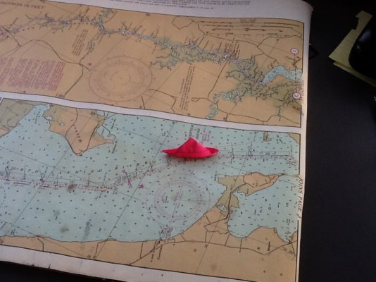
I have used this combo chart/gps unit to great effect.
 
Not entirely tin foil hat concerns. There has been news in the past few years about how easy it is to hack or spoof the system and I think Russia has already done it. Will have to look again but don’t think the news was coming from the conspiracy theory nut jobbery elements but from real sources.

Also, rare though it might be, if the GPS goes out on your boat, a backup nav method would be handy. Not me though, not even counting the chart plotter, I have about a dozen GPS’s aboard.
A Russian (or Chinese) hack is what the fear is?

News flash - losing GPS on a boat is waaaay down the list of problems if that happens.

Of all the things to worry about in keeping a boat afloat, just seems that's sort in the absurd column. But I guess there's always a reason today isn't the day to leave - better wait until at least tomorrow.

Whatever did we do before there was electronic nav aids? Heart be still.
 
What’s wrong with having a plan B just in case. It doesn’t take much effort or money to brush up on DR skills and utilize e-charts without GPS. Isn’t that what good seamanship is about.
 
More likely you find yourself in a combat zone and somebody is jamming GPS systems to complicate nav for precision guided munitions.
 
More likely you find yourself in a combat zone and somebody is jamming GPS systems to complicate nav for precision guided munitions.

One of the Scandinavian has reported a loss of GPS, more than once. It is suspected it was Russia.
 
Personally, I always carried the paper charts for the area I was cruising and on long runs I would periodically mark my GPS location on the paper chart. So the OP still also has this option. But unless he is considering an end-of-world scenario, the easiest and inexpensive solution to his concern is to simply have more GPS units. We had 2 GPS units hard wired with exterior pucks plus a handheld version connected to the laptop. GPS redundancy is cheap.
 
Personally, I always carried the paper charts for the area I was cruising and on long runs I would periodically mark my GPS location on the paper chart. So the OP still also has this option. But unless he is considering an end-of-world scenario, the easiest and inexpensive solution to his concern is to simply have more GPS units. We had 2 GPS units hard wired with exterior pucks plus a handheld version connected to the laptop. GPS redundancy is cheap.

It's difficult to find a VHF handheld without GPS and charts.
 
Endeavor,

I haven't found the solution yet, but it is frustrating to see that all the inshore charts reside in my Garmin MFD, yet I seem to be locked into GPS in order to use them. It would be incredibly simple to make the system work without GPS and much faster than using paper charts. It would require pushing a button to change to "no GPS" mode.

Say I'm heading towards the West Point day marker, I would overlay my radar on the chart. I then touch that radar dot on the screen with a stylus to get a very accurate read out. Let's say it reads 2.43 miles bearing 17 degrees. That now appears instantly on my MFD, but it is using GPS to provide me with the bearing.

If I was in "no GPS mode, I touch the radar dot to get distance and the MFD asks me for the magnetic bearing. I then use my hand bearing compass to get 17 degrees. I touch the West Point day marker on the split screen and input the bearing. The MFD would instantly show my position without GPS. I could do the old school triangulation using other targets, but a single bearing and the radar distance within 1/10th mile would give me a fairly accurate position.

A running fix would also be easy with the MFD doing the calculations. Five minutes later I take another bearing of the same or a different target. The MFD updates showing my new position, plus COG, SOG, and a track. No pencil to paper, parallel ruler from compass rose, or chart table. Maybe it's a feature of some of the software noted above, but why not a safety feature on every MFD? Maybe people don't carry hand bearing compasses anymore?
 
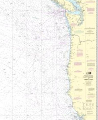
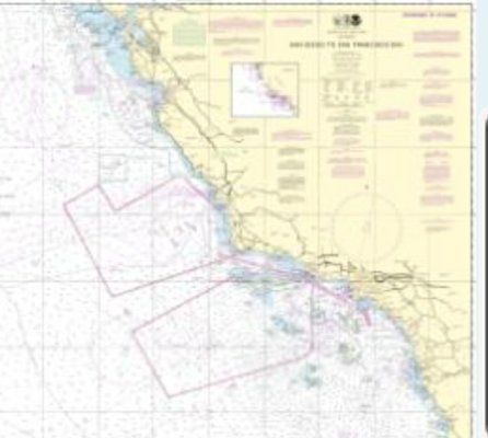
For emergency backup, large scale charts would suffice assuming you had radar and some basic observation skills. Cape Flattery to San Francisco chart is $27. Sf to San Diego is another $27. They would give you the lights and patterns to check against dead reckoning.

Would also give you much more backup than just GPS loss. Assumes some base navigation skills.

Screenshot_20210206-150144.jpegScreenshot_20210206-150532.jpeg
 
Back
Top Bottom