Milton

The friendliest place on the web for anyone who enjoys boating.
If you have answers, please help by responding to the unanswered posts.
I don't put a ton of stock into models for exact details.

I'd encourage you to reconsider this. You mention hurricane Andrew (1992) which spurred a ton of investment and development in weather forecasting and of course prompted massive changes in building codes to make structures survivable.

The accuracy of storm forecasting has improved 100x in the 32 years since Andrew specifically because of ability not only to capture data, but sift our the meaningless data to derive true indicators. The forecast for Helene was one of the most accurate I can recall. Milton landfall and intensity has not changed much since it was barely a breeze hovering off Yucatan. In 1992, NHC could only "see" three days in advance and even then, didn't have a lot of insight into true impact forecast.

Peter
 
I'd encourage you to reconsider this. You mention hurricane Andrew (1992) which spurred a ton of investment and development in weather forecasting and of course prompted massive changes in building codes to make structures survivable.
Peter, I understand what you are saying and yes things have improved drastically. A new, start from scratch model based on AI would be a huge improvement. Many models are code upon code over many years with nobody really knowing what all the code is really doing.
Most people interpret the graphics incorrectly and that is I guess more or less what I am alluding to. I should have said so instead of I don't put much stock in the models.
That cone 60 miles wide in not the hurricane force winds but the eye center probability. Hanging stock on a +- ten mile wobble when the cone is 60 miles wide is wishful thinking. Then again, if my home were on the beach within the cone, I might be changing my hopes and mood based on a 10 mile +or - wobble too.
 
The cone is margin of error. The NHC portrays track within +/- one sigma, which is to say there is a one in six chance it falls outside the cone. Over time, improved analytics have extended the forecast window and narrowed the cone. Improvements will continue but frankly are probably hampered by available computing power - the number of variables affecting weather are astronomical. When I retired 2-years ago, some of my interesting work was negotiating contracts with MIT-level wonks selling a process to refine oil that could not be demonstrated yet due to limitations on computing processors that simply didn't exist yet. In comparison, the use case was simple compared to weather.

Our house in Madeira Beach has 3.5 feet of water in the living room. We were in Mexico at the time and had a friend move out car to higher ground. I was stunned to learn that many of my neighbors stayed, and I saw hundreds of flooded cars get towed over the last week. As mentioned, the Helene forecast was incredibly accurate. I don't know what my neighbors were thinking when they decided to stay. one explained they had evacuated six times over 22 years and had grown complacent (their Tesla was flooded).

10-miles can make a huge difference if it puts you on the clean side. It's really remarkable.

The models are useful. But you must act on information.

Peter
 
I hear you on the computing power. Resolution is still not small enough for accurate prediction of air mass thunderstorms. It's also the reason the wind apps struggle with a compact hurricane.
Helene was a large hurricane for most of it's track and that allowed the formation of a high widespread storm surge. This storm is currently compact and will likely increase in size but is still not likely to be close to the size of Helene.
If you read there actual forecasts for specific areas the winds and surge drop fairly quickly away from the predicted center so the storm is likely to be small.
Listening to the media cry wolf all the time is what causes complacency in your neighbors. Helene was accurately predicted.
I have a neighbor with a home in your area that largely had his winter home untouched by Helene according to neighbors. He just went down to check on it and found the home looted and his car missing.
I have a friend who rents a home in Venice and believes it will be okay because it is not on the water. I told him if it is okay, don't count on you being the renter.
 
True I am not looking at a stream of raw data recorded/broadcast from hurricane hunter aircraft.

I am talking position/wind numbers published by NHC and similar data that all the "pictures" are drawn from.

Not a scientist, but an operator. Guess I should have been more clear on using the term "raw".
 
Last edited:
Forward speed has increased to 16 MPH (normal is around 14 MPH), which translates into less time to push storm surge water inland.

With the storm cone narrowing, it's likely I wont see hurricane force winds (>74 MPH). Rain totals also look to be lower for my area.

Keeping fingers crossed.

Ted
 
Hi, we have had today 55 knots max of wind in Royan, atlantic coast of France. Few days with a lot of rain, KIRK finishing acceptable surge corresponding the coef of the tide. Nothing to compare with what may happen in FL. Our best and friendly wishes to the trawler communauty - and others- in the area!
 
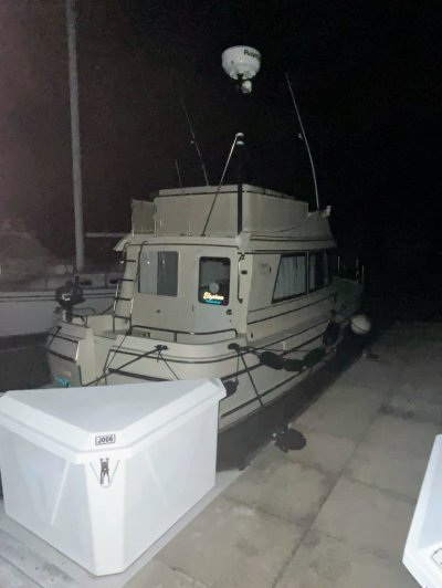
Getting good gusts. Monitoring the boat via wifi cameras. Surge is still negative in Tarpon Springs.
1000013976.jpg
 
St Pete is currently with winds NE 25 g to 40kts, and forecast to hit 40 g to 70, which will be sporty. (aviation wx at the airport)

Have friends that are there that give me some info, but have no surge info. Hopefully it will be minimal.

Weebles, I have a friend on Madeira Beach over by the Elks and was offered a two story house close by. With 4 ft of water, he and his wife had to be rescued and survived ok.

Hope the boat does well. It's well tied down on all around. And I just did my update on the lines and anchors. We'll see.

Waiting for the 5 o'clock update
 
NOAA 5pm forecast has Milton down to 120 MPH with a forward speed of 17 MPH. Projected track has landfall around Sarasota. Peak storm surge heights have increased modestly.

Fingers still crossed.

Ted
 
Lots of webcams in the projected storm locations but I tend to look for marina cams so I can see boat movement. Here's Riverhouse Palmetto, between Sarasota and Tampa. Live on top, time lapse below. That party barge is sure tied loosely at the stern and it's moving around a lot, but maybe that's on purpose to accommodate a storm surge.

 
Landfall Siesta Key Cat 3 @ 2030 ish
 
The aftermath of Milton in the Fort Myers area was not as bad as expected. A record number of tornadoes from Milton destroyed more inland mobile homes.

Barrier islands seem to have suffered more, although the storm surge wasn't as high as feared.

Watching the 6am coverage, some 25' and smaller boats left in the water on the bay side of Fort Myers Beach. Some cars left when mandatory evacuation was declared Tuesday. Plan on increasing insurance claims because of those not smart enough to move them or looking to replace what they have. :banghead:

Ted
 
I guess we'll know more as they day goes on, but it looks like it could have been much worse. I've got a friend who lives in Largo. I'll be interested to hear how he faired in the next few days. He's 35 ft above sea level and a bit inland. They got a lot of rain and wind.
 
Dad lives in Stuart - area got shredded. Lifted the roof off their second floor concrete condo and dropped it back down, but they're okay. What a mess.
 
How do you think Milton will effect boating and boat manufacturing in Florida?
It seems clear GOMEX is continuing to heat up. Milton is the result of the highest GOMEX temperatures ever recorded. As predicted by iccc due to MMCC. Rapid intensification now seems to be so much more common. Storm frequency may not be the metric to look at as it correlates poorly with loss of life and economic damage.
A secondary question is boating infrastructure. To what extent will it be rebuilt and when?
 
North of Stuart in St Lucie county, several tornados here, a couple less than a mile away. Killed two in an adjacent neighborhood. Much of the county without power. All this happened before the storm came ashore in Sarasota because of unusual rain bands.

This may just add to the many residents that were thinking of moving out of Florida due to heat/storms/other reasons. Sure many keep moving here... so it's hard to tell whether the shortage of slips will get better or worse.
 
How do you think Milton will effect boating and boat manufacturing in Florida?
It seems clear GOMEX is continuing to heat up. Milton is the result of the highest GOMEX temperatures ever recorded. As predicted by iccc due to MMCC. Rapid intensification now seems to be so much more common. Storm frequency may not be the metric to look at as it correlates poorly with loss of life and economic damage.
A secondary question is boating infrastructure. To what extent will it be rebuilt and when?
In the last hundred years global population has gone from 2 billion to 8 billion. 100 years ago 90% of the world's population didn’t have electricity, automobiles, or air conditioning. MMCC isn't going to stop until the world population is reduced. It's an unfortunate pyramid problem where you need an ever increasing younger population to support the older population. Unfortunately, no politician has the stomach to say that. Don't expect change before the next pandemic. As the earth is slow to respond, my guess is there will be a decline in temperatures in about a century or so.

Ted
 
Greetings,
Mr. OC. With the greatest of respect, MMCC isn't going to stop until mankind manages those things that are contributing to said change. A few: A move away from the "disposable" economy. Proper recycling and control of waste, in ALL forms and a clean-up of the oceans and waterways. Unfortunately, the quest for wealth greatly overshadows the quest for wellness.

Not wanting to troll or start any arguments/discussions so that is my opinion. Done.
 
In the last hundred years global population has gone from 2 billion to 8 billion. 100 years ago 90% of the world's population didn’t have electricity, automobiles, or air conditioning. MMCC isn't going to stop until the world population is reduced.

Ted
I agree. Trying to diminish one's "carbon footprint" is an exercise in futility until we get control of the number of "carbon feet." We may well find out what is the carrying capacity of Spaceship Earth.
 
Those of us far away from this disaster ache for our brethren boaters. Too many smashed up boats over the past few years. But bringing this discussion back to Milton, the news is not offering a lot of insight into what happened out on the barrier islands. Just assumptions at this point. As we have friends with homes on the islands, including Useppa, we were wondering if there is any beta. Thanks.

Again, we all love boats (otherwise we wouldn't be on this forum) and hate to see this.
 
Back to the hurricane. Fortunately, looks like the damage along the coast wasn't a lot worst than Helene, but still some surge south of Sarasota.
News from friends there say that the barrier islands in the St. Pete area are accessible and no additional mud or road obstructions. A friend on Treasure Island stay in a condo and said the wind sounded like a freight train all night.

I have a few friend that have power there, but most are without. My neighborhood is still not accessible, so don't know the condition.

Have friends that are going to try to get down there today or tomorrow, so I'll get and update.
 
If it werent for the tornadoes on Wednesday early afternoon, it would have just been a windy day in Port St. Lucie. I went down to the marina in Stuart this morning to check on Elysium, and she was still secure in her spider web of lines. Feeling very lucky.
 

Attachments

  • IMG_9202.jpeg
    IMG_9202.jpeg
    98.4 KB · Views: 33
If it werent for the tornadoes on Wednesday early afternoon, it would have just been a windy day in Port St. Lucie. I went down to the marina in Stuart this morning to check on Elysium, and she was still secure in her spider web of lines. Feeling very lucky.
Awesome man! So glad you came out ok!
 
We didn’t get it awfully bad in New Port Richey. Lots of rain but our lake/pond did not get to the house. Street was flooded but stayed at the sidewalk level. No power yet as expected. Will be heading back from campground in the am, early to try to avoid some of the traffic.
Highest wind i saw reported was steady 55 with gusts to 72 mph out of the NE at around midnight.
We lucked out
 
A friend on Treasure Island stay in a condo and said the wind sounded like a freight train all night.
Why on earth would anybody want to ride that out on a barrier island? They are lucky to be alive!
 
We did ok...one corner of our patio is damaged. Lots of large limbs
Boat is just fine. We had a negative surge the entire time. Many of the sailboats sat on the keel.

Lots of cleanup and the power is out. But I expect restoring the power here won't take too long. For now I have about 2 or 3 days of generator/fuel reserve


But, we are close to the anclote River and all that rain we got, plus a 100 miles inland is now coming down the river. It's currently around 25.5 feet and scheduled to crest around 26.8. Therefore is 27.3 or so. Our house is in no danger of flooding, but the roads get tough to travel on if you don't have a truck with some lift.

I do like to be prepared. And my prep was probably a 7/10. To raise that a bit, I think I may get a metal roof and nice big diesel generator.
 
Back
Top Bottom