You are using an out of date browser. It may not display this or other websites correctly.
You should upgrade or use an alternative browser.
You should upgrade or use an alternative browser.
Dorian aims for East Coast of Florida
- Thread starter High Wire
- Start date
The friendliest place on the web for anyone who enjoys boating.
If you have answers, please help by responding to the unanswered posts.
If you have answers, please help by responding to the unanswered posts.
FoxtrotCharlie
Guru
Yes. Black Sound. Of course none of these pics show Black Sound and the shipyard. ?
Good luck

Action
Guru
- Joined
- Mar 13, 2015
- Messages
- 679
- Location
- Phoenix, AZ USA
- Vessel Name
- Enigma
- Vessel Make
- 1997 Wellcraft Excel 26 SE
WOW, I thought Dorian's eye went over the top of GTC. I was expecting much worse.
Action
Guru
- Joined
- Mar 13, 2015
- Messages
- 679
- Location
- Phoenix, AZ USA
- Vessel Name
- Enigma
- Vessel Make
- 1997 Wellcraft Excel 26 SE
Looks like Dorian is loosing a little punch.
Still a menace to be prudent around.
Still a menace to be prudent around.
Some pics of GTC finally.
New Plymouth still has some buildings standing , and the ferry dock and other private docks still standing . That’s kind of surprising compared to the devastation of the other islands.
New Plymouth. Ferry dock with roof still standing (arrow)
Bluff House in background, under the wing.
Entrance to White Sound I think
While that's bad, it's still positive compared to other nearby areas and does show the difference between the worst and just horribly bad. Probably something like 120-130 mph winds hit GTC based on the damage. Very different than 180 mph. Typically the worst winds hit only a very small area.
dhays
Guru
- Joined
- May 26, 2015
- Messages
- 9,575
- Location
- Gig Harbor, WA
- Vessel Name
- Kinship
- Vessel Make
- 2010 North Pacific 43
To be fair, I think I heard the Bahamian PM mention that he thought the death toll would rise as they get more information.
Very true. I just hate to see thing like the government saying 5 deaths or now 7 when the reality is they have no idea yet. May be none or virtually none in GTC.
Steve91T
Guru
- Joined
- Sep 12, 2016
- Messages
- 898
- Location
- USA
- Vessel Name
- Abeona
- Vessel Make
- Marine Trader 47’ Sundeck
A little gentle rocking at Daytona Beach's Halifax Harbor Marina, real winds to start right after dark
https://youtu.be/nP-JsMYGXfA
I think we are in the clear!!! Ever see it get bad?
menzies
Guru
Update from Hope Town.
September 4th:
1 PM: From HTVFR...Quick update-relief efforts are being coordinated and the damage assessments using the video footage are being compiled. A satellite phone is now in the hands of HTVFR and communication has been accomplished.
From the US Embassy, Nassau: You can help relief efforts by only sharing verified information from trusted sources. Please share this widely.
U.S. Coast Guard continues search and rescue operations in the Northern Bahamas, now with support from Customs and Border Protection as well.
They have been welcomed by people in Abaco and Freeport who need help. There have been no reports of violence against USCG or CBP operations.
As of 8:00 pm on September 3, they had successfully airlifted 61 people from the Northern Bahamas to Nassau over two days, including three people from Freeport.
menzies
Guru
Flyover of all of Guyana. It actually does not look as bad as compared to Marsh and Treasure. There definitely is NOT a new cut from the Atlantic through to the Sea of Abaco. And though it is hard to tell, the dunes are still there.
https://www.facebook.com/383729321652021/videos/723477888079630/
https://www.facebook.com/383729321652021/videos/723477888079630/
Lou_tribal
Guru
Just got an alert issued for Saturday in Nova Scotia for winds that could reach hurricane force and waves that are expected to be between 5m (west) and 10 meters (east).
I guess I will find a place with no tree around to park my car and stay home!!!
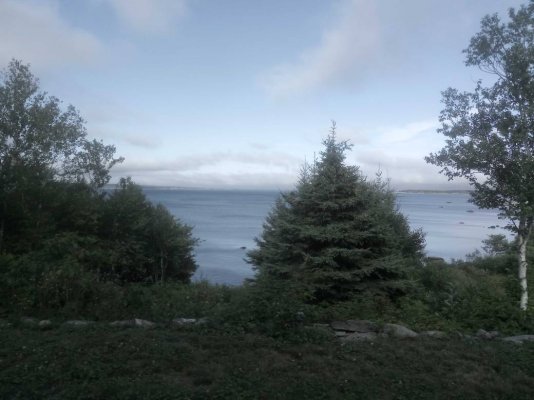
At least I will have an amazing show in front of me, here is my actual view from the house terrace.
L
I guess I will find a place with no tree around to park my car and stay home!!!
At least I will have an amazing show in front of me, here is my actual view from the house terrace.

L
Yes, it's always been headed to Nova Scotia but the Weather Channel never mentions it. May not be a hurricane, but just a very strong tropical storm or may be a CAT 1. Either way, not something expected by people there.
I just watched the video from the Weather Channel from Marsh Harbour, on the ground. Showed many people walking around and I was shocked areas weren't still flooded more, also showed the CG medics and the CG flying people to hospitals in Nassau. It would seem in looking at it that they will be very ready to receive help when it arrives and getting it there shouldn't be too problematic.
I just watched the video from the Weather Channel from Marsh Harbour, on the ground. Showed many people walking around and I was shocked areas weren't still flooded more, also showed the CG medics and the CG flying people to hospitals in Nassau. It would seem in looking at it that they will be very ready to receive help when it arrives and getting it there shouldn't be too problematic.
cardude01
Guru
- Joined
- Nov 26, 2012
- Messages
- 5,290
- Location
- USA
- Vessel Name
- Bijou
- Vessel Make
- 2008 Island Packet PY/SP
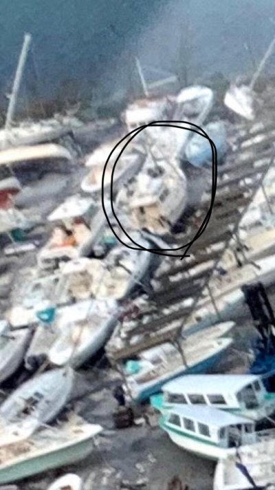
Finally got a pic of the yard. Looks like some (all?) of the boats are laid over? That’s not a great sign. I assume they were all grinding against the concrete with the wave action? Smh.
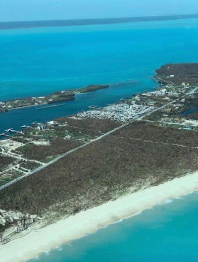
A “better” pic. [emoji25]
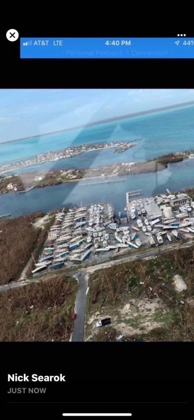
This might be it. Hard to tell on this cell phone. The black shapes on the side could be my solar panels. Short stubby mast. It seems to be sitting upright?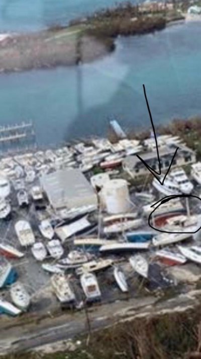

A “better” pic. [emoji25]

This might be it. Hard to tell on this cell phone. The black shapes on the side could be my solar panels. Short stubby mast. It seems to be sitting upright?

Last edited:
mcboatface
Senior Member
Just shows that even with all the computer hardware and human resources we have today we still only have a general idea of where a hurricane is going to go. Certainly a strong reason to leave if you possibly can.
Still hoping for the turn to the northeast as soon as possible to keep it a fair distance from communities.
Daytona Beach web cam with Dorian ~90 miles offshore:
https://www.volusia.org/news/daytona.stml
Not sure about that. It appears to me that Dorian is exactly where the majority of the models, including the NHC, said it would be five days ago. Pretty impressive if you ask me.
menzies
Guru
I just downloaded and zoomed in on the second pic - about 1/3rd of the boats are still upright. The majority of the damage is on the stacked sailboats on the left side of the photo. Though I know that pic is just half of the yard.
Last edited:
menzies
Guru
5pm Advisory. It still hasn't passed north. They are saying that it could briefly attain Major Hurricane strength with the next day.
...AIR FORCE HURRICANE HUNTER REPORTS THAT DORIAN HAS STRENGTHENED A
LITTLE...
...EYE NOW EAST OF THE COAST OF SOUTHEASTERN GEORGIA...
SUMMARY OF 500 PM EDT...2100 UTC...INFORMATION
----------------------------------------------
LOCATION...30.6N 79.8W
ABOUT 150 MI...245 KM S OF CHARLESTON SOUTH CAROLINA
ABOUT 275 MI...440 KM SSW OF WILMINGTON NORTH CAROLINA
MAXIMUM SUSTAINED WINDS...110 MPH...175 KM/H
PRESENT MOVEMENT...NNW OR 345 DEGREES AT 8 MPH...13 KM/H
MINIMUM CENTRAL PRESSURE...961 MB...28.38 INCHES
The initial motion is now 345/8. Dorian is moving around the
western end of the subtropical ridge, and it should recurve
northward and northeastward into the mid-latitude westerlies during
the next 12-36 h. This motion should bring the center of Dorian
near the coast of South Carolina in about 24 h and near or over the
coast of North Carolina during the 36-48 h period. After that time,
the cyclone is forecast to accelerate northeastward into the
Atlantic toward the Canadian Maritimes, with a quick northeastward
motion continuing through 120 h. The track guidance remains very
tightly clustered, and the new forecast track is little changed from
the previous forecast. It should be noted that the track is close
to and almost parallel to the coast of the southeastern United
State, and any deviation to the left of the track could bring the
center onshore anywhere in the Carolinas.
menzies
Guru
That’s what I’m thinking. I might try to take the next boat over there next week. As long as they don’t plan on staying but maybe one night.
Well, ask yourself this.
What are you going to do if she is damaged or trashed?
What are you going to do if she is fine?
rslifkin
Guru
- Joined
- Aug 20, 2019
- Messages
- 8,014
- Location
- Rochester, NY
- Vessel Name
- Hour Glass
- Vessel Make
- Chris Craft 381 Catalina
I'd expect the answers would be something like:Well, ask yourself this.
What are you going to do if she is damaged or trashed?
What are you going to do if she is fine?
If damaged, take pictures, contact insurance and at least get that process moving so when next steps are possible, they can start. And if no major damage, secure anything necessary to prevent further damage.
If not damaged, determine if anything needs to be done to prevent damage. And then wait until there's some way to get her back in the water and out of there.
That’s what I’m thinking. I might try to take the next boat over there next week. As long as they don’t plan on staying but maybe one night.
It looks like there's a relatively decent chance of relatively modest damage. No way to tell anything for sure as you just don't know what happened in the meantime. Just can hope. Now, the other question is do they have a working lift at this point.
Hope you can get over there before too long.
rslifkin
Guru
- Joined
- Aug 20, 2019
- Messages
- 8,014
- Location
- Rochester, NY
- Vessel Name
- Hour Glass
- Vessel Make
- Chris Craft 381 Catalina
I think the mast is still there along with the forestay (which appears to be casting a shadow on the deck). Mast looks a bit short in the picture, but I think it's just the angle it was taken from and not a snapped mast. Snapped and bent over was my first thought, but after looking closer, I don't think so.
Similar threads
- Replies
- 6
- Views
- 661

