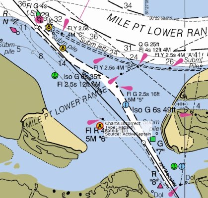
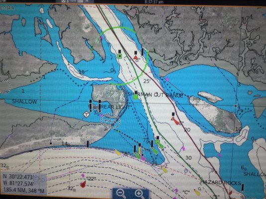
This is less than a mile from the mouth of our lagoon.
Because of the deepening of the river to be able to accept the bigger ships coming through the new Panama Canal the ACE took away the small jetties that were protecting the mouth of the ICW south of the river. Clearly, while they could do all of the studies that they wanted, no one would know the impact until they actually did it.
So where are we right now? Before you basically went right down the middle of the ICW, in fact the channel was not as narrow as depicted in the above chart, it was pretty deep and wide.
If you are approaching this part of the ICW, either form the north or south, you will think that one set of markers have been badly placed or moved. From the north it will look like the west side is Red, Red, Green, Red, and then, a set further south, the east side is Green, Green, Red, Green. They are not. That is because there is a sharp jog to the north west at one point. Pushing you close to the concreted edge of the ICW. Then it jogs east again. Simply trust the markers as they are laid out and you will be fine. I draw five foot and have no depth issues.
As mentioned, due to the removal of the jetties and the deepening of the river itself there is now a constant strong flow at the mouth of the ICW. At Springs this can be quite severe, but really something to be mindful of and ready for rather than dangerous as you are still in the (new part of the) deep river and there is plenty of room and depth where it happens so time and space to adjust if you have to.
Welcome to the hood, and what I believe is one of the most beautiful parts of the ICW, which many boaters miss going outside to St Augustine - and I include Palm Valley in that for first timers as the houses are pretty amazing - subsequent passages through there, not so much!


