N2K to PC interface (USB)???

The friendliest place on the web for anyone who enjoys boating.
If you have answers, please help by responding to the unanswered posts.

mvweebles

Guru
Joined
Mar 21, 2019
Messages
7,780
Location
United States
Vessel Name
Weebles
Vessel Make
1970 Willard 36 Trawler
What are folks using to interface their PC-based nav systems to NMEA 2000 network? I run Coastal Explorer on Windows 10 laptop and have a fairly new Simdad NSS EVO3 backbone. I prefer MFD for primary, but would not mind integration of PC, especially if it makes it easier to upload a route created away from boat. Rose Point NEMO Gateway at $700 the right answer, or something else? I get frustrated easily, so plug/play preserves brain cells for me.

Thanks in advance.

Peter.
 
Last edited:
A little off topic. I went from Garmin to the same Simrad unit you have. Point being I had about 20 routes that I wanted to transfer. As long as there in a GPX format I went from my PC to the Simrad using a SD card. Than using ethernet, I transferred them from one Simrad to another. It was fairly easy.

If you go to Yacht Devices they make WiFi, ethernet and USB to NEMA2000 gateways for under 200.
 
Last edited:
Connecting the laptop to the Ethernet port might give you access to the N2K data. My chatplotters, radar interface and wifi interface (before built in wifi) connect to Navico’s network expansion port and I use this cable to connect a standard cat 5 cable to extend the network. Or you could connect via the wifi similar to connecting an iPad for navigation apps. They use port 10110 as I recall.
https://www.lowrance.com/lowrance/t...inder-cables-adapters/cablerj45-to-5-pin1.5m/

James
 
It partly matters what software you want to run on the PC. You mentioned Coastal Explorer, and with that I'd use a Nemo. It's an excellent product.


Marteron has a closed system. Their software only works with their adapters, and their adapters only work with their software.


Actisense seems to be the most widely supported, but I don't think I've ever tried it with CE.


For configuring N2K devices from a PC, you almost always need a device specific to teh N2K device that you are trying to configure.


Keep in mind that many N2K to ethernet/wifi devices actually convert N2K to NMEA 0183, and it's 0183 on ethernet/wifi. The upside of that is that there is a defacto standard for sending 0183 over IP. The down side is that you lose a lot of data in translation, and only get what teh device translates.


Part of the problem is that there is no standard, defacto of committee, for N2K over IP. Yes, there is now OneNet, and perhaps in a decade or two someone will support it. In the mean time, everyone's OS-side API is unique. That's why nobody can manage/configure an N2K device from a PC with anything other than their own adapter. As a result I think I have a good half dozen different such adapters. It's maddening, and downright 1980s.
 
What are folks using to interface their PC-based nav systems to NMEA 2000 network? I run Coastal Explorer on Windows 10 laptop and have a fairly new Simdad NSS EVO3 backbone. I prefer MFD for primary, but would not mind integration of PC, especially if it makes it easier to upload a route created away from boat. Rose Point NEMO Gateway at $700 the right answer, or something else? I get frustrated easily, so plug/play preserves brain cells for me.

Thanks in advance.

Peter.

I have been suffering through the same decision process. Planning to change my "All in One" PC software to Coastal Explorer this winter, adding a gateway for the NEMA 2000 information, and possibly adding the JD engine data onto the network. Hard to be sure how plug and play everything will be and how many boat units will be required.

Ted

Lots of luck there, Ted. I have used CE forever carrying it on a small laptop on all delivery jobs whether going up to Chicago or down the Atlantic seaboard. The license is for three computers, and I have desktop and two LTs. Every time I change a computer, I tell Rose Point at which point they kill the authorization to the old one and give me a link to get the new one up and running. I have leapfrogged this way at least once on all three machines. Route planning is easier than on any installed plotter, and I have readily sent the routes for the deliveries over to Garmin, Furuno, etc plotters so I can have two plotter screens in front of me. I might swap back and forth to the radar of the installed plotter, but the laptop is my go to for "what's next?" questions and Active Captain info.
 
Lots of luck there, Ted. I have used CE forever carrying it on a small laptop on all delivery jobs whether going up to Chicago or down the Atlantic seaboard. The license is for three computers, and I have desktop and two LTs. Every time I change a computer, I tell Rose Point at which point they kill the authorization to the old one and give me a link to get the new one up and running. I have leapfrogged this way at least once on all three machines. Route planning is easier than on any installed plotter, and I have readily sent the routes for the deliveries over to Garmin, Furuno, etc plotters so I can have two plotter screens in front of me. I might swap back and forth to the radar of the installed plotter, but the laptop is my go to for "what's next?" questions and Active Captain info.

Not sure what you mean by "Lots of luck"?

At the very least, I want the AIS targets on the PC. From what I've read, importing the GPS position, and heading sensor are beneficial. My thought was that the ability to display most MFD information on the PC would be a nice backup. Currently I only have the OEM panel for the engine and would like to have a backup for RPM, oil pressure, coolant temperature, and engine battery voltage.

Ted
 
It partly matters what software you want to run on the PC. You mentioned Coastal Explorer, and with that I'd use a Nemo. It's an excellent product…

Agreed. I installed a a Nemo Gateway when I upgraded the Nav computer to a NUC. It has worked with no problems for quite a number of years now, combining both Nemea 0183 and N2K. I decommissioned the Actisense devices.

You will find, with CE and Windows systems that you have to disable the firewalls, etc. They don’t “play nice” with the CE and the Gateway. I bring the NUC home to upgrade software and maps several time a year and turn the firewalls back on when I do so.

Jim
 
Last edited:
I just tried the yacht devices n2k to WiFi device and I like it a lot. I especially like how they directly support a n2k dashboard right out of the box direct to a web page that you can access from your phone or iPad. I can get tach, temp, fuel usage and other info right on my phone!

Incidentally I added this device to my new 9.5’ dinghy with a 25 horse Yamaha. I never though I’d have a n2k network on a dinghy, but there it is.


I've wondered how it's useful to get that info on your phone. How do you use it?
 
In 2017, our last systems upgrade time, we intentionally went with Nobeltec charting programs as it easily plays with Furuno and Maretron gear. We will investigate further in a year or two to see if CE has changed their software to work with an all Furuno system. That said, we have two GPS units (Simrad and Sitex) that interface well with Furuno, Maretron and Nobeltec whereas a Furuno GPS unit is less wieldy.

Will the NEMO allow CE to interface with an all Furuno and Maretron system? I'd guess yes and that may well be one of our future changes.
 
I've wondered how it's useful to get that info on your phone. How do you use it?


Well, so far it’s winter and I’m mostly just putting the dinghy in the water for short periods and working the kinks out, added trim tabs, added a -5degree wedge etc…

I used it for real the other day to check the tach to see whether the prop was ideal or not (it was spot on the recommended rpm). The fuel usage rate looked interesting and that little outboard appears to burn a lot more fuel wot than just a few knots slower. This might actually be real,life useful in judging how far we can go.

I mainly wanted the tach and this was a better investment than adding the Yamaha or other fixed gauges. Instead of traditional electronics, I ordered ram mounts for a handheld vhf and for my phone. Basically, everything I will use will,be displayed on my iPhone.


Got it. So your phone is replacing an MFD, much as others have used a tablet...
 
I have a Maretron USB100 that I just found in storage, must be from one of the last builds I did before I stopped working. No box but it is either unused or just used for setup. If you are interested send me a PM, I have no need for it.
 
OpenCPN

I run my entire system with 3 raspi4 and 17inch monitors through a Maretron USB100 adapter. Each pi can do everything, but I use each for a different purpose. One as a plotter, 2nd as a radar overlay on a plotter, and the 3rd for all the gages I measure.
 
Thanks for the good comments. To my tastes, the Rose Point Nemo appears to be the most reliable path to acceptable outcome (calculus includes margin for brain damage caused by learning curve and frustration).

Question for those running NUCs. I assume it's tucked away in a cabinet - what are you using for input devices? Monitor?

For those running primary navigation off a computer (Windows, Pi, etc), do you find the screen and data-input finicky? Meaning is it easy to cause a screen to skip to something else, potentially difficult to return to base navigation? I find the base function of an MFD very intuitive for everyone aboard. I find PC based systems generate a wide knowledge gap between the captain and crew which is uncomfortable for me, especially if it means I am summoned from slumber to correct an errant swipe of a touch screen.

BTW - similar to RGano, I've had CE for many years. I met Brad (forget his last name) at a Poulsbo Trawler Fest around 2000 I suppose when he was first starting out. I had a very long gap in boating from about 2006 to 2017 and yet I was able to update my software, I think I may have paid $99 but maybe not even that.

Peter
 
Read this thread and appreciate how much it’s caused me to make use of the links and learn. But have a different philosophy than seems to be expressed here.
When working had an IT guy I paid for to keep things running, inform me what to get for hardware, troubleshoot software, act as the interface with the techs supporting proprietary software and such. One thing he stressed over and over was to the extent possible keep things segregated. That way the office could continue to run should one component of software or hardware fail, get contaminated or have other issue. Sure have them be able to talk to each other if it could be done without the risk of contamination but they should be able to run as standalone.
Hence on the boat although our various screens can mirror each other they can run completely independently of each other. They don’t share charts nor gps. Even though there’s availability of navionics , C-MAP etc on each each one has its independent source. For input failure points are
GPS - all (pads, computers, backbone) have independent sources.
AIS/radar-the backbone has its source and pads can mirror but otherwise use marine traffic with its latency and other difficulties.
Depth, wind, speedo etc.- don’t see any significant benefit sending this out beyond the backbone and related MFDs. The likely failure point is the instrument. Unless you have an independent source for each system (computer, mfd, pads) what have you gained? There’s no real increase in redundancy.
So I think it’s easy to get independent systems with their own gps source and their own independent chart source and vendor. But if linked you’re still limited by the sensors (depth, sonar, wind, radar, AIS, speed through water, cameras etc. ) being shared. My experience to date is its the sensors not the MFDs which are the weak point you can’t devise a workaround while underway. Have multiple MFDs. One fails go with the other. I’ve thought about adding a second AIS unit and a second sonar not hooked in to the MFDs backbone but rather available to the computer and pads. If I have an excess of boat bucks then a second radar.
So what I’m wondering is why do this stuff?
 
Last edited:
Read this thread and appreciate how much it’s caused me to make use of the links and learn. But have a different philosophy than seems to be expressed here.
When working had an IT guy I paid for to keep things running, inform me what to get for hardware, troubleshoot software, act as the interface with the techs supporting proprietary software and such. One thing he stressed over and over was to the extent possible keep things segregated. That way the office could continue to run should one component of software or hardware fail, get contaminated or have other issue. Sure have them be able to talk to each other if it could be done without the risk of contamination but they should be able to run as standalone.
Hence on the boat although our various screens can mirror each other they can run completely independently of each other. They don’t share charts nor gps. Even though there’s availability of navionics , C-MAP etc on each each one has its independent source. For input failure points are
GPS - all (pads, computers, backbone) have independent sources.
AIS/radar-the backbone has its source and pads can mirror but otherwise use marine traffic with its latency and other difficulties.
Depth, wind, speedo etc.- don’t see any significant benefit sending this out beyond the backbone and related MFDs. The likely failure point is the instrument. Unless you have an independent source for each system (computer, mfd, pads) what have you gained? There’s no real increase in redundancy.
So I think it’s easy to get independent systems with their own gps source and their own independent chart source and vendor. But if linked you’re still limited by the sensors (depth, sonar, wind, radar, AIS, speed through water, cameras etc. ) being shared. My experience to date is its the sensors not the MFDs which are the weak point you can’t devise a workaround while underway. Have multiple MFDs. One fails go with the other. I’ve thought about adding a second AIS unit and a second sonar not hooked in to the MFDs backbone but rather available to the computer and pads. If I have an excess of boat bucks then a second radar.
So what I’m wondering is why do this stuff?

My hunch is that except for very low-end systems or very high-end systems, integration is unavoidable. AIS is about the only stand-alone adjunct I can think of these days, and even those are available ingegrated into VHF (both receive-only and full B-transpond). Frankly, I have no data on likely failure points in a navigation system, though I strongly suspect anything based on consumer-grade/Windows platform will be a weak link. But would be good to know if the MFD display or the sensors or the cabling was the weak point (voltage spike/drop and grounding is likely high on the list). Would be good to know risk being mitigated both in terms of impact and probability so a triage approach could be developed.

When I was delivering, I carried a laptop, hard-drive, GPS puck, and Cap'n Voyager software. I also printed-out paper-charts for several anchorages and/or ports along the way. My thinking was I could DR navigate if needed, then go old-school to get somewhere.

These days I simply do not have room on my boat for multiple dedicated displays, and I don't want the clutter anyway. Perhaps my faith is naive, but I happen to like the integrated systems and the data they share and the flexibility in display. Back when I had an old/faithful Furuno CRT radar and a standalone A/P, data was manually transcribed by yours-truly. Chance for human error was real and not infrequent. It changes how you approach navigation which fortunately still courses through my blood, albeit a bit in the background.

So I am fine with fully integrated systems. For redundant systems, I have a warm-standby A/P pump but I wish I had a fully redundant A/P - there is no workaround. Second on the list would be a redundant radar. Again, no workaround. Redundant nav system is way down the list as there are a ton of workarounds. I always wonder why so much discussion is devoted to GPS redundancy and chance US Military will scramble signals for civilian use.

But I do like route-planning on a PC vs a chart plotter. Just more convenient. Would be nice to have them interfaced more directly. As mentioned up-thread, looks like the CE Nemo makes sense for me.

Good discussion as always. And thanks to all who contributed -

Peter
 
Read this thread and appreciate how much it’s caused me to make use of the links and learn. But have a different philosophy than seems to be expressed here.
When working had an IT guy I paid for to keep things running, inform me what to get for hardware, troubleshoot software, act as the interface with the techs supporting proprietary software and such. One thing he stressed over and over was to the extent possible keep things segregated. That way the office could continue to run should one component of software or hardware fail, get contaminated or have other issue. Sure have them be able to talk to each other if it could be done without the risk of contamination but they should be able to run as standalone.
Hence on the boat although our various screens can mirror each other they can run completely independently of each other. They don’t share charts nor gps. Even though there’s availability of navionics , C-MAP etc on each each one has its independent source. For input failure points are
GPS - all (pads, computers, backbone) have independent sources.
AIS/radar-the backbone has its source and pads can mirror but otherwise use marine traffic with its latency and other difficulties.
Depth, wind, speedo etc.- don’t see any significant benefit sending this out beyond the backbone and related MFDs. The likely failure point is the instrument. Unless you have an independent source for each system (computer, mfd, pads) what have you gained? There’s no real increase in redundancy.
So I think it’s easy to get independent systems with their own gps source and their own independent chart source and vendor. But if linked you’re still limited by the sensors (depth, sonar, wind, radar, AIS, speed through water, cameras etc. ) being shared. My experience to date is its the sensors not the MFDs which are the weak point you can’t devise a workaround while underway. Have multiple MFDs. One fails go with the other. I’ve thought about adding a second AIS unit and a second sonar not hooked in to the MFDs backbone but rather available to the computer and pads. If I have an excess of boat bucks then a second radar.
So what I’m wondering is why do this stuff?


I very much agree with this approach. There are many way to accomplish the objective, which to me is a system where everything keeps working except the part that’s broken.
 
My hunch is that except for very low-end systems or very high-end systems, integration is unavoidable. AIS is about the only stand-alone adjunct I can think of these days, and even those are available ingegrated into VHF (both receive-only and full B-transpond). Frankly, I have no data on likely failure points in a navigation system, though I strongly suspect anything based on consumer-grade/Windows platform will be a weak link. But would be good to know if the MFD display or the sensors or the cabling was the weak point (voltage spike/drop and grounding is likely high on the list). Would be good to know risk being mitigated both in terms of impact and probability so a triage approach could be developed.


When I was delivering, I carried a laptop, hard-drive, GPS puck, and Cap'n Voyager software. I also printed-out paper-charts for several anchorages and/or ports along the way. My thinking was I could DR navigate if needed, then go old-school to get somewhere.


These days I simply do not have room on my boat for multiple dedicated displays, and I don't want the clutter anyway. Perhaps my faith is naive, but I happen to like the integrated systems and the data they share and the flexibility in display. Back when I had an old/faithful Furuno CRT radar and a standalone A/P, data was manually transcribed by yours-truly. Chance for human error was real and not infrequent. It changes how you approach navigation which fortunately still courses through my blood, albeit a bit in the background.


So I am fine with fully integrated systems. For redundant systems, I have a warm-standby A/P pump but I wish I had a fully redundant A/P - there is no workaround. Second on the list would be a redundant radar. Again, no workaround. Redundant nav system is way down the list as there are a ton of workarounds. I always wonder why so much discussion is devoted to GPS redundancy and chance US Military will scramble signals for civilian use.


But I do like route-planning on a PC vs a chart plotter. Just more convenient. Would be nice to have them interfaced more directly. As mentioned up-thread, looks like the CE Nemo makes sense for me.


Good discussion as always. And thanks to all who contributed -


Peter


I agree that space constraints can force you to an MFD approach. But people
often have multiple MFD displays anyway. Otherwise you are looking at tiny Hollywood squares images of each on one screen.

Really the two big things that force you to separate displays with a non-MFD approach are charting and radar. Also throw in a fish finder if that’s important to you. Charting and radar products can also display sensor data, so you have multiple ways to see that.

That said, much of this mission-driven. For longer and more remote cruises, the interest there will likely be in firewalling individual failures while keeping other system operational. Not just for safe navigation, but also for the convenience of continuing your trip rather than stopping for repairs.
 
Believe both Peter and TT make very valid points. Both have many miles under their keels. I have great respect for their intelligence, experience and knowledge. I only wanted to expand the discussion. Like so many things on a cruising boat there’s many ways to skin the cat. My pockets aren’t that deep. So when thinking about this believe to the extent I can create standalone systems it is more cost effective in lowering my risk and therefore stress. Even if the best I can do is to create systems that are more standalone when I can’t achieve complete independence. Have had radar fail mid passage. Now can’t use it for dodging squalls. But have a multiplicity of weather sources not just girbs or forecasts and can read clouds. Rather spend my money on a weather course than a subscription to tell me what I can get for free elsewhere with a little effort. Have a multiplicity of communications via different technologies (satellite,SSB, vhf, cellular). They are each standalone. Although we have fixed solar panels we also have portable foldout ones. Reason is to have a multiplicity of charging sources for comms and other key elements. Just wanted to point out at all levels (one mfd and one pad or $50k of electronics running as two completely independent systems ) think it’s a benefit .
 
I have these installed as well. One in the Zodiac and the other is going in the Tollycraft for redundancy and for data via wifi to my tablets.

https://panbo.com/quark-elec-a026-ais-receiver-with-wifi-gps-and-nmea-0183-multiplexing/

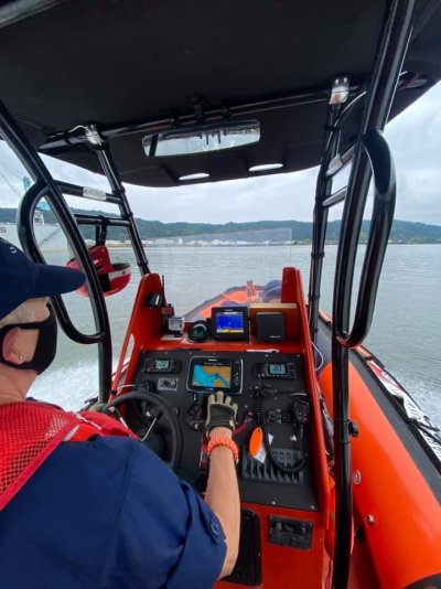
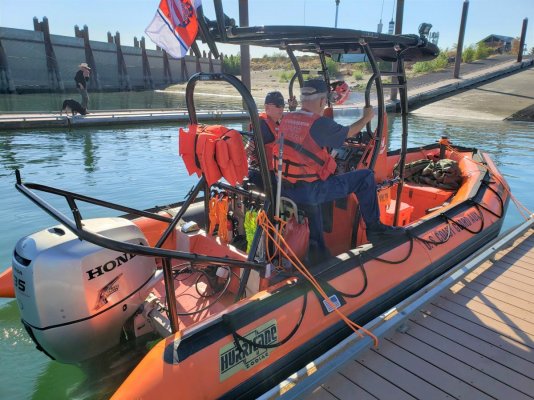
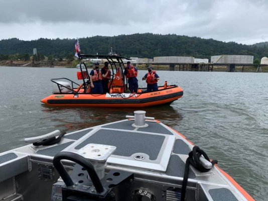
I volunteer for the CG and we take redundancy and risk management very seriously. As well as I am an IT manager for 11 hospitals. We are redundant where ever possible with either the hardware, application or data center.

VT
 

Attachments

  • 236498019_3064973097055469_1798251665662402521_n.jpg
    236498019_3064973097055469_1798251665662402521_n.jpg
    71.8 KB · Views: 39
  • August Patrol.jpg
    August Patrol.jpg
    189.6 KB · Views: 47
  • 236450288_3064973013722144_723841797981160235_n.jpg
    236450288_3064973013722144_723841797981160235_n.jpg
    78.8 KB · Views: 41
I agree that space constraints can force you to an MFD approach. But people
often have multiple MFD displays anyway. Otherwise you are looking at tiny Hollywood squares images of each on one screen.

Really the two big things that force you to separate displays with a non-MFD approach are charting and radar. Also throw in a fish finder if that’s important to you. Charting and radar products can also display sensor data, so you have multiple ways to see that.

That said, much of this mission-driven. For longer and more remote cruises, the interest there will likely be in firewalling individual failures while keeping other system operational. Not just for safe navigation, but also for the convenience of continuing your trip rather than stopping for repairs .

So what would stop your voyage cold? For me, radar, AP, and maybe depth sounder (Florida Bahamas ICW). Depending on itinerary, access to weather info (incl tides and currents) could be a show stopper.

I have a pc aboard anyway, and I prefer it for route planning. PC based software such as CE also has route breadcrumbs that is sort of handy too. So I'd like to interface PC to NMEA for no other reason but I hate seeing different XTE when you emulate a route between two devices that are not interfaced. Not exactly the end of the world.

Peter
 
One thing I have found to be a useful exercise is to create a break/recovery analysis document. It’s just a list of important systems on the boat - not just electronics - and a thought exercise about what happens if it fails. The two key questions are

1) what’s the scope of impact that the failure causes? What else stops working? So for example, if your gps fails, you also lose your position on your charts, might lose your Auto pilot, don’t have emergency position for VHF distress, etc.

2) what are you going to do about it? This can range from “do nothing”, to “call sea tow”, switch to a secondary gps, replace with a spare, etc.

And answer all this in the context of how YOU cruise. That will cause widely different answers. The results can help you decide where you want redundant devices, what spares to carry.

Things like a failed fresh water pump, or a failed toilet may be much more of an issue than a failed radar, for example. And for a lot of people none of it may matter much since you’ll just head home. And fix it later.
 
Back
Top Bottom