Travels of "Emma B" (JD powered Helmsman)

The friendliest place on the web for anyone who enjoys boating.
If you have answers, please help by responding to the unanswered posts.
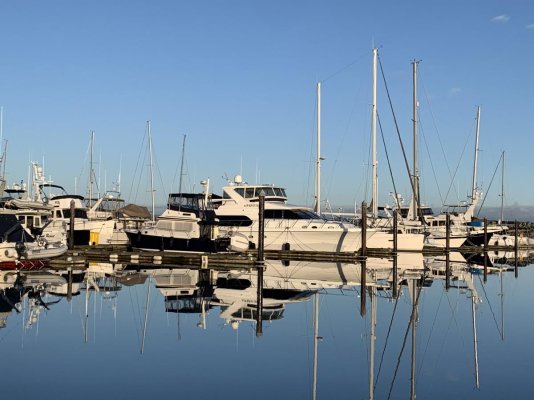
After what can only be described as a “violent” day yesterday weather wise... this was mid afternoon today.
I’m sure we’ve all made Port on a crazy day, thankful to have been in there after the bumpy seas outside, then to wake up the next day to flat calm and wonder “how can that be?”...
That’s weather for ya...


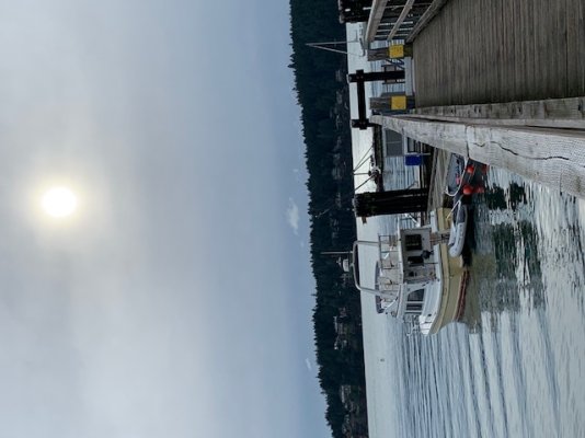
After so many days of no or minimal sun, I was motivated! Washed the entire exterior. Hauled out the dingy and cleaned it and it’s bottom, filled the water tanks and walked over 3 miles.
After so many dull days, sunshine will do that to ya ��
 

Attachments

  • F18C0546-7ED7-421D-9898-053B99738629.jpg
    F18C0546-7ED7-421D-9898-053B99738629.jpg
    120.8 KB · Views: 42
Has anyone been to Port Browning marina on N Pender Island?
 
Has anyone been to Port Browning marina on N Pender Island?

Yes, but not at this time of year. In the season, there is a nice pub there, the marina is better than just adequate, though coming from Port Sidney, you may be disappointed. There is a decent breakwater out front, so except in a strong SE, the marina is protected. You can walk up to the shopping centre in 5 minutes, the only good shopping on the Penders. Other than the pub, whose food depends on staffing, I know nothing about other eating opportunities. In Covid times, I wouldn't expect much, but you did get lucky at Maple Bay, so you may also do well at Pt B.
Good luck and enjoy.
 
Has anyone been to Port Browning marina on N Pender Island?

High on my list of favorites but that may be because of old memories. Great pub at the head of the dock. Docks are good too. Highlight is arriving by going through the cut from Bedwell Harbour. Better to go against the tide than with it, unless you can hit slack, then great. Did anyone say "narrow"? Pre reading about going through the cut is useful but if you can follow aids to navigation you should be fine. Convoluted bend at the Bedwell end. If there is a good current the cut is one of the few useful places to make a radio "Safety" call on 1 watt to announce your transit and ask if any concerned traffic.
Have you heard of bus stops? Just up the road from the marina is the closest "ride stop". Hang there and a local will pick you up and take you down the road (if they feel like it), no obligation to stop for you and no obligation on your part to accept them as a ride, it is all explained on the information sign at the "stops". COVID? I don't know. Rides might be cancelled because of it.
FYI, the Camano Owners Club has been having their annual rendezvous at Port Browning Marina for the last few years. We were only able to make it to just one.
 
Agree with Greg S.

Pender Canal transit is definitely a highlight!

If you have time and decent weather check out the anchorages on Prevost Island as well.(about 12 nm from Port Browning and would be an ideal spot to gunk hole if you need to kill time while waiting to time slack at the canal).
 
Thanks for the replies.
No worries on being disappointed after Sidney.
I favour funky over fancy..
I’ve emailed them last night to see if the pub is still open.
Look forward to checking it out.
Appreciate the info lads
 
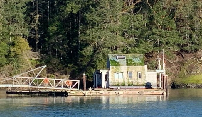
Stopped to visit my friend and fellow Helmsman owner John on a nearby island.
Come see our new place he says..
It will be fun he says...
So, not wanting to look like the boat bum I am, had a shower and put clean cloths on before heading over.
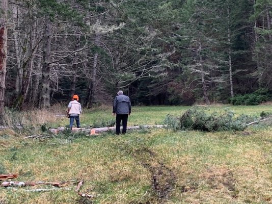
Once there I was treated to hauling brush across a muddy field :)
Some fun eh
Im only teasing and it was fun, great exercise and followed up by an awesome meal, drinks and nice visit.
I’ve mentioned before that although I am a long time boater, John was such an awesome mentor in learning the tides, currents and how to deal with the rapids out here! Made the steep learning curve far easier.
A great friend!
You can see by the picture why I call him “big John”
 

Attachments

  • 31DA65D0-925F-4691-AF2A-BE472B637108.jpeg
    31DA65D0-925F-4691-AF2A-BE472B637108.jpeg
    171.6 KB · Views: 45
  • B8D1CAF3-EC70-4AB3-B61D-11E4A17A725B.jpeg
    B8D1CAF3-EC70-4AB3-B61D-11E4A17A725B.jpeg
    72.2 KB · Views: 40
Quote:
If you have time and decent weather check out the anchorages on Prevost Island as well.(about 12 nm from Port Browning and would be an ideal spot to gunk hole if you need to kill time while waiting to time slack at the canal).

Is that not entering USA waters?
 
Travels of "Emma B" (JD powered Helmsman)

.............the anchorages on Prevost Island......

Is that not entering USA waters?


Prevost is definitely in Canada, and Annette Inlet is a magical spot.
 
Last edited:
Quote:
If you have time and decent weather check out the anchorages on Prevost Island as well.(about 12 nm from Port Browning and would be an ideal spot to gunk hole if you need to kill time while waiting to time slack at the canal).

Is that not entering USA waters?

No, Frank. Prevost gave his name to both the Island in the Gulf Islands (BC waters) and the harbour on Stuart Island in the San Juans, (US). Roughly equidistant from Port Browning, in opposite directions.
 
Got ya..
Just found it and yes, I was looking south..
Certainly looks protected in a SE
I’ve been by it a few times before in/out of Ganges but never stopped, I will check it out, thanks
 
Last edited:
Well... was tucked in again at Maple Bay for the last few nights of wind and rain.
The ribs at the pub had nothing to do with the choice.
Awoke to sunshine.....SUNSHINE!
After such an extended crappy period how glorious to get underway in blue sky’s and feel the heat of the sun!
Very calm seas all the way to Annette Inlet (thx lads). Yep... had to try it out.
So nice to be swinging at anchor again.
Amazing how the sun lifts your spirit.


Leaving Maple Bay
Underway
Looking out Annette Inlet
View from dinette
 

Attachments

  • FFAC71DB-5738-4310-A355-C79CF95E69BF.jpg
    FFAC71DB-5738-4310-A355-C79CF95E69BF.jpg
    127.7 KB · Views: 51
  • 7F94FD8E-F12A-4A9E-878D-F3DC6AE55FA4.jpg
    7F94FD8E-F12A-4A9E-878D-F3DC6AE55FA4.jpg
    120.1 KB · Views: 44
  • 5D8EA5C6-5129-4FAB-B7FE-30006EFB2E9C.jpg
    5D8EA5C6-5129-4FAB-B7FE-30006EFB2E9C.jpg
    97.3 KB · Views: 46
  • 561DEC5E-990D-4319-87D8-F46633B0A6F2.jpg
    561DEC5E-990D-4319-87D8-F46633B0A6F2.jpg
    152.8 KB · Views: 44
  • 6CEA6012-260D-4E44-A00F-56EB3EC528B0.jpg
    6CEA6012-260D-4E44-A00F-56EB3EC528B0.jpg
    136.4 KB · Views: 41
  • 57B5E6C6-F5E7-4634-BB04-3BF92A074051.jpg
    57B5E6C6-F5E7-4634-BB04-3BF92A074051.jpg
    128.7 KB · Views: 47
Thanks for the recommendation on this anchorage.
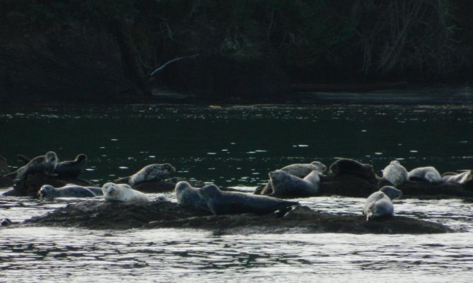
Very protected in a SE and enjoyed 2 coffees watching the multitude of birds and seals this morning. Great way to start the day.
 
Very pleasant anchorage for sure Frank! I have, on occasion, seen Sea Otters flat on their backs enjoying the sun at the entrance to Annette.
 
It’s now on the “go back to” list...
Selby Cove, next up, looked very nice too.
I’m enjoying “putting around”... no set plan..
Hope to be back your way mid February or so.
 
So nice to have a couple of decent days in a row.
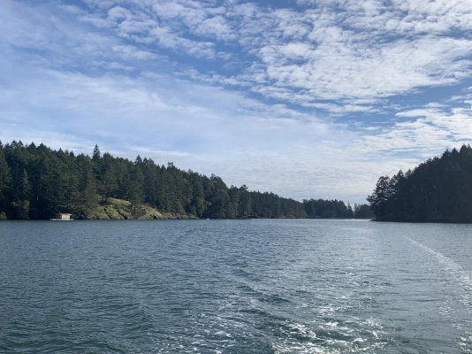
Looking back leaving Annette Inlet
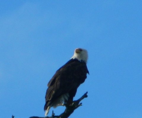
Resident eagle Pics are typically iPhone, eagle is my Nikon with zoom)
Lighthouse on the point
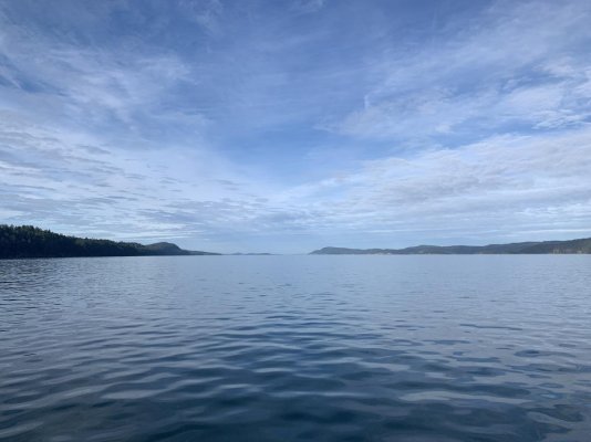
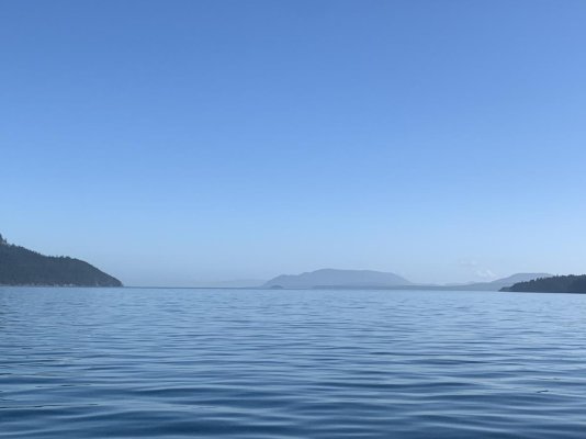
Calm waters of Trincomali Strait
 

Attachments

  • DEB67470-DE7E-4C93-9508-392E0706424B.jpg
    DEB67470-DE7E-4C93-9508-392E0706424B.jpg
    172.4 KB · Views: 36
  • A60605DF-43C3-424A-86B0-D03652D76924.jpeg
    A60605DF-43C3-424A-86B0-D03652D76924.jpeg
    126 KB · Views: 37
  • 0BC11F30-C502-471B-AE63-52342445D204.jpeg
    0BC11F30-C502-471B-AE63-52342445D204.jpeg
    182.3 KB · Views: 36
  • E71127C6-703B-4954-80D1-A4FE64F19675.jpg
    E71127C6-703B-4954-80D1-A4FE64F19675.jpg
    152.6 KB · Views: 38
  • DF970F94-3E99-41BD-A3C4-3D2839CEEF93.jpg
    DF970F94-3E99-41BD-A3C4-3D2839CEEF93.jpg
    92.7 KB · Views: 32
I remember Trincomali Strait.
It’s a long run.
 
I was surprised at the wildlife yesterday.
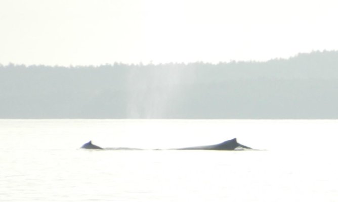
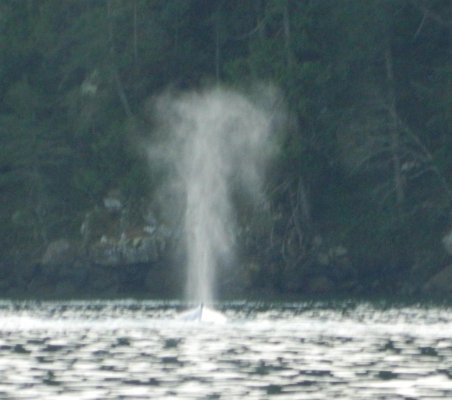
Quite a variety of birds, seals and was blessed by 2 humpbacks feeding.
This was my first whale encounter since being north.
Sure makes a run more interesting
 

Attachments

  • D995CFAD-5831-4982-963E-D422357A7A68.jpg
    D995CFAD-5831-4982-963E-D422357A7A68.jpg
    95.5 KB · Views: 33
  • 42AACA15-CB49-47E5-904D-92781E8728C2.jpg
    42AACA15-CB49-47E5-904D-92781E8728C2.jpg
    108.7 KB · Views: 32
  • F0618111-0166-44A8-8097-61F75AA69AD7.jpg
    F0618111-0166-44A8-8097-61F75AA69AD7.jpg
    22.9 KB · Views: 31
  • 816FD595-9861-43CD-B1D6-961B60F0754E.jpg
    816FD595-9861-43CD-B1D6-961B60F0754E.jpg
    43.3 KB · Views: 29
  • 6F9D64A0-B4D7-4D26-B6FE-AABFB5B45B7D.jpg
    6F9D64A0-B4D7-4D26-B6FE-AABFB5B45B7D.jpg
    47.4 KB · Views: 30
  • 10990A6B-6E95-4580-9DF1-EB73C173564F.jpg
    10990A6B-6E95-4580-9DF1-EB73C173564F.jpg
    107.1 KB · Views: 34
Last edited:
I was surprised at the wildlife yesterday.
Quite a variety of birds, seals and was blessed by 2 humpbacks feeding.
This was my first whale encounter since being north.
Sure makes a run more interesting

Interesting. Most Humpbacks head south to breed for the winter although I'm hearing reports that some do stay around; it has been suggested that perhaps they are not old enough to breed yet.
 
I was surprised to see them. Always a treat. Was also surprised at how fast they can move at times.
 
Wifey B: At the moment, not a big fan of rain. :rofl:

:flowers:Well that guarentees a personal introduction anytime soon!! Ketchikan's annual rainfall 2020 was 176 inches. Keeps the riff raf out:whistling:
 
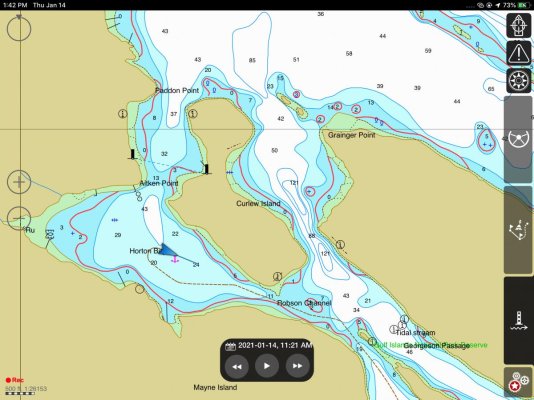
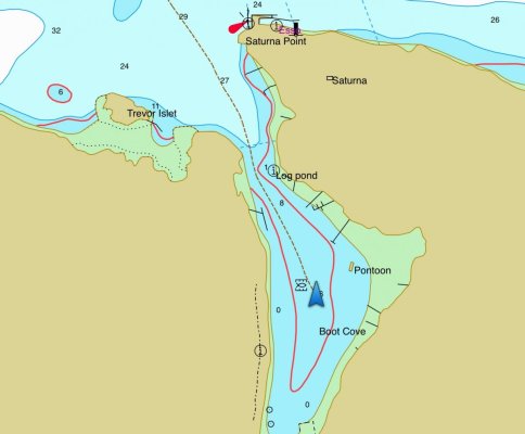
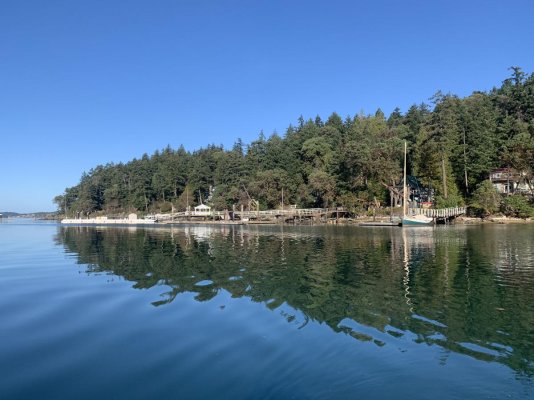
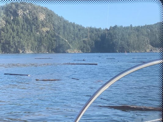
After dodging logs, checked out Horton Bay on the way but with some wind forecast, decided on Boot Cove as it looked small and well protected.
What a beautiful little cove it is! A rock bluff runs along the starboard side when entering and its ringed by sailboats on moorings. Very picturesque!
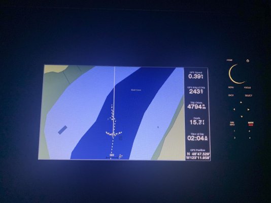
After a very nice evening and hitting the bunk early, I was awoken at 12:30 with the anchor chain groaning and the boat laying over in the whistling gusts. The bluff I thought would protect simply diverted the wind and it funneled through. Why does this always seem to happen after midnight and in pitch black! Up I got, fired up the JD, turned on the plotter and there I sat on anchor watch until just after 4am when the winds started to subside. The Cove is so small I knew I wouldn’t have time to react without the plotter on and engine running should we have dragged. The Delta held and the side to side arch was quite wide on the plotter. Funny, as I sat there this morning having coffee, the cove flat calm and once again picturesque, it was as if last night was a dream...
 

Attachments

  • 37DDF1F1-6DCF-4111-95AF-E87E23FC7631.jpg
    37DDF1F1-6DCF-4111-95AF-E87E23FC7631.jpg
    138.5 KB · Views: 39
  • 47078300-089D-450C-845C-E7E036C1E17F.jpg
    47078300-089D-450C-845C-E7E036C1E17F.jpg
    71.1 KB · Views: 40
  • 2E84FF0E-F55D-4D5E-A895-37AFDB870BBC.jpg
    2E84FF0E-F55D-4D5E-A895-37AFDB870BBC.jpg
    191.7 KB · Views: 32
  • 0152FE54-37C8-4240-A7D3-7A6188EEC9A7.jpg
    0152FE54-37C8-4240-A7D3-7A6188EEC9A7.jpg
    119.5 KB · Views: 32
  • 05EAD193-BD08-483D-B392-976C038D440D.jpg
    05EAD193-BD08-483D-B392-976C038D440D.jpg
    80.7 KB · Views: 36
  • FCE2E939-CFBF-4D25-8384-8615E7711B39.jpg
    FCE2E939-CFBF-4D25-8384-8615E7711B39.jpg
    148.1 KB · Views: 30
  • EF8BCE7F-0D09-4791-805A-50BFB0862078.jpg
    EF8BCE7F-0D09-4791-805A-50BFB0862078.jpg
    150.9 KB · Views: 28
Last edited:
After dodging logs, checked out Horton Bay on the way but with some wind forecast, decided on Boot Cove as it looked small and well protected.
What a beautiful little cove it is! A rock bluff runs along the starboard side when entering and its ringed by sailboats on moorings. Very picturesque!
After a very nice evening and hitting the bunk early, I was awoken at 12:30 with the anchor chain groaning and the boat laying over in the whistling gusts. The bluff I thought would protect simply diverted the wind and it funneled through. Why does this always seem to happen after midnight and in pitch black! Up I got, fired up the JD, turned on the plotter and there I sat on anchor watch until just after 4am when the winds started to subside. The Cove is so small I knew I wouldn’t have time to react without the plotter on and engine running should we have dragged. The Delta held and the side to side arch was quite wide on the plotter. Funny, as I sat there this morning having coffee, the cove flat calm and once again picturesque, it was as if last night was a dream...

Another place that is magical in the daylight, but not so much after dark. I think we have anchored in Boot Cove only once in well over 40 yrs of boating in the Gulf Islands. Our experience was similar to yours, set the anchor in calm conditions only to be awakened around midnight to an angry wind. Our response was to pull up and head to the outstation in Long Harbour rather than lose a whole night of sleep.
 
:flowers:Well that guarentees a personal introduction anytime soon!! Ketchikan's annual rainfall 2020 was 176 inches. Keeps the riff raf out:whistling:

On second thougts,:thumb: it was unkind of me to consider any as 'Riff Raf'. more the case of rain keeping us Riff Raf in!!!
As to this post, it is a great read following Frank's adventure particularly with the size and description of the Camano trawler. I to am a small trawler owner, not that I couldn't afford or desire larger, it is for many of the same reasoning that Frank desided on the Camano style.
Here are a series of our craft (Sister boat)

Index of /BoatInfo/Marben27

As I read Frank, visions of sharing some of the same scenery comes to mind.
Thanks for sharing your adventures.
 
Funny... Winter Cove was the one I didn’t check out..
Duly noted...
 
The Winter Cove most of us know is south of Active Pass.
And as I recall it’s got a rep of windy nights also.
 
Never have been.
Read about it numerous times.

We frequently have thought of anchoring there going north from Port Browning but over time we always just anchor at P Browning mostly as we arrive at PB latish.
 
From Cutter Cove the run to Port Browning was on calm seas with blue sky’s.
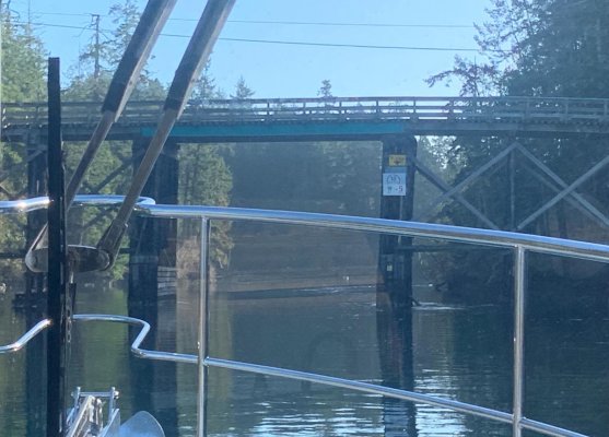
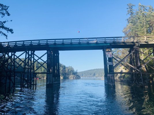
After the earlier mentions here, had to try out Pender Canal. I can see where it would be a handful if not close to slack. Although I knew there was enough height, still was a bit unnerving thinking about the radar arch and VHF antenna up there going through for the first time, but there was lots of room. Once through, Bedwell Harbour seemed a bed for logs. There has been so many lately! Was just an awesome day as I continued on toward Piers Island.
 

Attachments

  • 371158B7-4328-453C-8D75-8C4943098218.jpg
    371158B7-4328-453C-8D75-8C4943098218.jpg
    65.3 KB · Views: 30
  • 9C221AC1-187A-4B5F-A8CA-1852707A6390.jpg
    9C221AC1-187A-4B5F-A8CA-1852707A6390.jpg
    72.1 KB · Views: 27
  • 36E998AF-0A6D-48D1-8123-455FD0469E5C.jpg
    36E998AF-0A6D-48D1-8123-455FD0469E5C.jpg
    136.5 KB · Views: 28
  • 811561FA-418E-4CF6-A7EA-F8AB2595855D.jpg
    811561FA-418E-4CF6-A7EA-F8AB2595855D.jpg
    106.6 KB · Views: 28
  • B5743615-BADB-4877-9358-6853EE83591C.jpg
    B5743615-BADB-4877-9358-6853EE83591C.jpg
    186.1 KB · Views: 32
  • 10DD5AC5-3E3D-4B4A-B635-0D06F90EED99.jpg
    10DD5AC5-3E3D-4B4A-B635-0D06F90EED99.jpg
    122 KB · Views: 31
  • 5074F13D-DDA3-42AC-A724-9973A784C9F2.jpg
    5074F13D-DDA3-42AC-A724-9973A784C9F2.jpg
    170.7 KB · Views: 29
Back
Top Bottom