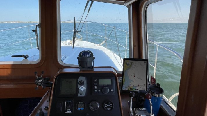
Will my autopilot follow waypoints from Navionics on my iPad?

The friendliest place on the web for anyone who enjoys boating.
If you have answers, please help by responding to the unanswered posts.
The main reason Coastal Explorer is my primary system is multiple large screens and more importantly ease of use. I haven’t found anybody's MFD that allows you to use a trackball or mouse to interact with it. I started using a trackball when I ran Coastal Explorer on a small notebook in a 22’ C-Dory because of lack of space for a mouse and I hated trackpads. With a wireless trackball, I could be any where at the helm and able to control the display plus rough seas aren’t a problem. You don’t need the keyboard very often. I found creating routes on an MFD a cumbersome process mainly because using keys only to move a cursor and zoom in and out and my fingers and touchscreens don’t get along.

I could go on but I have spent less money on Coastal Explorer over 18 years than the price of most 12 inch MFDs not to mention the only thing that went obsolete is computer it ran on. The computers are multipurpose so I just don’t use them on the boat.

Tom
 
Doing great circle courses are PIA. But coastally not necessary. Figuring out best courses to achieve best velocity made good it also a PIA but again coastally with power not a realistic oncern. So basically for most of us we want to know safe waters to travel, aids to navigation, currents and surrounding traffic.
Most iPad set ups don’t show radar nor AIS. Virtually all MFDs have those capabilities. . Have come to believe having those two things are more important coastal and near shore than offshore or open ocean. Open ocean collision avoidance is easier. Ship lights can be seen at least 15m off and with cruise ships being such highly light often out miles further as a glow in the sky. Ships have professionals on them. Behavior is predictable.
Have come to believe with the hard edges, risk of grounding, confined channels you need much more help coastally than open ocean. I’ve gotten to Bermuda from Marion several times with just celestial and no electronics. I would never attempt the simplest short coastal transit depending upon celestial. Being 50m off in the middle is ocean doesn’t matter. Having no useful sights for a day or two doesn’t matter.
So coastally I want much more electronics to help me than offshore. I want two different chart sources. I don’t want to be dependent upon hour old information from MarineTraffic. I want real-time AIS and want to be seen as well as see. I want the best radar I can afford.
At our helm there’s C map on the MFD and navionics on a IPad. Often have NOAA or other charts on a laptop. Always have the radar and AIS transceiver on.
Off shore would think nothing about proceeding with a knot stick, a compass, my celestial information on a small handheld computer and the books as backup, even a plastic Davis will get me there. Don’t need depth. Can see weather. Can see ships. But having a boat doing coastal without a full suite of electronics scares the pants off of me.
 
Last edited:
The main reason Coastal Explorer is my primary system is multiple large screens and more importantly ease of use.

Definitely a strong draw. Pilothouse dash space is at a premium on our boat and the monitor would have to be on a swing arm. Do you have a touch screen monitor?
 
Also there’s a learning curve to coastal explorer.

That's for sure. I am still on the learning curve with Navionics and have no problem putting in the time on the right platform. Just hoping to minimize the times I climb that curve.
 
The main reason Coastal Explorer is my primary system is multiple large screens and more importantly ease of use. I haven’t found anybody's MFD that allows you to use a trackball or mouse to interact with it. I started using a trackball when I ran Coastal Explorer on a small notebook in a 22’ C-Dory because of lack of space for a mouse and I hated trackpads. With a wireless trackball, I could be any where at the helm and able to control the display plus rough seas aren’t a problem. You don’t need the keyboard very often. I found creating routes on an MFD a cumbersome process mainly because using keys only to move a cursor and zoom in and out and my fingers and touchscreens don’t get along.

I could go on but I have spent less money on Coastal Explorer over 18 years than the price of most 12 inch MFDs not to mention the only thing that went obsolete is computer it ran on. The computers are multipurpose so I just don’t use them on the boat.

Tom
I'm with you Tom. I run CE on a cheap laptop that stays on the boat with another laptop as CE backup. Screen output goes to a Gechic monitor (3/4" thick) mounted on the instrument console, and CE talks to the Simrad AP. I prefer defining a complete route, sometimes of dozens of waypoints, that the AP then follows. Been doing this for many years and thousands of miles without incident. The only oddity I have never figured out is that to avoid having to acknowledge every new waypoint after activating a route, I need to issue the command to follow the route with the handheld remote. If I do so on the main control head, each waypoint has to be approved before a turn is made.
 
My laptop has a touchscreen but I rarely use it. The second monitor doesn’t have a touchscreen. My fingers and touchscreens don’t like each other so 98% of the time I use a trackball.

Delfin, on my Raymarine EVO, I have to acknowledge each waypoint whether I start the route on the wireless remote or control head. I’m surprised Simrad works differently. My complaint on the Raymarine remote is the waypoint alarm goes off on the control head up to a second before the remote, but if you push the button on the remote too quickly it puts the AP into track mode so misses the turn. Don’t get me started on the Raymarine remote.

Tom
Yep, the trackball rules.
 
I no longer let my navigation software send instructions to my autopilot. For me it just seams less efficient than letting the autopilot head for the next way point while making a few adjustments along the way.

When I brought the boat up from LA I had an autopilot and an IPad. It worked fine. I adjusted course far more often to avoid obstacles than correcting heading. I eventually came to the conclusion that manually operating the autopilot was more convenient.

Once In the PNW I installed new electronics. For a while I would let the chart plotter control the autopilot. Sounds cool, leave the harbor, punch a button and the boat drives it’s self to the desired destination. Reality is always different. It just became more work to dodge obstacles. I also got tired of all the squealing at every waypoint.

I just don’t see it as very important to have Navionics on an IPad giving commands to an autopilot.

:thumb:
 
C'mon, Garmin. Get in the NMEA game!

Notwithstanding some technical Apple iPad issue, I'd assume Garmin with have to be dragged kicking and screaming into adding more advanced features to the Navionics iPad app. They're trying to maintain a reason for people to buy low end MFDs and missing features is certainly a compelling reason.
 
You can export a gpx file from Navionics. Then you have to figure out how to get it into the chartplotter currently configured with your simrad auto pilot.
 
You may want to reconsider using only an iPad for navigation. My autopilot is connected to a Raymarine eS127 which uses Navionics charts. My back-up, which is also on the dashboard, is an iPad Pro using Aqua Maps. I have a YDNR WiFi interface connected to the eS127 via the Raymarine SeaTalk network that transmits GPS data, depth, heading and AIS data to the iPad/Aqua Maps via WiFi. When underway I display Raymarine Sonar charts on my eS127 and USCG/USACE data on the iPad. The reason I have adapted this system is because there have been many times when I have searched the horizon for a buoy or day marker shown on the Raymarine Sonar chart only to have ended up finding I was looking the wrong way. I found the different vector (correct) on Aqua Maps. But the reason I continue to navigate using the Raymarine Sonar charts is because they have proven to be extremely accurate over my past 6000 miles of using them. I can’t say that about the Aqua Map’s USACE charting in side-by-side comparison.
Mike Bythewood
Mainship 400 “Scout”
 
Of the three options, the most reliable seems to be number 2. I would have thought that Garmin's ownership of Navionics would make transferring route data between those easier than between Navionics and other chartplotters, but that does not seem to be the case.

My lower helm does not have an abundance of free space into which I could mount one of those giant new MFDs and I am already accustomed to navigating from a screen the size of an iPad. Furthermore, I read a lot of good stuff about the trackball and have come to mistrust many touchscreens. Again, that all is pointing me to option 2 with a recent generation of chartplotter in the 7-9 inch range.

  1. Learn to use iNavX, buy their WiFi gizmo, and connect it to my NMEA network
  2. Learn to use Garmin, buy their WiFi gizmo, buy a lightly used Garmin chartplotter, and connect it to my NMEA network
  3. Learn Coastal Explorer, buy their WiFi gizmo, buy a 12 VDC PC and monitor, and connect it to my NMEA network
 

Attachments

  • 8AF46A55-B9F0-46F6-A592-3C339F1C1312_1_201_a.jpg
    8AF46A55-B9F0-46F6-A592-3C339F1C1312_1_201_a.jpg
    103.4 KB · Views: 33
Of the three options, the most reliable seems to be number 2. I would have thought that Garmin's ownership of Navionics would make transferring route data between those easier than between Navionics and other chartplotters, but that does not seem to be the case.

My lower helm does not have an abundance of free space into which I could mount one of those giant new MFDs and I am already accustomed to navigating from a screen the size of an iPad. Furthermore, I read a lot of good stuff about the trackball and have come to mistrust many touchscreens. Again, that all is pointing me to option 2 with a recent generation of chartplotter in the 7-9 inch range.

  1. Learn to use iNavX, buy their WiFi gizmo, and connect it to my NMEA network
  2. Learn to use Garmin, buy their WiFi gizmo, buy a lightly used Garmin chartplotter, and connect it to my NMEA network
  3. Learn Coastal Explorer, buy their WiFi gizmo, buy a 12 VDC PC and monitor, and connect it to my NMEA network
Regarding #3....I have no CE gizmo, have a regular cheap laptop, and CE connects to the AP with a few clicks.
 
The WiFi gizmo is to let Navionics on the iPad see the route and progress. Not essential to the operation of the autopilot in any of those three options, but more of a desire by me. I should have clarified that better.
 
The WiFi gizmo is called a NEMO. It takes in NMEA 2000 and NMEA 0183 data and can output it over an Ethernet. By connecting that Ethernet port to an open port on a router or wireless access point, that data is available to any application that can read NMEA 2000/0183. I have used it to view AIS data in Navionics and to feed a second computer (Microsoft Surface Go) running Coastal Explorer also.

Tom
 
I don't mean to use "gizmo" in any derogatory way. There are several WiFi gateways and several by the manufacturers of the navigation equipment. They all serve important roles in the process. I'm sure one of them will be in my set up when the time comes.
 
I already fall into a camp on this subject. For the next couple (few?) seasons, I expect to be at that minimalist end being happy with Navionics running on an iPad and my AP16 getting manual heading instructions from me. At some point we expect to strike off over the horizon and at that time I expect to want/need a more robust solution. I want my AP16 to receive heading commands from my navigation software.

I don't see how this increases the robustness of your system. There is nothing wrong with noting XTE and making minor course corrections as part of your watchstanding routine.

Want, maybe. Need, hardly.
 
Depending on WiFi as connection along a network is less than robust, at least in my definition. I guess you could also say that depending on any network connection, including NMEA 2000, is not robust enough to "depend" on for navigation, but doing so would leave only hand steering or making frequent course corrections. That is what I am doing today. Set the AP to a heading and adjust as needed.

There are two separate but interrelated parts of that, right? WiFi vs. wired connections, and AP following a route vs. minor course corrections. Getting m AP to follow a route is my objective, and my reading suggests that a WiFi connection between the nav application and the autopilot is less than robust.

There are two camps on electronics.

Minimalists, usually an iPad or phone with Navionics and those who want a full suite of same brand integrated electronics.

One is cheaper and does get the job done. The other gives more options which equates to better safety.

Neither is the answer for all.

The camp I fall in to is the minimalist as I have an iPad running Navionics and I do not see myself going to a full suite of same brand integrated electronics. Thankfully, no one is limited to either extreme and there are options all along the continuum between those two camps.
 
Last edited:
Autopilot, waypoints, Navionics & iPad

You left out a lot of information.

First, an old POS Simrad autopilot (A/P) do you really want to use that?

Second, which iPad do you have?

Third, which NMEA network do you have?

When the time comes for you, all of the info we provide may not have any relevance to what the market is supplying.

Today, what you want to do is not possible. The MFD is the iPad that is connected to the rudders through the A/P and they are connected together thru the NMEA network. What you are missing is that the iPad can't (to my knowledge) connect to the NMEA backbone to interface with the A/P. AND, the sentences that are being transmitted from the iPad, even running Navionics, probably has some added goodies that don't help.

I only know Garmin and I can use a tablet (iPad) to do route planning and then use wifi to transfer that route to my MFD.

I wouldn't do that because I can go to my MFD in the AM before we leave and put the destination into the MFD AND then I can tell the MFD to plot the course, called autoroute. I review the plot and if changes are necessary, I make them, if not I tell the MFD to go.

The course is laid in, and after we are away from the dock, I engage the A/P and let it steer the boat. It steers me while I sit on the bridge with my remote and watch the water for debris.

I know you are trying to get away cheap utilizing an iPad but why would Garmin want you to do that?

Besides the fact that they sell NAV products why would they want the liability of you using some iPad that could go bad at any point, plus have 100's of interface needs for every version of iPad.

Spend the time to accumulate a cruising chest with a lot of money to get the right NAV products and other goodies you'll need.

BTW, Navionics is owned by Garmin, runs on my Garmin MFD and drives my Garmin A/P on a NMEA 2000 backbone, so why someone would say Navionics doesn't output NMEA I can't tell.

I'm also of the belief that mixing too many different products in a NMEA network is potentially asking for trouble and isn't this driving your boat which cost a lot of money and has people you care about onboard?
 
There are two separate but interrelated parts of that, right? WiFi vs. wired connections, and AP following a route vs. minor course corrections. Getting m AP to follow a route is my objective, and my reading suggests that a WiFi connection between the nav application and the autopilot is less than robust.

Here's my point of view: I don't see the value in having any connection between the nav application and AP. So I wouldn't care about hardening the connection. Failure of the connection would have no material impact on my ability to navigate safely and effectively.

This of course reflects my experience and preferences, but I have traveled >20k miles solo in the last few years with stand alone APs on trawlers. If I thought that my safety or operating requirements would improve by connecting them I would have done so.

I understand the objective, but question the utility and certainly the necessity in real world situations. Not trying to deny progress, but there are any number of tools for monitoring progress and triggering alarms, in the rare case that you need to follow a track closely. But in those cases a careful watch would be called for.
 
Back
Top Bottom