RedRascal
Senior Member
Starting this thread to share some learnings about the Argo navigation program that is both a phone/tablet based program and web based map. I am not connected to Argo in anyway, I am just trying to plug the hole Garmin created by removing the Navionics web based Chart Viewer tool a few weeks back. I use to use the chart view program for general planning on my office dual screen computer. Also in the past I have had trouble with Navionics in offline map mode with routing. At times Navionics has to told me to download charts again before the auto route function would work. That really sucks when you are off grid. So I decided to pay the $20 subscription fee to Argo to see if it could do better. At this point I've only played with two routes in the web viewer.
Observations so far:
-Paying the $20 subscription was easy via the web
-Routing is way faster than what navionics would do, like a couple seconds where as navionics would chug away on the web and sometimes fail.
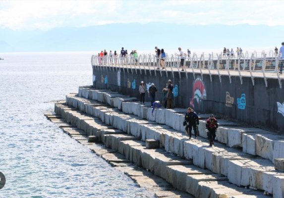
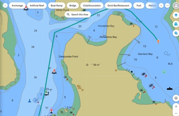
-First route I plugged in from Seattle to Victoria, BC went right across the breakwater/seawall(Ogden Point) outside of Victoria. Are you freakin kidding me.
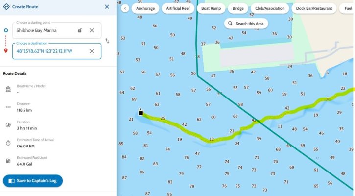
-Second route from Seattle to San Juan Island cut a channel marker.
-Not sure what charts they use for Canada, they seem more like a glorified google map than a chart.
I'll post more when I get some more time with it, not a good first impression though. I attached the pic of the seawall it wanted you to hop over and the route that cut a buoy. As a general rule I typically stay in channels unless I have good info that I can operate safely outside of a channel.
Observations so far:
-Paying the $20 subscription was easy via the web
-Routing is way faster than what navionics would do, like a couple seconds where as navionics would chug away on the web and sometimes fail.
-First route I plugged in from Seattle to Victoria, BC went right across the breakwater/seawall(Ogden Point) outside of Victoria. Are you freakin kidding me.
-Second route from Seattle to San Juan Island cut a channel marker.
-Not sure what charts they use for Canada, they seem more like a glorified google map than a chart.
I'll post more when I get some more time with it, not a good first impression though. I attached the pic of the seawall it wanted you to hop over and the route that cut a buoy. As a general rule I typically stay in channels unless I have good info that I can operate safely outside of a channel.