NOAA Request for Comment - Replace "Feet" with "Meters" as unit of measure???

The friendliest place on the web for anyone who enjoys boating.
If you have answers, please help by responding to the unanswered posts.
Ted - my assumption was the notice was referring to wave height, not water depth.
How does that change what I wrote? I'd be fine going out in one meter seas, but not 2 meter. 1 to 2 meter becomes a head scratcher.

Ted
 
The real question is what will they use in shallower water? Are we talking depth to a tenth of a meter? If not, why would you choose a less precise measurement? So if AICW (Atlantic Intra Coastal Waterway) depths are going to reflect least depth, does the depth say 1 meter or 5 feet? Remember, your not rounding up (deeper) with least depth.

If they are going to a tenth of a meter, it probably doesn't matter much as who uses NOAA charts as opposed to Aquamaps, Coastal Explorer, or etc, anyway? It will be a long time before the above chart companies don't offer user preference for feet or meters.

Ted

Forgive me for interpreting your words as discussing water depth on a topic about high-seas wave heights.

Peter
 
Forgive me for interpreting your words as discussing water depth on a topic about high-seas wave heights.

Peter
My original post was about depth. My second post was about wave height. In a world where everything is getting more precise, why should NOAA become less precise?

Ted
 
Greetings,
Mr. SK. In regards your post (#28). In our local grocery store the labels on the products, are in metric BUT in the flyers AND on the larger advertising signs in, primarily, the meat/fish and produce departments the weights are in imperial (lbs/oz). One of my MANY complaints...

I know the exact reason for this absurdity. What sounds like a better deal? "pork ribs for $2.99/ lb" OR "pork ribs for $6.59/ Kg"?
Makes price comparisons a pain in the brain. Mixing measurement systems is a PIA and dangerous IMO.

I was schooled in the imperial system and was only exposed to metric in grade 10 Physics. Drove a VW beetle as my first car (hence my regular? reference to 10mm wrenches) Pursued a career in science so became quite used to working in metric.

Ditch and bury the imperial system.
 
Greetings,
Mr. SK...

1725586113031.jpeg
 
My original post was about depth. My second post was about wave height. In a world where everything is getting more precise, why should NOAA become less precise?

Ted

Your second post referred back to your first post "How does that change what I wrote?" which was about water depth. Since this is a NOAA RFC for public input, just want to make sure folks are clear the proposed changes only apply to High Seas weather products. Is it a camel nose under the tent in the way to full scale metric? Perhaps.

Peter.
 
You think you have problems.

Australia signed on to metric units in 1947, it became mandatory in 1970. However, we changed to metric curency in 1966. Interestingly the US has had metric currency for ever, yet chose to stay imperial with measurements.

A large portion of my tools, screws machines are still in the imperial measurement system, meaning I have just about two of evertything in my workshop to cover all eventualities.

My boat is 36' & does 8 knots and for me it always will be that way, despite the fact the insurance company claims my boat is 10.97 meters, or is that metres? I am not sure that knots is an imperial measure given its nautical history, however the powers to be are still happy to refer to its speed over water in knots, not K/L per hour.

Gee, on re reading this I sound like an imperial Dinosaur.
 
Can still be knots, nautical kilometers per hour. As a bonus, your goes eight fifths faster.
 
Knots make sense to keep using with geographic measurement systems since it's a minute of latitude. Meters/kilometers is a linear measurement, and is a reasonable approximation for shortish distances on a globe. But for longer distances, like those traveled by plane or boat, I think knots makes sense, and is rooted in something physical, rather than an arbitrary declaration by some long dead King.
 
Your second post referred back to your first post "How does that change what I wrote?" which was about water depth. Since this is a NOAA RFC for public input, just want to make sure folks are clear the proposed changes only apply to High Seas weather products. Is it a camel nose under the tent in the way to full scale metric? Perhaps.

Peter.
Peter it refers to the reduced accuracy (because of increment size) of meters. If they aren't going to use tenths of a meter, how would you say, " seas are going to be 3 to 5 feet". Clearly 1 to 2 meters implies something else (3.4' to 6.7').

Ted
 
Maybe 3 to 5 feet will translate to 90-150 CM. No need for decimals.
we have been using 30cm is a foot already even though it is 0.984252
 
Peter it refers to the reduced accuracy (because of increment size) of meters. If they aren't going to use tenths of a meter, how would you say, " seas are going to be 3 to 5 feet". Clearly 1 to 2 meters implies something else (3.4' to 6.7').

Ted
I think it was Psneeld who used the term "Significant Digit" in an earlier post. Accuracy of a forecast is hampered by the underlying data from multiple swells and multiple wind patterns all wrapped into a forecast model to arrive at the average of the highest 1/3rd of waves. Given the variability of the underlying data, it's arguable that 1-2 meters more accurately describes the underlying precision of the forecast than 3-5 feet.

I'm sure the NOAA models could spit-out a very precise number, perhaps 32.68" - 64.274". 3-5 feet, while less precise is more accurate. 1-2 meters is likely more so.

Peter
 
Knots make sense to keep using with geographic measurement systems since it's a minute of latitude. Meters/kilometers is a linear measurement, and is a reasonable approximation for shortish distances on a globe. But for longer distances, like those traveled by plane or boat, I think knots makes sense, and is rooted in something physical, rather than an arbitrary declaration by some long dead King.
5400TH.JPG
 

Attachments

  • 5400TH.JPG
    5400TH.JPG
    72.7 KB · Views: 17
Last edited:
For a bit of comedy on the topic, watch the Saturday Night Live. George Washington skit
Oct 29, 2023. Posting a link from my phone has defeated me, but it is worth the watch.
I send anchored at American Camp, 4th of July Beach off San Juan Island. 1000002779.jpg
 
A knot is only a knotical mile at the equator latitude between longitudes. So why are we wanting to keep that measurement. A kilometer, if universally adopted is the same anywhere in any direction.
 
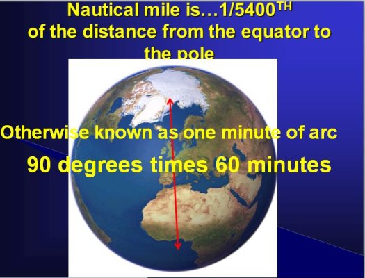
A knot is only a knotical mile at the equator latitude between longitudes. ...

Actually it's not; the earth is not a sphere, so the equator is somewhat longer than a meridian. (see slide above.) ...or more precisely, it is longer than two meridians.
 
Last edited:
Actually it's not; the earth is not a sphere, so the equator is somewhat longer than a meridian. (see slide above.) ...or more precisely, it is longer than two meridians.
are you saying the measured distance between longitudes remains the same up to the poles. I don't think so. So if equator latitude is used for the knot distance then it gets less as you go north or south.
 
Longitude cannot be used for distance measure because the lines pass through earth's north/south poles becoming closer together until they converge at zero.

However, latitude not only can be used to measure, it is the definition of a nautical mile (nm = 1/60th of a degree of latitude (a 'second') which remains constant anywhere on earth). Indeed, nautical charts did not need a distance scale and rarely had them. Distance was plucked from the latitude tick-marks on the margin perimeters of the chart (graphic pulled from the attached article).


Peter

Measuring distance on a chart - latitude.jpg
 
Yes Peter, at the equator.
Up here along the 49th I guess a knot is shorter, so we can travel more miles in a day. :cool:
 
Yes Peter, at the equator.
Up here along the 49th I guess a knot is shorter, so we can travel more miles in a day. :cool:

No, a nautical mile is the same everywhere. It is 1/60th of a degree of latitude which is the same in Alaska as it is in Panama. If it measured longitude, then you'd be correct. From the article I linked

"...the distances between each latitude line are equal, whereas the distances between each Longitude line gets smaller as the lines approach the poles. Only at the Equator are the lines of latitude and longitude at the same distance."​

Peter
 
Last edited:
Aha, the distance, between latitudes, each latitude being equal distance, one minute of latitude.
At the equator, a degree of longitude is the same as a degree of latitude, about 69 miles (111 km). But it decreases as you move closer to the north or south pole. Fill in your latitude to find out how long a degree of longitude is at that distance from the equator.
 
No. I'm saying what I said. If you measure the 360 degree circumference of the earth along two meridians, you will get 21,600 nautical miles(or 40,000km). If you measure 360 degrees along the equator, as YOU suggested, you will get a larger number, which is not really useful for defining a nautical mile, as YOU seemed to suggest in your previous message.

I really do have a pretty good grasp on this. I lived, flew, boated and taught Fundamentals of Navigation at the state university for 20 years near 60N, where a degree of longitude happens to be 30 miles (roughly:giggle: ) ... and a degree of latitude remains 60 nautical miles, which is where we began. Because the earth is flat...er flattened...ellipsoid, a nautical mile cannot be defined along the equator, only along a meridian.;)
are you saying the measured distance between longitudes remains the same up to the poles. I don't think so. So if equator latitude is used for the knot distance then it gets less as you go north or south.
 
Last edited:
are you saying the measured distance between longitudes remains the same up to the poles. I don't think so. So if equator latitude is used for the knot distance then it gets less as you go north or south.
Latitude only. A nautical mile is one minute of latitude. As you surmised, the distance between longitude lines varies by latitude.
 
Every year I see that more and more that claim to be so experienced need to go back to the basics. Or stick to the threads on boat colors or fabric choices.
 
For those with an interest in horology and navigation, Dava Sobel's book Longitude is a great book. I highly recommend it.
 
Back
Top Bottom