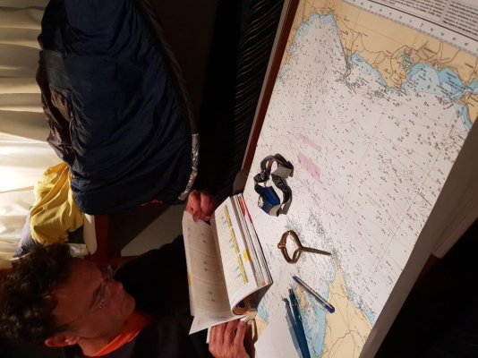
If the gps shuts down you can still navigate wth the digital charts, even easier than with paper. Usually the charts are stored on redundant devices. If all power goes down you won’t need navigation in any event.
If all power goes down, you might need to let someone know where you are, and a paper chart might come in handy for that, I understand your logic, and if you are in a area you are familiar with, I would imagine this would be fine... Me personally, I would always want a paper chart or two onboard.
Regarding the Navy teaching celestial (which I doubt) I can elate that about ten years ago I was asked to give a lecture at the Naval Observatory in DC. When there, my host asked if there was anything they could do for me. I asked if they could get me a sextant which I assumed they had many of. After asking all his colleagues he came back to tell me that no one knew of the existence of a sextant in that institute. Amazing!!
And by the way, most NAVY ships, and all submarines, navigate by inertial guidance. Surface ships use gps and the inertial is back up. For subs, GPS won’t work when submerged but inertial guidance is more than sufficient.
I have heard similar things... However, I can state that we were DRILLED in celestial navigation during my tenure in the service, 1992 - 2012. This included LAN, sunlines, moonlines, determining gyro error against Polaris, horizontal sextant angles for visual navigation, ad infinitum. We had a GPS (WRN-6, with crypto) interfaced with a WSN (Inertial Navigation System), and on my first and second ship, we even had NAVSAT, the precursor to GPS (doppler based) interfaced to a WSN-5.
I even wrote BASIC programs on my Casio calculator to handle sight reduction!
It was an incredible time to serve and apparently the end of an era... We were forced to source a diverse range of information sources for position derival, to include radio navigation, radar, sonar, GPS, NAVSAT, and visual aids. I have spent many, many hours hunkered over a chart, dropping LOP's. Voyage planning was an entirely different manner, and we did not have the tools available now.
We did have a tool, called JOTS, which was a graphical display of the ship's position, the charts were vector and not very detailed, and the navigation team did not have access to any displays as they were in CIC (Combat Information Center).
Thanks for bringing back some great memories, I had the best office in the world, the bridge of a ship, with the best view, and the coolest job in the United States Navy, shipboard navigation!!!


